- Sapulpa, Oklahoma
-
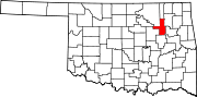
Sapulpa, Oklahoma — City — Location of Sapulpa, Oklahoma
Coordinates: 36°0′13″N 96°6′17″W / 36.00361°N 96.10472°WCoordinates: 36°0′13″N 96°6′17″W / 36.00361°N 96.10472°W Country United States State Oklahoma County Creek, Tulsa[1] Area – Total 18.7 sq mi (48.3 km2) – Land 18.6 sq mi (48.3 km2) – Water 0.0 sq mi (0.1 km2) Elevation 715 ft (218 m) Population (2010) – Total 20,544 – Density 1,028.5/sq mi (397.1/km2) Time zone Central (CST) (UTC-6) – Summer (DST) CDT (UTC-5) ZIP codes 74066-74067 Area code(s) 539/918 FIPS code 40-65400[2] GNIS feature ID 1097835[3] Sapulpa is a city in Creek and Tulsa counties in the U.S. state of Oklahoma. The population was 20,544 at the 2010 United States census, compared to 19,166 at the 2000 census.[4] It is the county seat of Creek County[5].
Contents
History
Early History
The town was named after Chief James Sapulpa,[6] the area's first permanent settler, who was a full-blood Lower Creek Indian of the Kasihta Tribe from Osocheetown, Alabama. In about 1850, he established a trading post near the meeting of Polecat and Rock creeks (about one mile (1.6 km) southeast of present-day downtown Sapulpa). When the Atlantic and Pacific Railroad (later known as the Frisco railroad) built a spur to this area in 1886, it was known as Sapulpa Station. Sapulpa post office was chartered in 1889. The town was chartered in 1898.[7][8]
Controversy over Creek County Seat location
After Oklahoma became a state, each county held an election to determine the location of the county seat. Sapulpa competed with Bristow, Oklahoma for county seat of Creek County. After five years of contested elections and court suits, the question was settled by the Oklahoma Supreme Court on August 1, 1913. Sapulpa was ruled the winner. The county courthouse was completed in 1914, replacing an earlier structure built in 1902.[6]
Economic Development
The area around Sapulpa mainly produced walnuts when the town was founded. In 1898, the Sapulpa Pressed Brick was established, followed in a few years by the Sapulpa Brick Company. This began the clay products industry. The Frisco built a railyard in Sapulpa and by 1900 designated Sapulpa as the location of an overhaul base for its rolling stock. [6] The founding of Premium Glass Company in 1912 marked Sapulpa's entry to glass manufacturing. Premium Glass was absorbed into Liberty Glass Company in 1918. Other glass producers in the city were Bartlett-Collins Glass Company, Schram Glass Company, and Sunflower Glass Company. According to the Encyclopedia of Oklahoma History, Sapulpa became known as "The Crystal City of the Southwest."[9]
Geography
Sapulpa is located at 36°0′13″N 96°6′17″W / 36.00361°N 96.10472°W (36.003536, -96.104822)[10].
According to the United States Census Bureau, the city has a total area of 18.7 square miles (48 km2), of which, 18.6 square miles (48 km2) of it is land and 0.04 square miles (0.10 km2) of it (0.11%) is water.
Demographics
As of the census[2] of 2000, there were 19,166 people, 7,430 households, and 5,357 families residing in the city. The population density was 1,028.5 people per square mile (397.2/km²). There were 8,114 housing units at an average density of 435.4 per square mile (168.2/km²). The racial makeup of the city was 80.95% White, 3.75% African American, 8.69% Native American, 0.40% Asian, 0.03% Pacific Islander, 0.99% from other races, and 5.19% from two or more races. Hispanic or Latino of any race were 2.45% of the population.
There were 7,430 households out of which 32.5% had children under the age of 18 living with them, 54.8% were married couples living together, 12.9% had a female householder with no husband present, and 27.9% were non-families. 24.2% of all households were made up of individuals and 10.5% had someone living alone who was 65 years of age or older. The average household size was 2.54 and the average family size was 3.00.
In the city the population was spread out with 26.1% under the age of 18, 7.9% from 18 to 24, 27.5% from 25 to 44, 23.7% from 45 to 64, and 14.8% who were 65 years of age or older. The median age was 37 years. For every 100 females there were 91.2 males. For every 100 females age 18 and over, there were 86.9 males.
The median income for a household in the city was $32,245, and the median income for a family was $37,558. Males had a median income of $30,524 versus $21,609 for females. The per capita income for the city was $17,266. About 11.5% of families and 12.9% of the population were below the poverty line, including 15.2% of those under age 18 and 17.4% of those age 65 or over.
Newspaper controversy
The Sapulpa Daily Herald gained national media attention in early November 2008 for not reporting the election of Barack Obama as President, reporting only that John McCain had won among the voters of Creek County. Critics charged that the omission related to racism, as Obama's victory as the first African American elected president was an historic event. The newspaper maintains that it only covers local news events.[11]
Economy
Sapulpa is notable as the home of Frankoma Pottery, Liberty Glass Company and Happy Burger.
Notable natives and residents
- Max Meyer, an immigrant to the United States and settler in Sapulpa in 1906, was subject of the biography Preposterous Papa (reprint 1992 in paperback) by his son Lewis Meyer, Tulsa author and bookseller. Meyer was a merchant and philanthropist, who built public projects from profits from the more than 50 oil wells he developed.[12]
- The musicians known as The Collins Kids, Lorrie and Larry Collins, resided near Sapulpa in the early 1950s.[13]
- Former Major League Baseball player Don Wallace (who played for the Los Angeles Angels in the 1960s) was born in Sapulpa.Baseball-Reference
- Eugene Bavinger (b. 1919, Sapulpa) is an abstract expressionist painter.[14]
- George William Miller (b. March 9, 1925 – d. March 17, 2006) was born in Sapulpa. He served as the 65th United States Secretary of the Treasury under President Carter from August 6, 1979 to January 20, 1981. He previously served as the 11th Chairman of the Federal Reserve, where he began service on March 8, 1978.
References
- ^ Zoning Index
- ^ a b "American FactFinder". United States Census Bureau. http://factfinder.census.gov. Retrieved 2008-01-31.
- ^ "US Board on Geographic Names". United States Geological Survey. 2007-10-25. http://geonames.usgs.gov. Retrieved 2008-01-31.
- ^ MuniNet Guide: Sapulpa, Oklahoma.[1]
- ^ "Find a County". National Association of Counties. http://www.naco.org/Counties/Pages/FindACounty.aspx. Retrieved 2011-06-07.
- ^ a b c Hubbard, James W. Encyclopedia of Oklahoma History and Culture. "Sapulpa."[2]
- ^ Sapulpa Historical Society. "Area History."[3]
- ^ City of Sapulpa, "Connect to Sapulpa's Heritage."[4]
- ^ Everett, Dianna. Encyclopedia of Oklahoma History and Culture. "Glass Manufacturing." Retrieved September 1, 2011.[5]
- ^ "US Gazetteer files: 2010, 2000, and 1990". United States Census Bureau. 2011-02-12. http://www.census.gov/geo/www/gazetteer/gazette.html. Retrieved 2011-04-23.
- ^ CNN Story
- ^ Art Cox, "Max Meyer and Sapulpa was a good fit", Sapulpa Herald, Nov 8-9, 1997, pp. 1-2, on "Tidbits of Creek County, Oklahoma Genealogy", Rootsweb.com
- ^ History & Encyclopedia Of Country, Western, & Gospel Music, composers, artists & songs
- ^ Eugene Bavinger at Askart.com
External links
Jackson, Pauline P. The Sapulpa and Bristow County Seat Contest." Accessed August 31, 2011 [6]
Municipalities and communities of Creek County, Oklahoma County seat: SapulpaCities 
Towns Depew | Kellyville | Kiefer | Lawrence Creek | Mannford‡ | Mounds | Shamrock | Slick
CDP Unincorporated
communitiesGhost towns Pameta | Phillipsburg | Pumpkin Center | Robertsburg | Thompsonville | Twin Mounds
Footnotes ‡This populated place also has portions in an adjacent county or counties
Municipalities and communities of Tulsa County, Oklahoma Cities Bixby‡ | Broken Arrow‡ | Collinsville‡ | Glenpool | Jenks | Owasso‡ | Sand Springs‡ | Sapulpa‡ | Tulsa‡
Towns CDPs Unincorporated
communityFootnotes ‡This populated place also has portions in an adjacent county or counties
County seats in Oklahoma Ada • Altus • Alva • Anadarko • Antlers • Arapaho • Ardmore • Arnett • Atoka • Bartlesville • Beaver • Boise City • Buffalo • Chandler • Chelsea • Cherokee • Cheyenne • Chickasha • Claremore • Coalgate • Duncan • Durant • El Reno • Enid • Eufaula • Fairview • Frederick • Guthrie • Guymon • Hobart • Holdenville • Hollis • Hugo • Idabel • Jay • Kingfisher • Lawton • Madill • Mangum • Marietta • McAlester • Medford • Miami • Muskogee • New Cordell • Newkirk • Nowata • Okemah • Oklahoma City • Okmulgee • Pauls Valley • Pawhuska • Pawnee • Perry • Poteau • Pryor • Purcell • Sallisaw • Sapulpa • Sayre • Shawnee • Stigler • Stillwater • Stilwell • Sulphur • Tahlequah • Taloga • Tishomingo • Tulsa • Vinita • Wagoner • Walters • Watonga • Waurika • Wewoka • Wilberton •
WoodwardCategories:- Populated places in Creek County, Oklahoma
- Populated places in Tulsa County, Oklahoma
- Cities in Oklahoma
- Communities on U.S. Route 66
- County seats in Oklahoma
- Tulsa Metropolitan Area


Wikimedia Foundation. 2010.