Nutbourne, Chichester

Nutbourne, Chichester

Coordinates: 50°50′34″N 0°52′55″W / 50.8429°N 0.88195°W / 50.8429; -0.88195

Nutbourne
Nutbourne.JPG
Nutbourne from the South
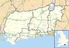
Nutbourne is located in West Sussex
Nutbourne

 Nutbourne shown within West Sussex
OS grid reference SU788054
Parish Southbourne
District Chichester
Shire county West Sussex
Region South East
Country England
Sovereign state United Kingdom
Police Sussex
Fire West Sussex
Ambulance South East Coast
EU Parliament South East England
UK Parliament Chichester
List of places: UK • England • West Sussex

Nutbourne is a village in the Chichester District of West Sussex, England located 2 miles (3km) east of Emsworth on the A259 road.

This small village on the south side of the former A27 road, now the A259, has a loop of road running through it with a ford on the south side of the village centre. It lies at the northern tip of Thorney Channel, an inlet of Chichester Harbour.

See also

External links

Media related to Nutbourne, Chichester at Wikimedia Commons


Wikimedia Foundation. 2010.

Игры ⚽ Нужно решить контрольную?

Look at other dictionaries:

  • Nutbourne — may refer to: Nutbourne, Horsham, West Sussex, England Nutbourne, Chichester, West Sussex, England This disambiguation page lists articles about distinct geographical locations with the same name. If an internal l …   Wikipedia

  • Nutbourne railway station — Nutbourne Location Place …   Wikipedia

  • Nutbourne Windmill — The mill in 2007 Origin Mill name Nutbourne Mill Mill location …   Wikipedia

  • Chichester (district) — Chichester District   Non metropolitan district   Chichester shown within West Sussex Sove …   Wikipedia

  • Chichester — For the larger local government district, see Chichester (district). For other uses, see Chichester (disambiguation). Coordinates: 50°50′11″N 0°46′45″W /  …   Wikipedia

  • Chichester railway station — This article is about a station in West Sussex. For the Metro station in Tyne and Wear, see Chichester Metro station. Chichester …   Wikipedia

  • Chidham and Hambrook — Coordinates: 50°49′45″N 0°52′59″W / 50.82914°N 0.88307°W / 50.82914; 0.88307 …   Wikipedia

  • Chidham — infobox UK place country = England static static image caption= latitude= 50.82914 longitude= 0.88307 official name =Chidham population = shire district= Chichester shire county= West Sussex region= South East England constituency westminster=… …   Wikipedia

  • Littlehampton railway station — Littlehampton Location Place …   Wikipedia

  • Selsey — Coordinates: 50°44′06″N 0°47′23″W / 50.73502°N 0.78977°W / 50.73502; 0.78977 …   Wikipedia

Share the article and excerpts

Direct link
Do a right-click on the link above
and select “Copy Link”