- Kholmsk
-
Kholmsk (English)
Холмск (Russian)- Inhabited locality - 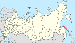
Location of Sakhalin Oblast in Russia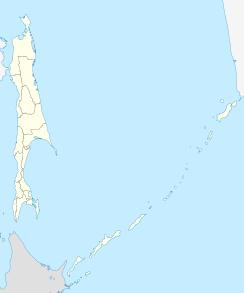
 Kholmsk
Coordinates: 46°39′N 141°52′E / 46.65°N 141.867°ECoordinates: 46°39′N 141°52′E / 46.65°N 141.867°E 

Coat of arms Flag Holiday 18 August[citation needed] Administrative status Country Russia Federal subject Sakhalin Oblast Administrative center of Kholmsk District[citation needed] Municipal status Representative body City Duma[citation needed] Statistics Population (2002 Census) 35,141 inhabitants[1] Founded 1870[citation needed] Postal code(s) 694620[citation needed] Dialing code(s) +7 424 33[citation needed] Official website Kholmsk (Russian: Холмск) is a town in Sakhalin Oblast, Russia, the administrative center of Kholmsky District. Population: 35,141 (2002 Census).
Contents
History
The town was founded in 1870 as a military post. After the Russo-Japanese War of 1904-05, the town was transferred to Japanese control, along with the rest of southern Sakhalin, under the Treaty of Portsmouth. The Japanese renamed the town Maoka (真岡), translating roughly as True Hill.
The Red Army retook the whole of Sakhalin at the end of the Second World War, with the town receiving its present name Kholmsk in 1946. The name is derived from the Russian word Kholm for hill, referring to the town's location on the hillside surrounding the harbour. On August 20, 1945, a combined marine battalion and the 113th infantry brigade landed in Port Maoka. They were preceded by a group of scouts, landed secretively by submarine Sh-118, in the Maoka area to successfully complete their task. However, Japanese resistance was desperate, and the landing party had to fight particularly fiercely and valiantly. Enemy fire set one of the coastguards on fire, to which the Russian response was intense naval bombardment of the city, causing more civilian deaths. It is known as Maoka Massacre.
As with a number of cities in the Russian Far East, Kholmsk has seen a large drop in population since the dissolution of the Soviet Union and the economic crisis which followed in the 1990s, with a 1989 population of over 50,000 now reduced to an estimated population of just over 31,000 in 2010.
Economy and infrastructure
Kholmsk is an important sea port for the island of Sakhalin. Since 1973, it has been the Sakhalin terminal of a SASCO train ferry to the port of Vanino on the Russian mainland, connecting the mainline rail network with that of the island.[2] Since Sakhalin railways use the Japanese gauge of 1,067 mm (3 ft 6 in), the railcars coming from the Russian mainland have their bogies changed in Kholmsk.[3]
International relations
Main article: List of twin towns and sister cities in RussiaTwin towns — Sister cities
Kholmsk is twinned with:
 Ansan, South Korea.[4]
 Kushiro City, Japan. (since 1975) [5]
External links
References
- ^ Федеральная служба государственной статистики (Federal State Statistics Service) (2004-05-21). "Численность населения России, субъектов Российской Федерации в составе федеральных округов, районов, городских поселений, сельских населённых пунктов – районных центров и сельских населённых пунктов с населением 3 тысячи и более человек (Population of Russia, its federal districts, federal subjects, districts, urban localities, rural localities—administrative centers, and rural localities with population of over 3,000)" (in Russian). Всероссийская перепись населения 2002 года (All-Russia Population Census of 2002). Federal State Statistics Service. http://www.perepis2002.ru/ct/doc/1_TOM_01_04.xls. Retrieved 2010-03-23.
- ^ SASCO: Vanino-Kholmsk (Russian)
- ^ Сахалинская узкоколейная железная дорога (The narrow-gauge railways of Sakhalin) (Russian)
- ^ Partnership between Russia and S.Korea
- ^ The Russian presence in Japan
Cities and towns in Sakhalin Oblast Administrative center: Yuzhno-Sakhalinsk
Alexandrovsk-Sakhalinsky · Aniva · Dolinsk · Kholmsk · Korsakov · Kurilsk · Makarov · Nevelsk · Okha · Poronaysk · Severo-Kurilsk · Shakhtyorsk · Tomari · Uglegorsk
 Categories:
- Cities and towns in Sakhalin Oblast


Wikimedia Foundation. 2010.