- Mont Aigoual
-
Mont Aigoual 
East face of Mont AigoualElevation 1,567 m (5,141 ft) Prominence 730 m (2,395 ft) Location Location  France
Range Massif Central Coordinates 44°07′22″N 3°34′30″E / 44.12278°N 3.575°ECoordinates: 44°07′22″N 3°34′30″E / 44.12278°N 3.575°E 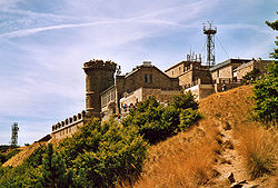 The weather observatory
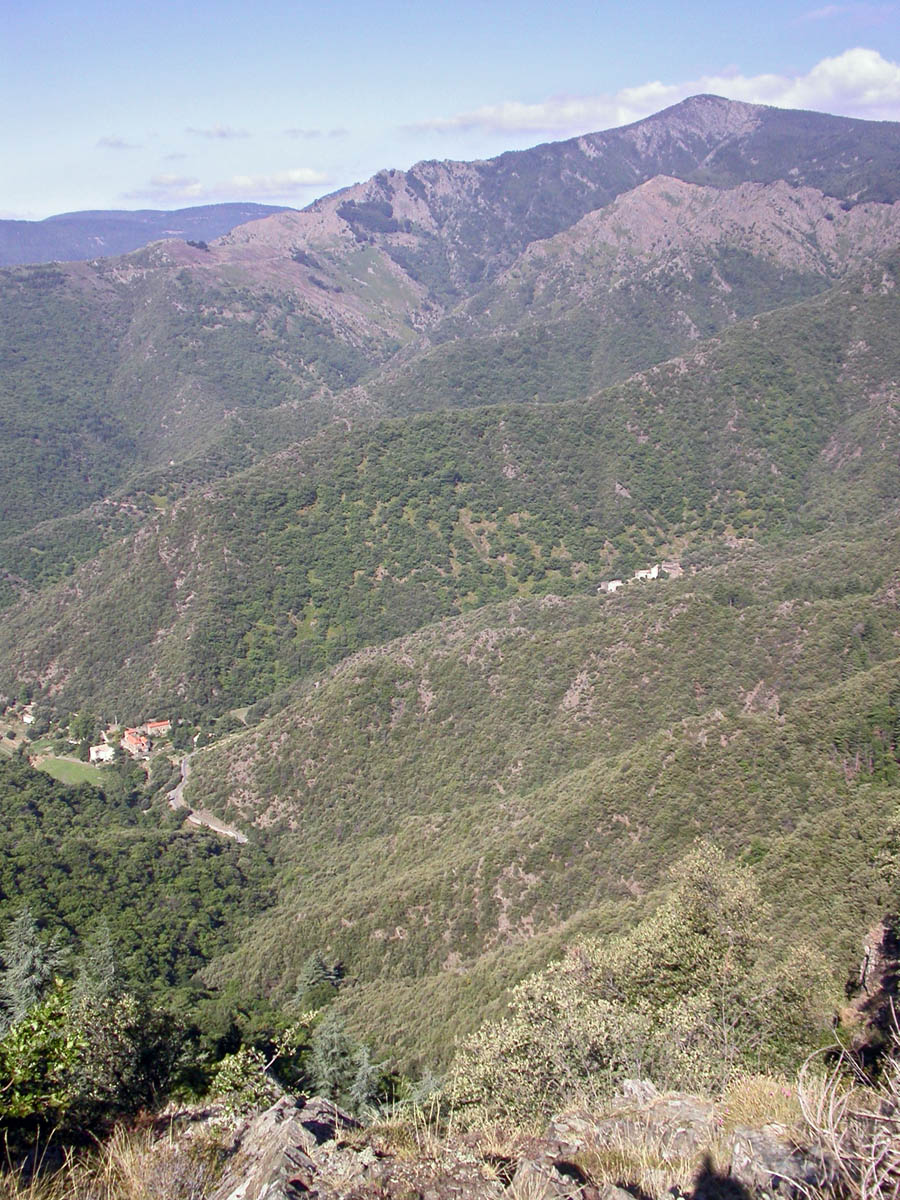
Mont Aigoual (Occitan: Mont Augal, elevation 1567m / 5141 ft) is the highest point of the Gard département, France. It is part of the Massif Central, and it is located within the Cévennes National Park.
This granite and schist outcrop is a major water catchment area in the Massif Central, being located where clouds from the cold Atlantic converge with warm Mediterranean air currents. The heavy rainfall has given the mountain its name: originally "Aiqualis" ('the watery one'). In an average year rainfall can measure up to 2250 mm (over 7 ft), making it the wettest place in France. Mont Aigoual forms part of the watershed between the Mediterranean and Atlantic.
The meteorological observatory, built in 1887 by the French Rivers Authority and Forestry Commission under the direction of Georges Fabre, is currently occupied by the French meteorological service (Météo France). It is the last remaining weather station in France which is still inhabited by meteorologists. An exhibition on weather forecasting is open to visitors in the summer months.
Severe weather conditions are sometimes recorded:
- Maximum Temperature : 28.2 °C in 1947;
- Minimum Temperature : -28 °C in 1956;
- Maximum wind speed : 360 km/h on November 6, 1966;
- Maximum rain in 24 hours: 607 mm from 6 p.m. on 30th to 6 p.m. on October 31, 1963;
- Maximum snow during one year : 10.24 metres;
- Frozen days: 144;
- High temperature days (> 25 °C) : 0;
- Rain days: 170;
- High wind days (> 16 m/s) : 265;
- Fog days: 241;
- Days with snow: 116.
When the sky is clear, it is possible to see the Mediterranean Sea, the Pyrenees, and also the Alps and Mont Blanc in particular. The summit is accessible by car from a variety of converging surfaced approaches.
References
- Green Guide:Languedoc, Roussillon, Tarn Gorges pp65–68, Michelin Tyre PLC, 1998 ISBN 2-06-136602-3
- The Rider - Tim Krabbe, Bloomsbury Publishing, 2002 ISBN 978-0747559412
Categories:

Wikimedia Foundation. 2010.