- Oatfield, Oregon
-
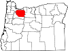
Oatfield, Oregon — CDP — Location of Oatfield, Oregon
Coordinates: 45°24′42″N 122°35′48″W / 45.41167°N 122.59667°W Country United States State Oregon County Clackamas Area – Total 4.4 sq mi (11.3 km2) – Land 4.4 sq mi (11.3 km2) – Water 0.0 sq mi (0.0 km2) Population (2000) – Total 15,750 – Density 3,608.1/sq mi (1,393.1/km2) Time zone Pacific (PST) (UTC-8) – Summer (DST) PDT (UTC-7) ZIP code 97267 Area code(s) 503 and 971 FIPS code 41-54325[1] Oatfield is a census-designated place in Clackamas County, Oregon, United States. It is in the Portland metropolitan area. As of the 2000 census, the population of the CDP was 15,750.
It is named after Oatfield Road, which runs between Milwaukie and Gladstone. Oatfield Road was named for the Oatfield family, well-known pioneers of the area.[2]
Contents
Geography
According to the United States Census Bureau, the CDP has a total area of 4.4 square miles (11 km2), all of it land.
Demographics
As of the census[1] of 2000, there were 15,750 people, 5,903 households, and 4,563 families residing in the CDP. The population density was 3,608.1 people per square mile (1,391.6/km²). There were 6,110 housing units at an average density of 1,399.7 per square mile (539.8/km²). The racial makeup of the CDP was 93.43% White, 0.47% African American, 0.53% Native American, 1.99% Asian, 0.12% Pacific Islander, 0.93% from other races, and 2.52% from two or more races. Hispanic or Latino of any race were 2.64% of the population.
There were 5,903 households out of which 30.6% had children under the age of 18 living with them, 65.9% were married couples living together, 8.5% had a female householder with no husband present, and 22.7% were non-families. 17.8% of all households were made up of individuals and 7.1% had someone living alone who was 65 years of age or older. The average household size was 2.65 and the average family size was 2.99.
In the CDP the population was spread out with 23.2% under the age of 18, 7.0% from 18 to 24, 24.7% from 25 to 44, 30.8% from 45 to 64, and 14.4% who were 65 years of age or older. The median age was 42 years. For every 100 females there were 95.2 males. For every 100 females age 18 and over, there were 92.3 males.
The median income for a household in the CDP was $59,769, and the median income for a family was $66,469. Males had a median income of $46,351 versus $33,247 for females. The per capita income for the CDP was $25,148. About 2.9% of families and 4.2% of the population were below the poverty line, including 4.5% of those under age 18 and 4.0% of those age 65 or over.
References
- ^ a b "American FactFinder". United States Census Bureau. http://factfinder.census.gov. Retrieved 2008-01-31.
- ^ McArthur, Lewis A.; Lewis L. McArthur (2003) [1928]. Oregon Geographic Names (Seventh Edition ed.). Portland, Oregon: Oregon Historical Society Press. pp. 716. ISBN 0-87595-277-1.
External links
- 1939 oral history memoir from Minerva Fessing Oatfield (an acquaintance of Abigail Scott Duniway), on the Library of Congress website
Coordinates: 45°24′42″N 122°35′48″W / 45.411612°N 122.596625°W
Municipalities and communities of Clackamas County, Oregon Cities Barlow | Canby | Damascus | Estacada | Gladstone | Happy Valley | Johnson City | Lake Oswego‡ | Milwaukie‡ | Molalla | Oregon City | Portland‡ | Rivergrove‡ | Sandy | Tualatin‡ | West Linn | Wilsonville‡
CDPs Jennings Lodge | Oak Grove | Oatfield | Sunnyside
Hamlets Village Unincorporated
communitiesBarton | Boring | Brightwood | Bull Run | Carus | Carver | Cazadero | Cherryville | Clackamas | Colton | Cottrell | Eagle Creek | Government Camp | Jean | Kelso | Ladd Hill | Lakewood | Liberal | Logan | Lone Elder | Macksburg | Marmot | Marquam | Marylhurst | Milwaukie Heights | Mountain Air Park | Needy | New Era | Redland | Rhododendron | Ripplebrook | Riverside | Shadowood | Springwater | Wankers Corner | Welches | Wemme | Yoder | Zigzag
Footnotes ‡This populated place also has portions in an adjacent county or counties
Categories:- Census-designated places in Oregon
- Portland metropolitan area
- Unincorporated communities in Clackamas County, Oregon


Wikimedia Foundation. 2010.