- Rollinsville, Colorado
Infobox Settlement
official_name = Rollinsville, Colorado
other_name =
native_name =
nickname =
settlement_type =Town
motto =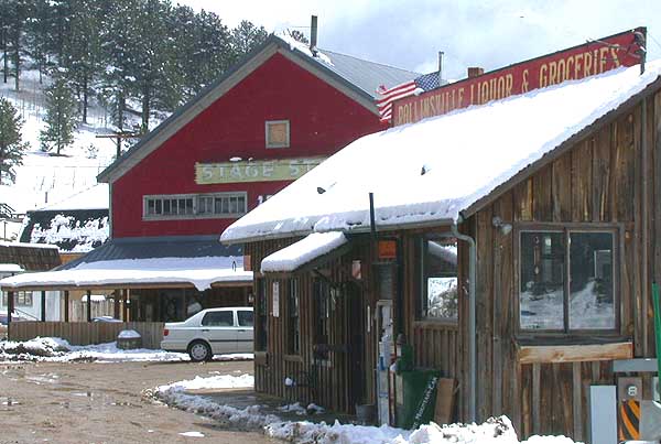
imagesize =
image_caption = Businesses along State Highway 119 in Rollinsville
flag_size =
image_
seal_size =
image_shield =
shield_size =
image_blank_emblem =
blank_emblem_type =
blank_emblem_size =
mapsize =
map_caption =
mapsize1 =
map_caption1 =
image_dot_
dot_mapsize =
dot_map_caption =
dot_x = |dot_y =
pushpin_
pushpin_label_position =left none
pushpin_map_caption =Location within the state of ColoradoLocation in Gilpin County and the state ofColorado
pushpin_mapsize =
subdivision_type = Country
subdivision_name = USA
subdivision_type1 = State
subdivision_name1 = flag|Colorado
subdivision_type2 = County
subdivision_name2 = Gilpin CountyGR|3
subdivision_type3 =
subdivision_name3 =
subdivision_type4 =
subdivision_name4 =
government_footnotes =
government_type =unincorporated town
leader_title =
leader_name =
leader_title1 =
leader_name1 =
leader_title2 =
leader_name2 =
leader_title3 =
leader_name3 =
leader_title4 =
leader_name4 =
established_title =
established_date =
established_title2 =
established_date2 =
established_title3 =
established_date3 =
area_magnitude =
unit_pref =
area_footnotes =
area_total_km2 =
area_land_km2 =
area_water_km2 =
area_total_sq_mi =
area_land_sq_mi =
area_water_sq_mi =
area_water_percent =
area_urban_km2 =
area_urban_sq_mi =
area_metro_km2 =
area_metro_sq_mi =
area_blank1_title =
area_blank1_km2 =
area_blank1_sq_mi =
population_as_of =
population_footnotes =
population_note =
population_total =
population_density_km2 =
population_density_sq_mi =
population_metro =
population_density_metro_km2 =
population_density_metro_sq_mi =
population_urban =
population_density_urban_km2 =
population_density_urban_sq_mi =
population_blank1_title =
population_blank1 =
population_density_blank1_km2 =
population_density_blank1_sq_mi =
timezone = MST
utc_offset = -7
timezone_DST = MDT
utc_offset_DST = -6
latd= 39
latm= 54
lats= 59
latNS=N
longd= 105
longm= 30
longs= 03
longEW=W
elevation_footnotes = GR|3
elevation_m = 2583
elevation_ft =
postal_code_type =ZIP code
postal_code = 80474
area_code =
blank_name = GNIS feature ID
blank_info = [http://geonames.usgs.gov/pls/gnispublic/f?p=gnispq:3:::NO::P3_FID:0202787 0202787]
blank1_name =
blank1_info =
website =
footnotes =Rollinsville is a small
unincorporated town and a U.S. Post Office located in Gilpin County,Colorado ,United States . It is located in the mountains southwest of the city of Boulder, on the flank of a hill aboveSouth Boulder Creek along State Highway 119 between Nederland and Black Hawk. It consists of a small cluster of residences and several businesses at the terminus of the road leading westward up toRollins Pass at the summit of theFront Range . The Rollinsville Post Office has theZIP Code 80474.cite web | date =January 2 2007 | url = http://zip4.usps.com/zip4/citytown.jsp | title = ZIP Code Lookup| format =JavaScript /HTML | publisher = United States Postal Service | accessmonthday = January 2 | accessyear = 2007]Geography
Rollinsville is located at coor dms|39|54|59|N|105|30|03|W|city (39.916320,-105.500851).
ee also
*
State of Colorado
**Colorado cities and towns
**Colorado counties
***Gilpin County, Colorado
**Colorado metropolitan areas
***Boulder Metropolitan Statistical Area
***Denver-Aurora-Boulder Combined Statistical Area
***North Central Colorado Urban Area
***Front Range Urban Corridor
*United States Forest Service
**Roosevelt National Forest References
External links

Wikimedia Foundation. 2010.