Brisbane road routes 1-30 — Routes 1 to 10 = Australian road routes table extended state = Queensland route shield = Qld M1.png route number = M1 route type = from locality = Cooroy to locality = Currumbin via locality1 = Caboolture via locality2 = Eagle Farm via locality3 … Wikipedia
Gateway Motorway — Infobox Australian Road road name = Gateway Motorway route route route photo = caption = M1: Bald Hills to Eight Mile Plains Metroad 4: Eight Mile Plains to Drewvale length = 48 direction = North South start = finish = est = through = Nudgee,… … Wikipedia
Metroad — A Metroad route marker as used in Sydney and Brisbane Metroads are the primary road routes serving the Sydney and Brisbane metropolitan areas in Australia. The Metroads form a network of radial and circumferential routes throughout the city,… … Wikipedia
Freeways in Australia — See also: Highways in Australia This is a list of freeways and motorways in Australia, sorted by states and territories and their corresponding routes. This list includes toll roads such as the CityLink freeway system in Melbourne. This list has… … Wikipedia
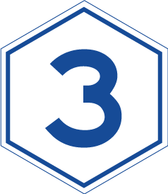
Metroad 3 (Brisbane) — The M3/A3 in Brisbane, Queensland, Australia, is a major urban road corridor. It connects Eight Mile Plains to Bald Hills via the following corridors: M3 Pacific Motorway between Eight Mile Plains and Brisbane CBD Coronation Drive and M3 Hale… … Wikipedia
Airport Link, Brisbane — QLDRoad name=Airport Link length= 6.5 direction=North South from=Toombul to=Bowen Hills via=LutwycheThe Airport Link is a tunnelled motorway grade road which is planned for the northern suburbs of Brisbane, Queensland, Australia. It will connect… … Wikipedia
Townsville — This article is about the metropolitan area of Townsville. For the Townsville CBD suburb, see Townsville City, Queensland. For the local government area, see City of Townsville. For other uses, see Townsville (disambiguation). Townsville… … Wikipedia
Caloundra, Queensland — Infobox Australian Place | type = suburb name = Caloundra city = Sunshine Coast state = qld caption = Caloundra Headland and the northern tip of Bribie Island lga = Sunshine Coast Regional Council postcode = 4551 pop = 93,248 [cite web | title =… … Wikipedia
Transport in Brisbane — Transport in Brisbane, the capital and largest city of Queensland, Australia, is provided by rail, river ferry, sea and air. Transport around Brisbane is managed by both the Brisbane City Council and the Government of Queensland, which owns… … Wikipedia
Sunshine Coast, Queensland — Infobox Australian Place | type = region name = Sunshine Coast state = qld caption = pop = 290,645* (2005)ABS LGA statistics of Caloundra, Maroochy Noosa [http://www.abs.gov.au/AUSSTATS/abs@.nsf/Latestproducts/3218.0Main%20Features42004… … Wikipedia