- Coburg, Oregon
-
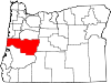
Coburg, Oregon — City — Shop on Willamette Street Location in Oregon
Coordinates: 44°8′14″N 123°3′49″W / 44.13722°N 123.06361°W Country United States State Oregon County Lane Incorporated 1893 Government – Mayor Judy Volta Area – Total 0.7 sq mi (1.8 km2) – Land 0.7 sq mi (1.8 km2) – Water 0 sq mi (0 km2) Elevation 398 ft (121.31 m) Population (2010) – Total 1,035 – Density 1,489.2/sq mi (575/km2) Time zone Pacific (UTC-8) – Summer (DST) Pacific (UTC-7) ZIP code 97408 Area code(s) 458 and 541 FIPS code 41-14400[1] GNIS feature ID 1119067[2] Website www.coburgoregon.org Coburg is a city (and a National Historic District) in Lane County, Oregon, United States, 8 miles (13 km) north of Eugene. The city's population as of the 2010 census was 1,035.[3]
Contents
History
The city was originally named Diamond after John Diamond, an early pioneer in the area, on whose land claim the city was located.[4] The city's current name comes from a stallion that was named after the Coburg district of Bavaria, Germany, from whence the horse had been imported.[4] The Coburg Historic District was placed on the National Register of Historic Places in 1986. The period of significance of the buildings in the district dates back to 1875.[5]
Economy
Business
Coburg is headquarters for Monaco Coach Corporation, a major manufacturer of recreational vehicles. Monaco Coach has a manufacturing plant in Coburg, as well as plants in Bend, Oregon, and Elkhart, Indiana. Coburg is also the headquarters of Marathon Coach, a manufacturer of luxury bus conversion motorcoaches.
Speed trap
Coburg's city government has generated hundreds of thousands of dollars for its budget through speeding fines at a speed trap on Interstate 5 located outside of city limits.[6] By 2003, the city was raising nearly half of its $1.7 million annual budget through traffic fines.[7] The speed trap was temporarily ended when Floyd Prozanski, a state legislator from Eugene, sponsored bills to make the practice against the law, effective January 2004.[6] Police Chief Hudson also lost his job, following the adoption of the new law.[7] However, the city annexed a segment of I-5, which enabled the continuation of revenue from traffic fines to motorists in this area.[6]
Geography
According to the United States Census Bureau, the city has a total area of 0.7 square miles (1.8 km2), all of it land.[8] It is situated near the Coburg Hills.[9] The city of Eugene is about 8 miles (13 km) to its south. As of November 2004, that area grew at least 26 acres (0.11 km2) due to annexation east of the city designed to incorporate a section of I-5 into city limits.[citation needed]
Demographics
 City hall and municipal court
2000 Census data
As of the census[1] of 2000, there were 969 people, 367 households, and 256 families residing in the city. The population density was 1,384.1 people per square mile (534.5/km²). There were 387 housing units at an average density of 552.8 per square mile (213.5/km²). The racial makeup of the city was 92.67% White, 1.96% Native American, 1.14% Asian, 0.31% Pacific Islander, 0.10% African American, 1.44% from other races, and 2.37% from two or more races. Hispanic or Latino of any race were 2.99% of the population. There were 367 households out of which 36.5% had children under the age of 18 living with them, 59.1% were married couples living together, 8.7% had a female householder with no husband present, and 30.0% were non-families. 21.8% of all households were made up of individuals and 6.3% had someone living alone who was 65 years of age or older. The average household size was 2.64 and the average family size was 3.07.
In the city the population was 28.6% under the age of 18, 6.5% from 18 to 24, 28.8% from 25 to 44, 25.8% from 45 to 64, and 10.3% who were 65 years of age or older. The median age was 38 years. For every 100 females there were 99.8 males. For every 100 females age 18 and over, there were 99.4 males. The median income for a household in the city was $47,500, and the median income for a family was $54,250. Males had a median income of $41,029 versus $26,071 for females. The per capita income for the city was $21,696. About 7.7% of families and 7.7% of the population were below the poverty line, including 4.5% of those under age 18 and 21.6% of those age 65 or over.
References
- ^ a b "American FactFinder". United States Census Bureau. http://factfinder.census.gov. Retrieved 2008-01-31.
- ^ "US Board on Geographic Names". United States Geological Survey. 2007-10-25. http://geonames.usgs.gov. Retrieved 2008-01-31.
- ^ "Race, Hispanic or Latino, Age, and Housing Occupancy: 2010 Census Redistricting Data (Public Law 94-171) Summary File (QT-PL), Coburg city, Oregon". U.S. Census Bureau, American FactFinder 2. http://factfinder2.census.gov. Retrieved October 31, 2011.
- ^ a b McArthur, Lewis A.; Lewis L. McArthur (2003) [1928]. Oregon Geographic Names (Seventh ed.). Portland, Oregon: Oregon Historical Society Press. ISBN 0-87595-277-1.
- ^ Lane County, nationalregisterofhistoricplaces.com
- ^ a b c "Coburg, Oregon Speed Trap Returns". theNewspaper.com. 2005-12-02. http://www.thenewspaper.com/news/08/811.asp. Retrieved 2009-01-29.
- ^ a b "Notorious for I-5 speed traps, Coburg police clean up their act". The Seattle Times. 2008-01-01. http://seattletimes.nwsource.com/html/localnews/2004103025_weborspeedtrap01m.html. Retrieved 2009-01-29.
- ^ "US Gazetteer files: 2010, 2000, and 1990". United States Census Bureau. 2011-02-12. http://www.census.gov/geo/www/gazetteer/gazette.html. Retrieved 2011-04-23.
- ^ "City of Coburg, Oregon". http://www.coburgoregon.org/.
External links
 Media related to Coburg, Oregon at Wikimedia Commons
- City of Coburg official website
- Oregon Blue Book entry for Coburg
Coordinates: 44°08′14″N 123°03′49″W / 44.137293°N 123.063579°W
Municipalities and communities of Lane County, Oregon Cities Coburg | Cottage Grove | Creswell | Dunes City | Eugene | Florence | Junction City | Lowell | Oakridge | Springfield | Veneta | Westfir
Unincorporated
communitiesAlvadore | Belknap Springs | Blachly | Blue River | Brickerville | Cheshire | Cloverdale | Crow | Culp Creek | Cushman | Deadwood | Deerhorn | Dexter | Disston | Dorena | Elmira | Fall Creek | Finn Rock | Franklin | Gillespie Corners | Glenada | Glenwood | Goldson | Goshen | Greenleaf | Heceta Beach | Horton | Indiola | Jasper | Lancaster | Latham | Leaburg | Linslaw | London Springs | Lorane | Low Pass | Mabel | Mapleton | Marcola | McCredie Springs | McKenzie Bridge | Minerva | Mohawk | Nimrod | North Beach | Noti | Pleasant Hill | Rainbow | Riverview | Saginaw | Searose Beach | Siltcoos | Swisshome | Tide | Tiernan | Triangle Lake | Vaughn | Vida | Walden | Walker | Walterville | Walton | Wendling | Westlake
Ghost towns Categories:- Cities in Oregon
- Populated places in Lane County, Oregon


Wikimedia Foundation. 2010.