- Oakridge, Oregon
-
Oakridge, Oregon — City — Highway 58 in Oakridge
Nickname(s): The Center of Oregon Recreation, Mountain Biking Capital of the Northwest Location in Oregon
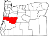
Coordinates: 43°44′46″N 122°27′48″W / 43.74611°N 122.46333°WCoordinates: 43°44′46″N 122°27′48″W / 43.74611°N 122.46333°W Country United States State Oregon County Lane Incorporated 1912 Government – Mayor Don Hampton Area – Total 2.0 sq mi (5.2 km2) – Land 1.9 sq mi (4.9 km2) – Water 0.1 sq mi (0.2 km2) Elevation 1,240 ft (377.9 m) Population (2010) – Total 3,205 – Density 1,596.3/sq mi (616.3/km2) Time zone Pacific (UTC-8) – Summer (DST) Pacific (UTC-7) ZIP code 97463 Area code(s) 458 and 541 FIPS code 41-54100[1] GNIS feature ID 1166689[2] Website www.ci.oakridge.or.us Oakridge is a city in Lane County, Oregon, United States. The population was estimated at 3,205 in 2010.[3] It is located east of Westfir on Oregon Route 58, about 40 miles (64 km) east of Eugene, and 150 miles (240 km) southeast of Portland. Surrounded by the Willamette National Forest, Oakridge is popular with outdoor enthusiasts for its hiking, mountain biking, wildflowers, fly fishing, birding, watersports, and nearby Willamette Pass ski area.
Contents
History
The area now known as Oakridge was first explored in 1852 as a possible route for pioneers coming from Central Oregon to the Willamette Valley. In 1912, a new community was formed and officially named Oakridge. Since its beginnings as a mountain ranch, Oakridge has been a railroad boomtown, a lumberjacks' haven,[4] and an outdoor enthusiast's destination.
The early boom for Oakridge can be attributed to the Southern Pacific Railroad. By 1910, work had already begun on Tunnel 22, a short route to connect Oakridge to the area now known as Westfir. Once up and running, the railroad played an integral part of the economy and lifestyle in Oakridge. By the late 1970s, however, the railroad had stopped its regular service in Oakridge and the depot was torn down. Today, the Union Pacific Railroad operates the rails, and trains are still a common sight in Oakridge.[5]
On July 2, 1946, Pope and Talbot Lumber Company purchased timberland near Oakridge. By 1948, the company built a large sawmill in Oakridge and had began a massive timber logging operation. While the railroad and Westfir's Hines sawmill began to slow down, the Pope and Talbot mill expanded and eventually employed more than 500 people. The combined economic base of the railroad and sawmills accounted for the population growth of the 1960s and '70s. However, in 1978 the Hines Mill in Westfir closed, and by 1985 the Pope and Talbot Mill had laid off all of its workers. The City of Oakridge now owns the property that formerly housed the Pope and Talbot sawmill.[6]
Today, Oakridge is popular with outdoor enthusiasts for its many recreational opportunities.[7]
Geography
Oakridge sits at an elevation ranging from 1,200 to 1,600 feet (370 to 490 m) above sea level.
According to the United States Census Bureau, the city has a total area of 2.0 square miles (5.2 km2), of which 1.9 square miles (4.9 km2) is land and 0.1 square miles (0.26 km2), or 4.52%, is water.[8]
Oakridge lies in a small valley in the foothills of the Cascade Range and is completely surrounded by Willamette National Forest. Five rivers are located in and around Oakridge, including Salmon Creek, Salt Creek, Hills Creek, and the Middle and North Forks of the Willamette River, the latter of which has been designated Wild and Scenic. Diamond Peak, a shield volcano located in nearby Diamond Peak Wilderness, can be seen from various spots in and around Oakridge. Waldo Lake, known as one of the purest lakes in the world, and Salt Creek Falls, the second highest waterfall in Oregon, are located 20 miles (32 km) east of town.[9][10]
Demographics
As of the census[1] of 2000, there were 3,148 people, 1,345 households, and 891 families residing in the city. The population density was 1,659.8 people per square mile (639.7/km2). There were 1,526 housing units at an average density of 804.6 per square mile (310.1/km2). The racial makeup of the city was 92.57% White, 0.32% African American, 1.59% Native American, 0.25% Asian, 0.06% Pacific Islander, 1.87% from other races, and 3.34% from two or more races. Hispanic or Latino of any race were 5.02% of the population.
There were 1,345 households out of which 25.5% had children under the age of 18 living with them, 50.6% were married couples living together, 10.7% had a female householder with no husband present, and 33.7% were non-families. 28.2% of all households were made up of individuals and 13.3% had someone living alone who was 65 years of age or older. The average household size was 2.34 and the average family size was 2.83.
In the city the population was spread out with 23.9% under the age of 18, 5.5% from 18 to 24, 23.6% from 25 to 44, 26.8% from 45 to 64, and 20.2% who were 65 years of age or older. The median age was 43 years. For every 100 females there were 104.2 males. For every 100 females age 18 and over, there were 100.4 males.
The median income for a household in the city was $26,622, and the median income for a family was $33,017. Males had a median income of $28,285 versus $18,672 for females. The per capita income for the city was $12,885. About 12.2% of families and 14.5% of the population were below the poverty line, including 18.1% of those under age 18 and 13.0% of those age 65 or over.
Economy
In 2006, Oakridge residents noticed a sharp increase in poverty, due to the low availability of jobs.[11]
Transportation
Land
State Highway 58, a designated freight route,[12] serves as a major connection between Highway 97 and Interstate 5. Running east-west, Highway 58 links the Willamette Valley and Central Oregon while crossing through the Willamette National Forest and Cascade Range.
Rail
Union Pacific Railroad's main north/south line in the western two-thirds of the United States, with cargo shipping services, runs through Oakridge. Amtrak shares the rail line and provides passenger train service to nationwide destinations from Eugene.[13]
Bus
Lane Transit District's Diamond Express runs three trips inbound and outbound on weekdays to the Eugene/Springfield area.[14]
Air
Oakridge State Airport is a public airport located one mile west of Oakridge. Eugene Airport, located 45 miles (72 km) west, is the closest regional terminal providing passenger and cargo air services with access to all world markets.
Ports
The closest International Shipping Ports to Oakridge are the Port of Coos Bay, located 145 miles (233 km) to the west in Coos Bay, and the Port of Portland, located 149 miles (240 km) to the north in Portland.
Education
The Oakridge School District consists of three schools and serves the children of Oakridge, Westfir, and outlying areas including High Prairie.
- Oakridge Elementary School - Grades K-6
- Oakridge Junior High - Grades 7-8
- Oakridge High School - 9-12
In 2008, Oakridge High School was recognized as one of the best high schools in America by U.S. News & World Report.[15]
The University of Oregon and Lane Community College are located 40 miles (64 km) west.
Notable people
- Mason Williams, composer, Classical Gas
References
- ^ a b "American FactFinder". United States Census Bureau. http://factfinder.census.gov. Retrieved 2008-01-31.
- ^ "US Board on Geographic Names". United States Geological Survey. 2007-10-25. http://geonames.usgs.gov. Retrieved 2008-01-31.
- ^ "Race, Hispanic or Latino, Age, and Housing Occupancy: 2010 Census Redistricting Data (Public Law 94-171) Summary File (QT-PL), Oakridge city, Oregon". U.S. Census Bureau, American FactFinder 2. http://factfinder2.census.gov. Retrieved October 31, 2011.
- ^ Jacklet, Ben. "Trouble in Timber Town". Oregon Business. http://www.oregonbusiness.com/articles/72-november-2009/2478-trouble-in-timber-town. Retrieved 2010-12-13.
- ^ "Oregon Railfan Sites". Frograil. http://www.frograil.com/railroad/or.htm. Retrieved 2010-12-04.
- ^ Tobe, Lisa. "Oakridge,Oregon". Sierra Institute. http://www.sierrainstitute.us/neai/OR_case_studies/Oakridge%20OR.pdf. Retrieved 2010-12-04.
- ^ "Former Lumber Town". NPR. http://www.npr.org/templates/story/story.php?storyId=129186583. Retrieved 2010-12-04.
- ^ "US Gazetteer files: 2010, 2000, and 1990". United States Census Bureau. 2011-02-12. http://www.census.gov/geo/www/gazetteer/gazette.html. Retrieved 2011-04-23.
- ^ Waterfalls of Oregon
- ^ Willamette National Forest - Waldo Lake Wilderness
- ^ Eckholm, Erik (2006-08-20). "Rural Oregon Town Feels Pinch of Poverty". New York Times. http://www.nytimes.com/2006/08/20/us/20poverty.html?pagewanted=1&_r=1. Retrieved 2010-05-20.
- ^ Oregon Department of Transportation, State Highway Freight System, March 2006
- ^ Amtrak, [1], JAN 2011
- ^ http://www.ltd.org/diamondex/index.html
- ^ Bates, Doug (2009-10-10). "Oakridge: A mill town on the mend". Oregonian. http://www.oregonlive.com/opinion/index.ssf/2009/10/oakridge_a_mill_town_on_the_me.html. Retrieved 2010-11-24.
External links
- Oakridge listing from the Oregon Blue Book
- Oakridge featured on NPR's State of the Re:Union
Municipalities and communities of Lane County, Oregon Cities Coburg | Cottage Grove | Creswell | Dunes City | Eugene | Florence | Junction City | Lowell | Oakridge | Springfield | Veneta | Westfir
Unincorporated
communitiesAlvadore | Belknap Springs | Blachly | Blue River | Brickerville | Cheshire | Cloverdale | Crow | Culp Creek | Cushman | Deadwood | Deerhorn | Dexter | Disston | Dorena | Elmira | Fall Creek | Finn Rock | Franklin | Gillespie Corners | Glenada | Glenwood | Goldson | Goshen | Greenleaf | Heceta Beach | Horton | Indiola | Jasper | Lancaster | Latham | Leaburg | Linslaw | London Springs | Lorane | Low Pass | Mabel | Mapleton | Marcola | McCredie Springs | McKenzie Bridge | Minerva | Mohawk | Nimrod | North Beach | Noti | Pleasant Hill | Rainbow | Riverview | Saginaw | Searose Beach | Siltcoos | Swisshome | Tide | Tiernan | Triangle Lake | Vaughn | Vida | Walden | Walker | Walterville | Walton | Wendling | Westlake
Ghost towns Categories:- Cities in Oregon
- Populated places in Lane County, Oregon


Wikimedia Foundation. 2010.