- Maywood Park, Oregon
-
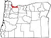
Maywood Park, Oregon — City — Hillside letters for Maywood Park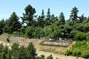 Location in Oregon
Coordinates: 45°33′12″N 122°33′43″W / 45.55333°N 122.56194°WCoordinates: 45°33′12″N 122°33′43″W / 45.55333°N 122.56194°W Country United States State Oregon County Multnomah Incorporated 1967 Government – Mayor Mark Hardie Area – Total 0.2 sq mi (0.4 km2) – Land 0.2 sq mi (0.4 km2) – Water 0 sq mi (0 km2) Elevation 77 ft (23.5 m) Population (2010) – Total 752 – Density 4,571.4/sq mi (1,764.7/km2) Time zone Pacific (UTC-8) – Summer (DST) Pacific (UTC-7) ZIP code 97220 Area code(s) 503 and 971 FIPS code 41-46730[1] GNIS feature ID 1639429[2] [3] Maywood Park is a city in Multnomah County, Oregon. The name came from a comment made by the wife of the man who developed the original subdivision, E.F. Taylor, who remarked one winter night how attractive the woods were in May.[citation needed] An enclave within the city of Portland, the residents of the city voted to incorporate in 1967 in an unsuccessful attempt to stop the construction of Interstate 205. The population was 752 at the 2010 census.[4]
Contents
History
In 1926, the city of Portland expanded Sandy Blvd through NE Portland to become a four lane highway, linking Portland with all points east. This expansion allowed much more development to take place in the Parkrose district, which at the time was primarily farmland. Beneath the eastern shadow of Rocky Butte, there existed a relatively untouched section of land that was a thick semi-old growth conifer forest. A triangular plot was purchased soon after by the Columbia Realty Company. Soon thereafter, the Maywood Park subdivision was plotted.
In 1930, Columbia Realty was bought out by Commonwealth, Inc. Under the direction of Robert H. Strong, Commonwealth took control of Maywood Park. The intention of the new developer was to build a neighborhood that would be of the same class as the Laurelhurst and Eastmoreland neighborhoods in southeast Portland.
 A street in Maywood Park
During the Great Depression, Maywood Park grew slowly throughout the 1930s. By the end of the decade though, home sales began to take off and in March 1939 there were 23 new homes under construction totaling a value of about $140,000, quite a large sum at the time. People were drawn to the neighborhood because it was far from the city center, but was easily accessible by automobile using Sandy Blvd. Another large draw was that, unlike the immediate surrounding area, Maywood Park was completely shrouded by huge conifer trees.
During World War II, the Federal Government constructed war worker housing in the surrounding area, known as Parkrose. This development was far different from the homes in Maywood Park with their mixed and sometimes eclectic styles of architecture, beautiful landscapes and tree shaded surroundings.
Highway development
After the passing of the Federal Aid Highway Act of 1956 and the subsequent construction of Interstate 5 through central Portland, it became apparent that the I-5 bypass of I-205 was to be routed through Maywood Park. Buoyed by a highway commission statement which stated that no highway should be pushed through an incorporated city without the city’s approval, the citizens voted to incorporate in 1967. The new city, now armed with more rights than would be afforded to a neighborhood, set out to dismantle the growing effort of the Oregon State Highway Commission to route I-205 through the city.
In 1968, the city filed a lawsuit against the highway commission seeking a halt to the continued design and engineering of I-205 within the incorporated area. The lawsuit also stated that the cost of constructing I-205 through Maywood Park was wasteful and not in the public interest. In addition, the city claimed that the buying of rights-of-way, road closures and changing of road grades without consent of the city were against Oregon law. The city lost this case and the highway commissions plans continued.
In 1971, Maywood Park again attempted to halt the freeway construction. This time, a suit was filed in Federal Court. The suit charged that the highway commission had refused to hold any public hearings and that construction of the freeway on the proposed route would require cutting many trees and stripping the land, which would cause a great interference with the wildlife of the area, and, in addition would created excessive noise and air pollution which would not be necessary if the freeway took another route. Once again, Maywood Park lost the suit. Now, beaten, the citizens of Maywood Park could do nothing as freeway construction began to tear apart their neighborhood. However a few concessions were made as a result of public hearings.
Maywood Park insisted that the freeway and access roads be sunken below grade to lessen the impact of vehicle sound. The freeway was sunk a great deal from its original planned grade. The city also demanded a large wall called a sound berm to be installed on the border of the freeway, which the state agreed to. And finally, the residents pleaded that “Every tree that can possibly be saved must be saved.” And so, in came the construction crews. The lower grade of the freeway has been the most successful sound limiting factor.
The city battled the Oregon Highway Department again in 1978 when a lawsuit was filed claiming that freeway construction had damaged properties along the western street of Maywood Place. Another concern addressed was the change in plans for the freeway from 6 lanes to 10 which was thought to be a greater impact on the city. Once again, the city lost the lawsuit and failed to bar construction.
Today, Maywood Park maintains a distinctive feel relative to the surrounding Parkrose district, in part because there are twice as many East-West streets as the rest of the Parkrose area.
Geography
According to the United States Census Bureau, the city has a total area of 0.2 square miles (0.52 km2), all of it land. The city is contained in a trapezoid bordered by NE Prescott Street to the north, NE 102nd Avenue to the east, I-205 to the south, and NE 92nd Avenue (across I-205) to the west, plus the eastern side of 92nd Avenue to Sandy Boulevard.[5]
Demographics
Historical populations Census Pop. %± 1970 1,305 — 1980 1,083 −17.0% 1990 781 −27.9% 2000 777 −0.5% 2010 752 −3.2% U.S. Decennial Census As of the census[1] of 2000, there were 777 people, 306 households, and 224 families residing in the city. The population density was 4,571.4 people per square mile (1,764.7/km²). There were 314 housing units at an average density of 1,847.4 per square mile (713.2/km²). The racial makeup of the city was 88.42% White, 2.06% African American, 0.90% Native American, 3.99% Asian, 0.13% Pacific Islander, 0.39% from other races, and 4.12% from two or more races. Hispanic or Latino of any race were 2.32% of the population.
There were 306 households out of which 27.8% had children under the age of 18 living with them, 60.1% were married couples living together, 9.5% had a female householder with no husband present, and 26.5% were non-families. 20.9% of all households were made up of individuals and 9.5% had someone living alone who was 65 years of age or older. The average household size was 2.54 and the average family size was 2.92.
In the city the population was spread out with 20.2% under the age of 18, 6.2% from 18 to 24, 25.7% from 25 to 44, 32.8% from 45 to 64, and 15.1% who were 65 years of age or older. The median age was 44 years. For every 100 females there were 92.8 males. For every 100 females age 18 and over, there were 90.2 males.
The median income for a household in the city was $56,250, and the median income for a family was $61,750. Males had a median income of $39,821 versus $36,071 for females. The per capita income for the city was $26,472. None of the families and 1.7% of the population were living below the poverty line, including no under eighteens and 1.7% of those over 64.
See also
- Mount Hood Freeway, a freeway revolt related to the development of I-205
References
- ^ a b "American FactFinder". United States Census Bureau. http://factfinder.census.gov. Retrieved 2008-01-31.
- ^ "US Board on Geographic Names". United States Geological Survey. 2007-10-25. http://geonames.usgs.gov. Retrieved 2008-01-31.
- ^ "US Gazetteer files: 2010, 2000, and 1990". United States Census Bureau. 2011-02-12. http://www.census.gov/geo/www/gazetteer/gazette.html. Retrieved 2011-04-23.
- ^ "2010 Census Redistricting Data (Public Law 94-171) Summary File". American FactFinder. United States Census Bureau. http://factfinder2.census.gov/faces/tableservices/jsf/pages/productview.xhtml?pid=DEC_10_PL_GCTPL2.ST13&prodType=table. Retrieved 11 August 2011.
- ^ http://www2.census.gov/geo/www/bas/st41_or/incplace/p4146730_maywood_park/BAS10P14100046730_001.pdf
External links
Municipalities and communities of Multnomah County, Oregon Cities Fairview | Gresham | Lake Oswego‡ | Maywood Park | Milwaukie‡ | Portland‡ | Troutdale | Wood Village
Unincorporated
communitiesBonneville | Bridal Veil | Corbett | Dodson | Dunthorpe | Interlachen | Kings Heights | Latourell | Riverview | Riverwood | Springdale | Warrendale
Footnotes ‡This populated place also has portions in an adjacent county or counties
Categories:- Cities in Oregon
- Populated places in Multnomah County, Oregon
- Portland metropolitan area


Wikimedia Foundation. 2010.