- Grand Ronde, Oregon
Infobox Settlement
official_name = Grand Ronde, Oregon
settlement_type = CDP
nickname =
motto =
imagesize =
image_caption =
image_
imagesize =
image_caption =
image_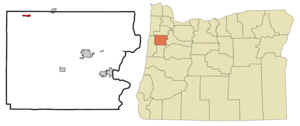
mapsize = 250px
map_caption = Location of Grand Ronde, Oregon
mapsize1 =
map_caption1 =subdivision_type = Country
subdivision_name =United States
subdivision_type1 = State
subdivision_name1 =Oregon
subdivision_type2 = County
subdivision_name2 = Polkgovernment_footnotes =
government_type =
leader_title =
leader_name =
leader_title1 =
leader_name1 =
established_title =
established_date =unit_pref = Imperial
area_footnotes =area_magnitude =
area_total_km2 = 1.7
area_land_km2 = 1.7
area_water_km2 = 0.0
area_total_sq_mi = 0.7
area_land_sq_mi = 0.7
area_water_sq_mi = 0.0population_as_of = 2000
population_footnotes =
population_total = 271
population_density_km2 = 159.8
population_density_sq_mi = 413.8timezone = Pacific (PST)
utc_offset = -8
timezone_DST = PDT
utc_offset_DST = -7
elevation_footnotes =
elevation_m = 105
elevation_ft = 344
latd = 45 |latm = 3 |lats = 42 |latNS = N
longd = 123 |longm = 36 |longs = 56 |longEW = Wpostal_code_type =
ZIP code
postal_code = 97347
area_code = 503
blank_name = FIPS code
blank_info = 41-30300GR|2
blank1_name = GNIS feature ID
blank1_info = 1142904GR|3
website =
footnotes =Grand Ronde is a
census-designated place (CDP) in Polk County,Oregon ,United States . Originally named "Grand Ronde Agency", the name of this city is a variation of the French "Grande Ronde" or "fine large valley", a description given to the area by the employees of theHudson's Bay Company , who wereFrench-Canadian . The population was 271 at the 2000 census. It is part of the Salem Metropolitan Statistical Area.History
Grand Ronde was the location of the headquarters of the
Grand Ronde Indian Reservation , which covered parts of Polk and Yamhill counties until the agency was closed in 1925. The organizational structure of the reservation was replaced by theConfederated Tribes of the Grand Ronde Community of Oregon , which was first incorporated May 13, 1935, terminated August 13, 1954, then reestablished in November, 1983.The Confederated Tribes own and operate Spirit Mountain Casino in Grand Ronde, which is a major local employer. In 1997, the Casino created the Spirit Mountain Community Fund, which supports a number of charities both within Polk county and throughout
Oregon from the Casino's gambling revenue.Geography
Grand Ronde is located at coor dms|45|3|42|N|123|36|56|W|city (45.061643, -123.615654)GR|1.
According to the
United States Census Bureau , the CDP has a total area of 0.6square mile s (1.7km² ), all of it land.Demographics
As of the
census GR|2 of 2000, there were 271 people, 113 households, and 61 families residing in the CDP. Thepopulation density was 413.8 people per square mile (161.0/km²). There were 140 housing units at an average density of 213.8/sq mi (83.2/km²). The racial makeup of the CDP was 67.16% White, 25.83% Native American, 2.95% Asian, 0.37% from other races, and 3.69% from two or more races. Hispanic or Latino of any race were 1.11% of the population.There were 113 households out of which 29.2% had children under the age of 18 living with them, 31.0% were married couples living together, 14.2% had a female householder with no husband present, and 46.0% were non-families. 36.3% of all households were made up of individuals and 6.2% had someone living alone who was 65 years of age or older. The average household size was 2.40 and the average family size was 3.07.
In the CDP the population was spread out with 28.8% under the age of 18, 8.5% from 18 to 24, 29.9% from 25 to 44, 25.8% from 45 to 64, and 7.0% who were 65 years of age or older. The median age was 36 years. For every 100 females there were 111.7 males. For every 100 females age 18 and over, there were 107.5 males.
The median income for a household in the CDP was $23,929, and the median income for a family was $20,139. Males had a median income of $19,722 versus $21,583 for females. The
per capita income for the CDP was $13,538. None of the families and 19.1% of the population were living below thepoverty line .Climate
The overall climate of Grand Ronde can be considered Mediterranean. This is characteristic of areas with wet, mild winters and warm, dry summers.
Grand Ronde is one of the wettest places in the contiguous United States. Precipitation data has been gathered in Grand Ronde sporadically since 1910 and continuously since 1948. That data shows the average annual precipitation from 1971-2000 to be 101.01". In contrast, rainfall in
Willamina , approximately 7 miles away, is 51.45". Additionally, precipitation at Laurel Mountain, located about 9 miles to the southeast and further up in theOregon Coast Range , comes down at an average rate of 120.89" per year.Temperature records for Grand Ronde are recorded at an unofficial location. Records there have been taken since 1993. The highest temperature recorded has been 103.8 on
July 27 1998 and the lowest was 9.0 onFebruary 2 1996 .References
External links
Wikimedia Foundation. 2010.