- Munhall, Pennsylvania
-
Munhall, Pennsylvania Borough  The Carnegie Library of Homestead, built from 1896 to 1898, located in Munhall
Country United States State Pennsylvania County Allegheny Coordinates 40°23′28.33″N 79°54′4.4″W / 40.3912028°N 79.901222°W Population 11,406 (2010) Timezone EST (UTC-5) - summer (DST) EDT (UTC-4) ZIP code 15120 Area code 412  Location of Munhall in Allegheny County
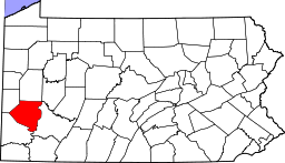 Location of Allegheny County in Pennsylvania
Website: Munhall, PA Munhall is a borough in Allegheny County, Pennsylvania, on the west bank of the Monongahela River, 8 miles (13 km) south of the confluence of the Monongahela and the Allegheny rivers where the Ohio River begins. It abuts the borough of Homestead. A large part of the Homestead Works of the Carnegie Steel Company existed in Munhall. Steel products were the only items made in Munhall in 1910 when 5,185 people lived here. In 1940, 13,900 people lived in Munhall. The population was 11,406 at the 2010 census.[1] Munhall, along with the boroughs of Homestead and West Homestead, are served by the Steel Valley School District.
Contents
Attractions
The Homestead Library, located in Munhall, was donated by Andrew Carnegie in 1896. It has been restored and modernized during the last quarter of a century. New electrical lighting has been installed; computers for the use of visitors have been installed; the indoors gloominess has vanished. Additionally, there are indoor pools, basketball courts, and other recreational facilities.
In 2000, Continental Realestate Companies opened The Waterfront. This large "LifeStyle" shopping center was built on the former site of the Carnegie Steel Works. Most of the structures associated with the steel mills on this site were demolished during construction. Still standing in the Waterfront development are some of the brick stacks from the Homestead Steel Works. In addition, near the river is a former mill structure known as the Pump House which was restored by the developer.
Geography
Munhall is located at 40°23′28″N 79°54′4″W / 40.39111°N 79.90111°W (40.391202, -79.901221).[2]
According to the United States Census Bureau, the borough has a total area of 2.4 square miles (6.2 km2), of which 2.3 square miles (6.0 km2) is land and 0.1 square miles (0.26 km2), or 4.55%, is water.
Surrounding communities
Munhall is bordered by Homestead, West Homestead and the Pittsburgh neighborhood of Lincoln Place to the west, by West Mifflin to the south and east, and by Whitaker to the east. Across the Monongahela River are the boroughs of Rankin and Swissvale to the northeast, and the city of Pittsburgh to the north.
Demographics
As of the census[3] of 2000, there were 12,264 people, 5,364 households, and 3,239 families residing in the borough. The population density was 5,311.2 people per square mile (2,049.9/km²). There were 5,780 housing units at an average density of 2,503.2 per square mile (966.1/km²). The racial makeup of the borough was 94.78% White, 3.38% African American, 0.02% Native American, 0.61% Asian, 0.29% from other races, and 0.92% from two or more races. Hispanic or Latino of any race were 0.80% of the population.
There were 5,364 households out of which 24.5% had children under the age of 18 living with them, 43.5% were married couples living together, 13.4% had a female householder with no husband present, and 39.6% were non-families. 35.7% of all households were made up of individuals and 19.3% had someone living alone who was 65 years of age or older. The average household size was 2.25 and the average family size was 2.95.
In the borough the population was spread out with 20.7% under the age of 18, 6.9% from 18 to 24, 26.8% from 25 to 44, 23.2% from 45 to 64, and 22.3% who were 65 years of age or older. The median age was 42 years. For every 100 females there were 85.0 males. For every 100 females age 18 and over, there were 81.3 males.
The median income for a household in the borough was $32,832, and the median income for a family was $41,847. Males had a median income of $32,202 versus $24,029 for females. The per capita income for the borough was $18,052. About 9.7% of families and 11.9% of the population were below the poverty line, including 18.2% of those under age 18 and 7.8% of those age 65 or over.
See also
References
- ^ "Race, Hispanic or Latino, Age, and Housing Occupancy: 2010 Census Redistricting Data (Public Law 94-171) Summary File (QT-PL), Munhall borough, Pennsylvania". U.S. Census Bureau, American FactFinder 2. http://factfinder2.census.gov. Retrieved September 21, 2011.
- ^ "US Gazetteer files: 2010, 2000, and 1990". United States Census Bureau. 2011-02-12. http://www.census.gov/geo/www/gazetteer/gazette.html. Retrieved 2011-04-23.
- ^ "American FactFinder". United States Census Bureau. http://factfinder.census.gov. Retrieved 2008-01-31.
External links
Municipalities and communities of Allegheny County, Pennsylvania Cities Clairton | Duquesne | McKeesport | Pittsburgh

Boroughs Aspinwall | Avalon | Baldwin | Bell Acres | Bellevue | Ben Avon | Ben Avon Heights | Bethel Park | Blawnox | Brackenridge | Braddock | Braddock Hills | Bradford Woods | Brentwood | Bridgeville | Carnegie | Castle Shannon | Chalfant | Cheswick | Churchill | Coraopolis | Crafton | Dormont | Dravosburg | East McKeesport | East Pittsburgh | Edgewood | Edgeworth | Elizabeth | Emsworth | Etna | Forest Hills | Fox Chapel | Franklin Park | Glassport | Glen Osborne | Glenfield | Green Tree | Haysville | Heidelberg | Homestead | Ingram | Jefferson Hills | Leetsdale | Liberty | Lincoln | McDonald‡ | McKees Rocks | Millvale | Monroeville | Mount Oliver | Munhall | North Braddock | Oakdale | Oakmont | Pennsbury Village | Pitcairn | Pleasant Hills | Plum | Port Vue | Rankin | Rosslyn Farms | Sewickley | Sewickley Heights | Sewickley Hills | Sharpsburg | Springdale | Swissvale | Tarentum | Thornburg | Trafford‡ | Turtle Creek | Verona | Versailles | Wall | West Elizabeth | West Homestead | West Mifflin | West View | Whitaker | White Oak | Whitehall | Wilkinsburg | Wilmerding
Townships Aleppo | Baldwin | Collier | Crescent | East Deer | Elizabeth | Fawn | Findlay | Forward | Frazer | Hampton | Harmar | Harrison | Indiana | Kennedy | Kilbuck | Leet | Marshall | McCandless | Moon | Mt. Lebanon | Neville | North Fayette | North Versailles | O'Hara | Ohio | Penn Hills | Pine | Reserve | Richland | Robinson | Ross | Scott | Shaler | South Fayette | South Park | South Versailles | Springdale | Stowe | Upper St. Clair | West Deer | Wilkins
CDPs Allison Park | Bairdford | Bakerstown | Carnot-Moon | Clinton | Curtisville | Enlow | Gibsonia | Glenshaw | Harwick | Imperial | Noblestown | Rennerdale | Russellton | Sturgeon
Unincorporated
communitiesAcmetonia | Blackridge | Blanchard | Broughton | Bruceton | Buena Vista | Creighton | Dorseyville | Elfinwild | Harmarville | Hickory Heights | Karns | Keown Station | Natrona | Natrona Heights | Warrendale | Wexford | Wildwood
Footnotes ‡This populated place also has portions in an adjacent county or counties
 Commonwealth of Pennsylvania
Topics - Cities
- Politics
- Government
- Delegations
- History
- Geography
- Geology
- Pennsylvanians
- State parks
- Symbols
- Visitor attractions
Metro areas Cities Largest
municipalities- Baldwin
- Berwick
- Bethel Park
- Brentwood
- Carlisle
- Chambersburg
- Columbia
- Darby
- Dunmore
- Elizabethtown
- Emmaus
- Ephrata
- Franklin Park
- Hanover
- Indiana
- Kingston
- Lansdale
- Lansdowne
- Monroeville
- Munhall
- Murrysville
- Norristown
- Penn Hills
- Phoenixville
- Plum
- Pottstown
- State College
- West Chester
- West Mifflin
- Whitehall
- Wilkinsburg
- Wyomissing
- Yeadon
Regions - Allegheny Mountains
- Allegheny National Forest
- Allegheny Plateau
- Atlantic Coastal Plain
- Blue Ridge
- Coal Region
- Cumberland Valley
- Delaware Valley
- Dutch Country
- Endless Mountains
- Happy Valley
- Laurel Highlands
- Lehigh Valley
- Main Line
- Northeast
- Northern Tier
- Northwestern
- Oil Region
- Pennsylvania Highlands
- Piedmont
- The Poconos
- Ridge and Valley
- South Central
- Susquehanna Valley
- Western
- Wyoming Valley
Counties - Adams
- Allegheny
- Armstrong
- Beaver
- Bedford
- Berks
- Blair
- Bradford
- Bucks
- Butler
- Cambria
- Cameron
- Carbon
- Centre
- Chester
- Clarion
- Clearfield
- Clinton
- Columbia
- Crawford
- Cumberland
- Dauphin
- Delaware
- Elk
- Erie
- Fayette
- Forest
- Franklin
- Fulton
- Greene
- Huntingdon
- Indiana
- Jefferson
- Juniata
- Lackawanna
- Lancaster
- Lawrence
- Lebanon
- Lehigh
- Luzerne
- Lycoming
- McKean
- Mercer
- Mifflin
- Monroe
- Montgomery
- Montour
- Northampton
- Northumberland
- Perry
- Philadelphia
- Pike
- Potter
- Schuylkill
- Snyder
- Somerset
- Sullivan
- Susquehanna
- Tioga
- Union
- Venango
- Warren
- Washington
- Wayne
- Westmoreland
- Wyoming
- York
Categories:- Populated places established in 1901
- Pittsburgh metropolitan area
- Boroughs in Allegheny County, Pennsylvania


Wikimedia Foundation. 2010.