- Marmaton Township, Bourbon County, Kansas
-
Marmaton Township — Township — Location in Bourbon County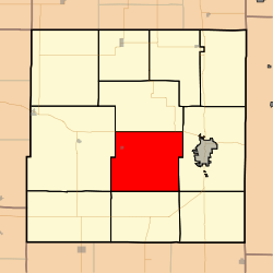
Coordinates: 37°48′45″N 094°49′21″W / 37.8125°N 94.8225°WCoordinates: 37°48′45″N 094°49′21″W / 37.8125°N 94.8225°W Country United States State Kansas County Bourbon Area – Total 56.11 sq mi (145.34 km2) – Land 56.04 sq mi (145.14 km2) – Water 0.08 sq mi (0.2 km2) 0.14% Elevation 820 ft (250 m) Population (2000) – Total 815 – Density 14.5/sq mi (5.6/km2) GNIS feature ID 0474758 Marmaton Township is a township in Bourbon County, Kansas, USA. As of the 2000 census, its population was 815.
Contents
Geography
Marmaton Township covers an area of 56.11 square miles (145.3 km2) and contains one incorporated settlement, Redfield. According to the USGS, it contains two cemeteries: Marmaton and Woods.
The streams of Bunion Creek, Cedar Creek, Chambers Branch, Elm Creek, Paint Creek, Pawnee Creek and Robinson Branch run through this township.
Transportation
Marmaton Township contains one airport or landing strip, Fort Scott Municipal Airport.
References
External links
Municipalities and communities of Bourbon County, Kansas Cities 
Townships Drywood | Franklin | Freedom | Marion | Marmaton | Mill Creek | Osage | Pawnee | Scott | Timberhill | Walnut
Unincorporated
communitiesDevon | Garland | Hiattville | Hammond | Marmaton | Pawnee Station | Xenia
Categories:- Townships in Bourbon County, Kansas
- Southeast Kansas geography stubs

Wikimedia Foundation. 2010.