- Churchville, Pennsylvania
-
- For the town of Bally, which was at one time named Churchville, see Bally, Pennsylvania
Churchville Census-designated place 
Country United States State Pennsylvania County Bucks Township Northampton Elevation 203 ft (61.9 m) Coordinates 40°12′03″N 74°59′49″W / 40.20083°N 74.99694°W Area 2.0 sq mi (5.2 km2) - land 2.0 sq mi (5 km2) - water 0.04 sq mi (0 km2), 2% Population 4,128 (2010) Density 2,064.0 / sq mi (796.9 / km2) Timezone EST (UTC-5) - summer (DST) EDT (UTC-4) Area code 215  Location of Churchville in Bucks County
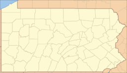
 Location of Churchville in Pennsylvania
 Location of Pennsylvania in the United States
Churchville is a census-designated place (CDP) in Northampton Township, Bucks County, Pennsylvania, United States. The population was 4,128 at the 2010 census.[1]
Contents
Geography
Churchville is located at 40°12′3″N 74°59′49″W / 40.20083°N 74.99694°W (40.200841, −74.996962)[2].
According to the United States Census Bureau, the CDP has a total area of 2.0 square miles (5.2 km2), of which 0.04 square miles (0.10 km2), or 0.98%, is water.
Demographics
Historical populations Census Pop. %± 1990 4,255 — 2000 4,469 5.0% 2010 4,128 −7.6% www.dvrpc.org/data/databull/rdb/db82/appedixa.xls As of the 2010 census, Churchville was 95.3% White, 0.5% Black or African American, 2.1% Asian, and 0.8% were two or more races. 1.2% of the population was of Hispanic or Latino ancestry.[2]
As of the census[3] of 2000, there were 4,469 people, 1,370 households, and 1,257 families residing in the CDP. The population density was 2,215.2 people per square mile (854.2/km²). There were 1,375 housing units at an average density of 681.6/sq mi (262.8/km²). The racial makeup of the CDP was 97.99% White, 0.40% African American, 1.19% Asian, 0.04% from other races, and 0.38% from two or more races. Hispanic or Latino of any race were 0.51% of the population.
There were 1,370 households out of which 42.8% had children under the age of 18 living with them, 85.9% were married couples living together, 4.3% had a female householder with no husband present, and 8.2% were non-families. 7.2% of all households were made up of individuals and 3.1% had someone living alone who was 65 years of age or older. The average household size was 3.20 and the average family size was 3.35.
In the CDP the population was spread out with 26.2% under the age of 18, 7.7% from 18 to 24, 23.9% from 25 to 44, 32.0% from 45 to 64, and 10.3% who were 65 years of age or older. The median age was 41 years. For every 100 females there were 95.4 males. For every 100 females age 18 and over, there were 91.9 males.
The median income for a household in the CDP was $95,010, and the median income for a family was $97,114. Males had a median income of $65,550 versus $41,750 for females. The per capita income for the CDP was $32,507. About 1.5% of families and 2.6% of the population were below the poverty line, including 2.1% of those under age 18 and 7.9% of those age 65 or over.
Neighborhoods
- Orchard Hill- Generally south and west of Second Street Pike and New Road
- Willow Greene- Between Tanyard and New Roads, west of Second Street Pike
- Windmill Village West- West of Willow Greene; Friesland Drive bisects this subdivision
- Northampton Hunt- East of Hatboro Road, South of Tanyard Road
Passenger trains
Main article: Churchville (SEPTA station)History
Churchville's population boom and growth as a commuter haven took place in the mid-1980s, just after the town lost it commuter railway line. Trains served the town until January 14, 1983[4] via SEPTA's Fox Chase-Newtown Rapid Transit Line. The station, and all of those north of Fox Chase, were closed due to failing diesel train equipment that the then-cash-strapped SEPTA could not afford to rehabilitate. As a result, ridership was low and the service cancelled on a "temporary" basis. As such, Churchville Station still appears in SEPTA's publicly posted tariffs.[5]
Although rail service was initially replaced with a Fox Chase-Newtown shuttle bus, patronage remained light. The traveling public never saw a bus service as a suitable replacement for a rail service, and the Fox Chase-Newtown shuttle bus service ended in 1999.
Resumption of passenger train service
In the ensuing years since 1983, there has been heavy interest by both residents and politicians in resuming passenger service to Churchville.
In September 2009, the Southampton-based Pennsylvania Transit Expansion Coalition (PA-TEC) began discussions with township officials along the railway, as well as SEPTA officials, about the realistic possibility of resuming even minimal passenger service to relieve traffic congestion in the region. Plans call for completing the electrification to Newtown, as originally planned in the late 1970s.
PA-TEC's efforts have received overwhelming bipartisan support by both Bucks and Montgomery County officials, as well as at the state level, despite SEPTA's overall reservations.[6] However, SEPTA has also confirmed they are willing to reestablish regular commuter service if strong political support exists in both counties.[7]
Notable natives and residents
- Alfred (Fred) Hagen, involved in the recovery of the Swamp Ghost[8]
- Kenny Vasoli of The Starting Line and Person L
- Jay Wright, coach of Villanova men's basketball.
References
- ^ "Race, Hispanic or Latino, Age, and Housing Occupancy: 2010 Census Redistricting Data (Public Law 94-171) Summary File (QT-PL), Churchville CDP, Pennsylvania". U.S. Census Bureau, American FactFinder 2. http://factfinder2.census.gov. Retrieved August 11, 2011.
- ^ "US Gazetteer files: 2010, 2000, and 1990". United States Census Bureau. 2011-02-12. http://www.census.gov/geo/www/gazetteer/gazette.html. Retrieved 2011-04-23.
- ^ "American FactFinder". United States Census Bureau. http://factfinder.census.gov. Retrieved 2008-01-31.
- ^ r8newtown.com. r8newtown.com. Retrieved on 2011-11-03.
- ^ SEPTA Tariff No. 154; effective July 1, 2009. (PDF) . Retrieved on 2011-11-03.
- ^ Werner, Jeff (March 5, 2010). "SEPTA: Reactivation of Newtown rail line a difficult prospect". Bucks Local News.[1]
- ^ r8newtown.com. r8newtown.com. Retrieved on 2011-11-03.
- ^ Bucks bizman recovers B-17. philly.com
Categories:- Census-designated places in Bucks County, Pennsylvania


Wikimedia Foundation. 2010.