- Morrisville, Bucks County, Pennsylvania
-
Morrisville Borough Official name: Borough of Morrisville Named for: Robert Morris Country United States State Pennsylvania County Bucks Elevation 56 ft (17 m) Coordinates 40°12′27″N 74°46′48″W / 40.2075°N 74.78°W Area 2.0 sq mi (5 km2) - land 1.8 sq mi (5 km2) - water 0.2 sq mi (1 km2) Population 8,728 (2010) Density 5,659.0 / sq mi (2,185 / km2) Mayor Rita Ledger Timezone EST (UTC-5) - summer (DST) EDT (UTC-4) ZIP Code 19067 Area code 215  Location of Morrisville in Bucks County
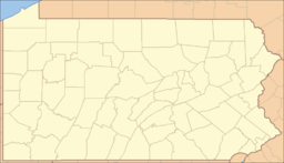
 Location of Morrisville in Pennsylvania
 Location of Pennsylvania in the United States
Website: morrisville-boro-gov.com Morrisville (
 /ˈmɒrɨsvɪl/; Philadelphia accent: [ˈmɑɹzvɪl] "Mars-ville") is a borough in Bucks County, Pennsylvania, United States. The population was 8,728 at the 2010 census.
Contents
Geography
Morrisville is located at 40°12′27″N 74°46′48″W / 40.2075°N 74.78°W (40.207458, -74.779918).[1] It is situated on the Delaware River directly across from Trenton, New Jersey. It is one of the eastern-most places in Pennsylvania (second only to Matamoras), and is part of a geographical salient that is mostly surrounded by New Jersey.
Originally a village located in Falls Township, until it was partitoned as a borough by the Pennsylvania Legislature in 1804. Morrisville is bordered by Falls Township to the south, Lower Makefield Township to the north and the Delaware River to the east.
Its name is the default city name in the 19067 ZIP code, which covers an area that includes Yardley, Lower Makefield, Morrisville, and part of Falls Township.
According to the United States Census Bureau, the borough has a total area of 2.0 square miles (5.1 km²), of which, 1.8 square miles (4.6 km²) of it is land and 0.2 square miles (0.5 km²) of it (10.15%) is water. U.S. 1 traverses Morrisville and crosses into New Jersey via the Trenton-Morrisville Toll Bridge.
Demographics
Historical populations Census Pop. %± 1930 5,368 — 1940 5,493 2.3% 1950 6,787 23.6% 1960 7,790 14.8% 1970 11,309 45.2% 1980 9,845 −12.9% 1990 9,765 −0.8% 2000 10,023 2.6% 2010 8,728 −12.9% www.dvrpc.org/data/databull/rdb/db82/appedixa.xls.</ref> As of the 2010 census, the borough was 75.7% White, 15.4% Black or African American, 0.3% Native American, 2.0% Asian, and 2.7% were two or more races. 10.2% of the population were of Hispanic or Latino ancestry [1].
As of the census[2] of 2000, there were 10,023 people, 4,154 households, and 2,612 families residing in the borough. The population density was 5,659.0 people per square mile (2,186.4/km²). There were 4,313 housing units at an average density of 2,435.1/sq mi (940.8/km²). The racial makeup of the borough was 75.98% White, 19.14% African American, 0.18% Native American, 1.20% Asian, 2.08% from other races, and 1.44% from two or more races. Hispanic or Latino of any race were 4.82% of the population.
There were 4,154 households out of which 38.5% had children under the age of 18 living with them, 42.7% were married couples living together, 15.0% had a female householder with no husband present, and 37.1% were non-families. 30.0% of all households were made up of individuals and 10.1% had someone living alone who was 65 years of age or older. The average household size was 2.41 and the average family size was 3.01.
In the borough the population was spread out with 24.7% under the age of 18, 7.9% from 18 to 24, 34.3% from 25 to 44, 21.1% from 45 to 64, and 12.0% who were 65 years of age or older. The median age was 36 years. For every 100 females there were 91.6 males. For every 100 females age 18 and over, there were 88.7 males.
The median income for a household in the borough was $43,095, and the median income for a family was $53,316. Males had a median income of $40,204 versus $30,110 for females. The per capita income for the borough was $21,404. About 8.9% of families and 10.0% of the population were below the poverty line, including 12.1% of those under age 18 and 8.8% of those age 65 or over.
Etymology
The borough is named for Pennsylvania merchant and banker Robert Morris, financier of the American Revolution. His home "Summerseat" still stands in town.
Sports
In 1955 the Morrisville Little League baseball team defeated Merchantville, NJ to claim the Little League World Series title. It is one of four Pennsylvania teams to have won the tournament since its inception in 1947.
Trivia
- A sunshine-filled Morrisville was featured in a TV commercial on how Pennsylvania locals have the right to choose their own Electric company.
- Morrisville was actually considered a location to house the capital of the United States. However, due to a rational argument from southern representatives, it was voted down due to geographical issues.
- The Olympic torch has passed through Morrisville twice via the "Trenton Makes" bridge and Bridge Street. The first occasion was in May 1984 on its way to the Summer Olympics in Los Angeles, California. The second occasion was in June 1996 when it passed through on its way to the Summer Olympics in Atlanta, Georgia.
- On the afternoon of Sunday, May 25, 1986 Hands Across America crossed over the "Trenton Makes" Bridge and into Morrisville. "More than five million people joined hands to form a line that stretched 4,152 miles – from New York City's Battery Park to a pier in Long Beach, California. This nationwide event, called Hands Across America, was intended to raise money to fight hunger and homelessness".
- The movie Signs included a scene at Burn's Pharmacy, which is located in Morrisville borough.
- Morrisville is the only town in America to have two signers of both the Declaration of Independence and the Constitution. (Robert Morris and George Clymer)
- Graystones, which is in Morrisville, is the site of the first land purchase in Pennsylvania.
Notable people
Morrisville is the birthplace or home to a number of famous Americans, including:
- Robert Morris[citation needed]
- George Clymer[citation needed]
- Asher Roth[3]
- Thomas Story Kirkbride[citation needed]
- Dick Hart—Former NFL player—Philadelphia Eagles [4]
- Willard Curtin- Lawyer and US Congessman.
References
- ^ "US Gazetteer files: 2010, 2000, and 1990". United States Census Bureau. 2011-02-12. http://www.census.gov/geo/www/gazetteer/gazette.html. Retrieved 2011-04-23.
- ^ "American FactFinder". United States Census Bureau. http://factfinder.census.gov. Retrieved 2008-01-31.
- ^ Crosley, Hillary (2009-02-05). "MC Asher Roth Readying Major-Label Debut". Billboard (magazine). http://www.billboard.com/bbcom/news/mc-asher-roth-readying-major-label-debut-1003938761.story. Retrieved 2009-03-05.
- ^ http://www.pro-football-reference.com/players/H/HartDi20.htm
External links
Categories:- Populated places established in 1798
- Boroughs in Bucks County, Pennsylvania


Wikimedia Foundation. 2010.