- New Bethlehem, Pennsylvania
-
New Bethlehem, Pennsylvania — Borough — 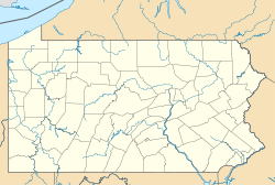
 New Bethlehem, Pennsylvania
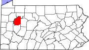
Coordinates: 41°00′12″N 79°19′51″W / 41.00333°N 79.33083°WCoordinates: 41°00′12″N 79°19′51″W / 41.00333°N 79.33083°W Country United States State Pennsylvania County Clarion Settled 1840 Incorporated 1853 Government – Type Borough Council – Mayor Area – Total 0.5 sq mi (1.2 km2) Population (2000) – Total 1,057 – Density 1,206.5/sq mi (462.5/km2) Time zone Eastern (EST) (UTC-5) – Summer (DST) EDT (UTC-4) Zip code 16242 New Bethlehem is a borough in Clarion County, Pennsylvania, United States. The population was 1,057 at the 2000 census.
Contents
Geography
New Bethlehem is located at 41°0′12″N 79°19′51″W / 41.00333°N 79.33083°W (41.003302, -79.330935)[1].
According to the United States Census Bureau, the borough has a total area of 0.5 square miles (1.3 km2), all of it land.
History
One of the prominent early settlers of the borough was Henry "Gum" Nolf (alternative spellings include Nulph), who built the first store, grist-, and saw-mill.[2] The town was first referred to as Gumtown in honor of Nolf, but subsequently was named Bethlehem, and later New Bethlehem to distinguish it from Bethlehem, Pennsylvania, in the eastern part of the state.
Demographics
As of the census[3] of 2000, there were 1,057 people, 489 households, and 274 families residing in the borough. The population density was 2,217.9 people per square mile (850.2/km²). There were 575 housing units at an average density of 1,206.5 per square mile (462.5/km²). The racial makeup of the borough was 98.49% White, 0.76% African American, 0.09% Native American, 0.09% Asian, 0.09% from other races, and 0.47% from two or more races. Hispanic or Latino of any race were 0.57% of the population.
There were 489 households out of which 21.9% had children under the age of 18 living with them, 44.0% were married couples living together, 9.4% had a female householder with no husband present, and 43.8% were non-families. 40.1% of all households were made up of individuals and 22.3% had someone living alone who was 65 years of age or older. The average household size was 2.08 and the average family size was 2.80.
In the borough the population was spread out with 19.0% under the age of 18, 6.8% from 18 to 24, 24.2% from 25 to 44, 23.8% from 45 to 64, and 26.1% who were 65 years of age or older. The median age was 45 years. For every 100 females there were 81.0 males. For every 100 females age 18 and over, there were 75.4 males.
The median income for a household in the borough was $25,069, and the median income for a family was $38,750. Males had a median income of $30,750 versus $20,469 for females. The per capita income for the borough was $17,796. About 13.9% of families and 16.0% of the population were below the poverty line, including 20.0% of those under age 18 and 9.4% of those age 65 or over.
Peanut Butter Festival
The city is home to a relatively unknown Peanut Butter Festival. Though the town is home to the Smucker's factory, the company does not sponsor the festival. The Peanut Butter Festival is a New Bethlehem Chamber sponsored event and is mainly set in the Gumtown Park.[4]
Flood of 1996
In 1996 there was a flood that destroyed many homes. Redbank Valley High School was shut down. It took a few months to clean and fix the damage until students where allowed to attend again. On a garage east of the Redbank Valley High School there is a line that shows how high the water level was at its highest point.
School District
Redbank Valley School District [1]
- Redbank Valley Jr/Sr High School
- New Bethlehem Elementary
- Mahoning Elementary
- Hawthorn Elementary
References
- ^ "US Gazetteer files: 2010, 2000, and 1990". United States Census Bureau. 2011-02-12. http://www.census.gov/geo/www/gazetteer/gazette.html. Retrieved 2011-04-23.
- ^ History of Clarion County. Davis, A.J., ed. "CHAPTER LXI: HISTORY OF NEW BETHLEHEM BOROUGH," L. L. Himes. Available online at http://www.rootsweb.ancestry.com/~pacchs/davis/61.htm
- ^ "American FactFinder". United States Census Bureau. http://factfinder.census.gov. Retrieved 2008-01-31.
- ^ Batz, Bob (September 14, 2006). "Tale of Peanut Butter Festival is spread thin". Pittsburgh Post-Gazette (PG Publishing Co., Inc.). http://www.post-gazette.com/pg/06257/721601-34.stm. Retrieved 16 January 2010.
External links
Municipalities and communities of Clarion County, Pennsylvania Boroughs Callensburg | Clarion | East Brady | Emlenton‡ | Foxburg | Hawthorn | Knox | New Bethlehem | Rimersburg | Shippenville | Sligo | St. Petersburg | Strattanville
Townships Unincorporated
communityScotch Hill
Footnotes ‡This populated place also has portions in an adjacent county or counties
Categories:- Populated places established in 1840
- Boroughs in Clarion County, Pennsylvania


Wikimedia Foundation. 2010.