- Como, Colorado
-
Como, Colorado — Town — The Como Roundhouse Location within the state of Colorado
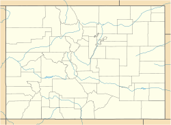
 Como, Colorado
Coordinates: 39°18′57″N 105°53′32″W / 39.31583°N 105.89222°WCoordinates: 39°18′57″N 105°53′32″W / 39.31583°N 105.89222°W Country  United States
State  State of Colorado
County Park County[1] Government – Type unincorporated town Elevation[1] 9,813 ft (2,991 m) Time zone MST (UTC-7) – Summer (DST) MDT (UTC-6) ZIP Code[2] 80432 Como is an unincorporated town and a U.S. Post Office in Park County, Colorado, United States. The Como Post Office has the ZIP Code 80432.[2]
Located at the northern end of South Park, the town is a historic mining settlement founded during the Pike's Peak Gold Rush in 1859. It sits approximately one-half mile (1 km) north of U.S. Route 285, approximately 9 miles (15 km) northeast of Fairplay. It is accessible by an unpaved county road off Highway 285 leading northwest over Boreas Pass (to Breckenridge) in the Front Range. The mountains northwest of town form a dramatic background to the town site, which sits on the flank of Little Baldy Mountain. The town was named by prospectors and miners from Como, Italy who came to work the gold fields of the area.
In 1879 the town became the location of a roundhouse of the Denver, South Park and Pacific Railroad, which was extended over Kenosha Pass to reach the silver mining areas during the Colorado Silver Boom. The roundhouse served as a junction for trains going northward over Boreas Pass and southward toward Fairplay and over Trout Creek Pass at the western end of South Park. The town has many historic weathered structures, including the roundhouse, and has the air of a ghost town that is still nevertheless populated, by 500 people. It has a small commercial district just off the main county road consisting of a post office and general store. The roundhouse is currently under renovation with intention of turning it into a principal tourist attraction in the area.
Geography
Como is located at 39°18′57″N 105°53′32″W / 39.31583°N 105.89222°W (39.315707,-105.892239).
See also
- Denver-Aurora Metropolitan Statistical Area
- Denver-Aurora-Boulder Combined Statistical Area
- Front Range Urban Corridor
- List of cities and towns in Colorado
References
- ^ a b "US Board on Geographic Names". United States Geological Survey. 2007-10-25. http://geonames.usgs.gov. Retrieved 2008-01-31.
- ^ a b "ZIP Code Lookup" (JavaScript/HTML). United States Postal Service. December 22, 2006. http://zip4.usps.com/zip4/citytown.jsp. Retrieved December 22, 2006.
Municipalities and communities of Park County, Colorado Towns 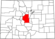
CDP Unincorporated
communitiesGhost towns Antero Junction | Buckskin Joe | Garo | Tarryall
Categories:- Populated places in Park County, Colorado
- Unincorporated communities in Colorado
- Colorado Mining Boom


Wikimedia Foundation. 2010.