- Richelieu, Indre-et-Loire
-
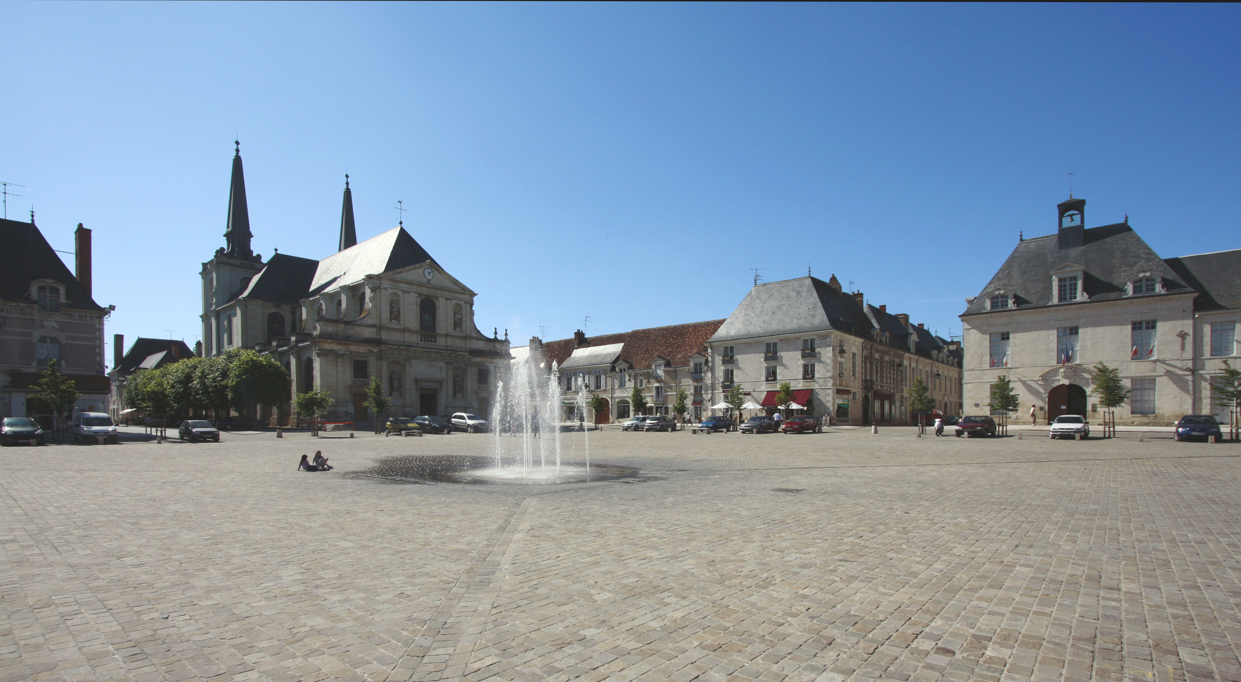
Richelieu

Place du Cardinal 
 Richelieu
Administration Country France Region Centre Department Indre-et-Loire Arrondissement Chinon Canton Richelieu Mayor Hervé Novelli
(2008–2014)Statistics Elevation 47–77 m (154–253 ft) Land area1 5.09 km2 (1.97 sq mi) Population2 1,993 (2006) - Density 392 /km2 (1,020 /sq mi) INSEE/Postal code 37196/ 37120 1 French Land Register data, which excludes lakes, ponds, glaciers > 1 km² (0.386 sq mi or 247 acres) and river estuaries. 2 Population without double counting: residents of multiple communes (e.g., students and military personnel) only counted once. Coordinates: 47°00′54″N 0°19′28″E / 47.015°N 0.3244°E
Richelieu is a commune in the Indre-et-Loire department in central France.
It lies south of Chinon and west of Sainte-Maure de Touraine and is surrounded by mostly agricultural land. Its inhabitants are called Richelais, and Richelaises.
Because of its design as the "ideal city" of the seventeenth century, the town is the subject of protective measures for its architecture.
Contents
History
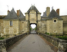 Town gate
In 1343, salt became a state monopoly by order of the Valois king Philip VI, who established the gabelle, the tax on salt. Anjou was part of the "great gabelle" area and encompassed sixteen special tribunals or "salt granaries", including that of Richelieu.
The village was a 17th century model "new town". It was built at the order of Cardinal Richelieu, who had spent his youth there and bought the village of his ancestors; he had the estate raised to a duché-pairie August 1631. He engaged the architect Jacques Lemercier, who was already responsible for the Sorbonne and the Cardinal's hôtel in Paris, the Palais Cardinal (now the Palais-Royal). With the permission of the king, Louis XIII, he created from scratch a walled town on a grid arrangement, and, enclosing within its volumes the modest home of his childhood, an adjacent palace, the château de Richelieu,[1] surrounded by an ornamental moat and large imposing walls enclosing a series of entrance courts towards the town and, on the opposite side, grand axially-planned formal vista gardens of parterres and gravel walks, a central circular fountain, and views reaching to an exedra cut in the surrounding trees and pierced by an avenue in the woodlands extending to the horizon. The pleasure grounds were enclosed in woodland;[2] since their innovative example was followed and extended at Vaux-le-Vicomte and in the gardens of Versailles, and since André Le Nôtre's father was employed at Richelieu in 1629, and it is not improbable that the young boy was employed as well,[3] it is worth making a detailed survey. Construction took place between 1631 and 1642 – the year of the Cardinal's death – and employed around 2000 workers.
The lost gardens
The château was approached by a long double allée of trees forming one of three avenues that met at a patte d'oie before the outer gates, which curved inwards to form half of a circle on the ground that was completed by the pattern formed by the three approaching approaches through the town; this nodal feature, with its flanking pavilions, survives, in the town's place du Cardinal. In the two spandrel shapes enclosed behind the outer walling were matching enclosed outer service courts. Through the arched central gateway the visitor entered the vast basse cour, with common stabling for a hundred horses in a flanking courtyard to the left, with barns and lodgings for gardeners and estate workers, and to the right, an identical courtyard with elite stabling, bakehouse and other offices. Continuing along the axis one passed through a smaller cour d'honneur enclosed by matching ranges each with a central dome and end pavilions. There was a central fountain. Beyond was the rectangular moat that surrounded the château itself, with its inner court, reached across a central draw-bridge leading to the grand domed gatehouse, a handsome structure with Hercules and Mars in niches on either side and a statue of Louis XIII above, with a statue of Fame crowning the dome.
The inner court was about two-thirds the width of the avant-cour. The main corps de logis was domed; its left-hand range enclosed the modest house of Richelieu's youth. Wings enclosed the court on either side; once again they had end pavilions with squared domes. On the façades of the piano nobile there were niches in the piers between windows, containing statues, and niches in the ground floor containing busts.
The garden front looked onto a square parterre that was itself surrounded by moats and reached by a central bridge. Like the two outer courts, it was divided in four plats with a central feature. To either side a major cross-axis extended the patterned gardens. Ahead, at the terminus of the main axis, the woods drew back in an exedra.
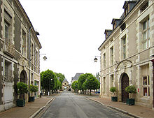 Grande Rue near Place des Religieuses
The town
The town itself is about 700 meters long by 500 meters wide. It is accessible by three monumental gates; a fourth, dummy gate exists to respect the symmetry of the whole. The urban plan revolves around two symmetrically arranged places: Place Royale (religious) and the Place du Cardinal (now Market Square), in which are grouped the presbytery, the "audience" (now the town hall), a covered open market hall (still surviving, with wooden pillars and roof beams) and shops.
To ensure quick settlement, the Cardinal imposed no city taxes. In return, buyers of plots for construction undertook to build within two years a "flag" or a house according to the plans and specifications filed with the court of the city, while being forced to choose as builder one of the Cardinal's appointees. A register of specific transactions is kept, allowing historians to know today the list of owners of the original buildings of the city.
Upon the death of Cardinal, the city ceased to grow, but continued to have illustrious visitors, like Louis XIV of France, Jean de La Fontaine, and Voltaire. According to La Fontaine, Richelieu was at the time of writing the "most beautiful village of the universe."
In 1790, during the convening of the Estates General, representatives of the town of Richelieu sat with those of Mirebeau in the delegation of Saumur, within the generality of Tours. The same year, the town of Richelieu was separated from Saumur to integrate with the then new Department of Indre-et-Loire.
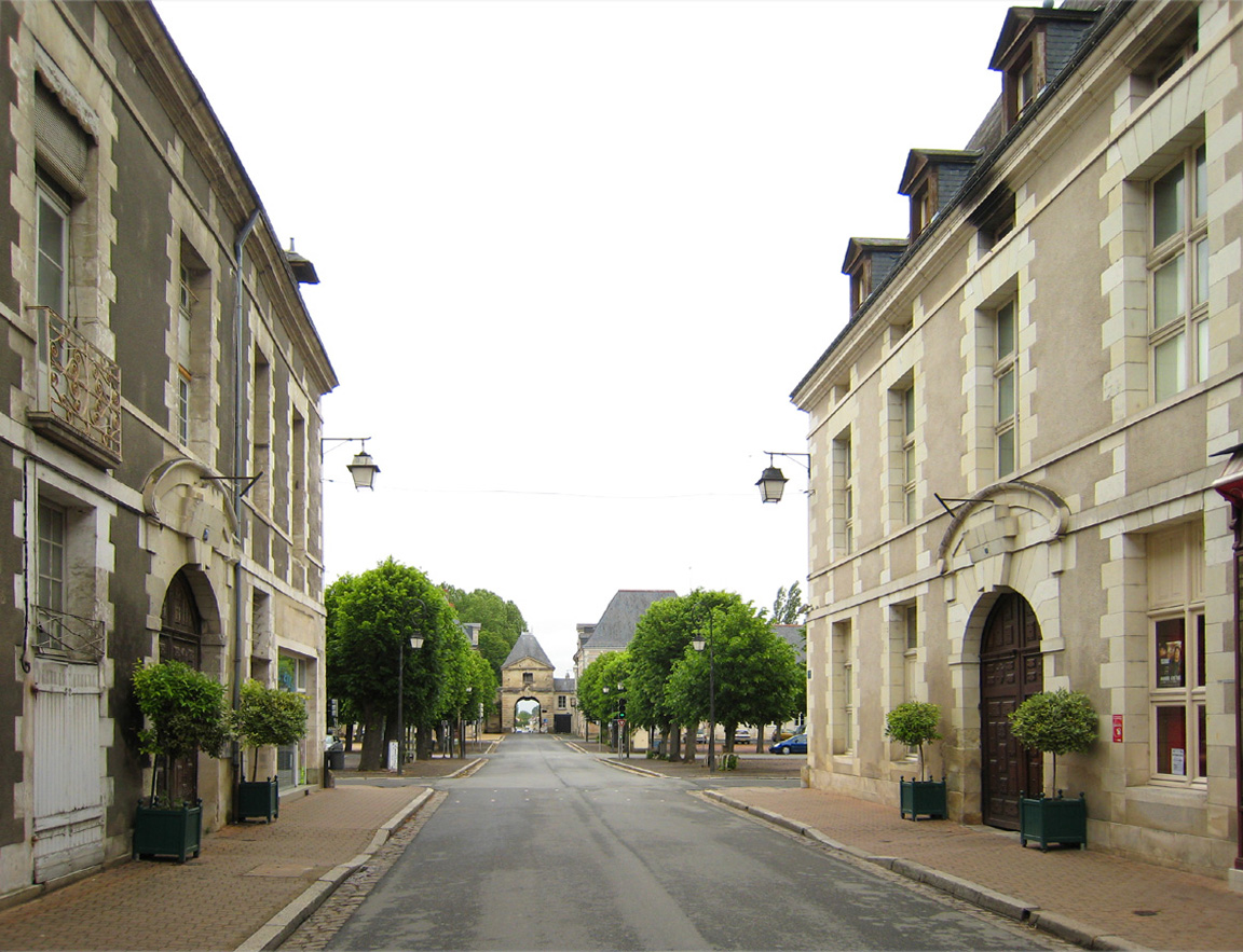
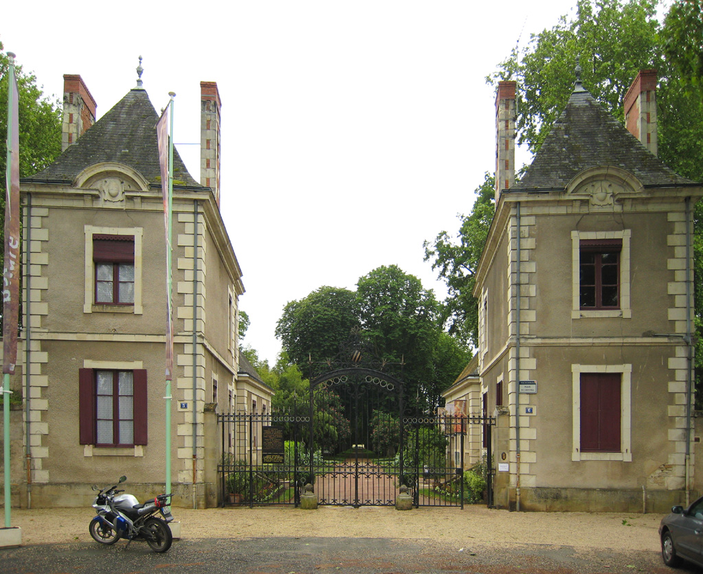
The Palace park
 Palace park entry
After a period of decline, the palace was dismantled in the nineteenth century — not for any great political reasons, but by an estate agent. It was sold, stone for stone, as building material. Elements of the fabric appear to have been reused on farms in the area.
The walled gardens remain, and are open as a public park. A few fragments of the palace buildings remain, such as the bridges over the moats, the "Honour Gateway", and some buildings from the service ranges; one of the latter is in use as a kind of museum or information centre and includes pictures and models of the palace as it once was. This building is covered in carved graffiti from visitors to the site, dating back at least as far as 1905, and including dated initials from the periods of both World War I and World War II, plus some graffiti from bearers of the Richelieu name.
There is a small shop and management office at the entrance, and a car park between that and the town.
Administration today
The mayor of Richelieu is Hervé Novelli, formerly a Secretary of State in the French cabinet. He is assisted by five deputies.
Festival
Periodically the town holds historical re-enactments.
Notes
- ^ The château was engraved by Jean Marot, La magnifique chasteau de Richelieu, about 1660; it is unlikely that essential changes had been made since the Cardinal's death. The château was described, on the basis of Marot's engraving, by H. Carrington Lancaster, "The Chateau de Richelieu and Desmaretz's Visionnaires" Modern Language Notes 60.3 (March 1945:167-172) on which the present description is based.
- ^ SMarot's engraving preserves the layout of the gardens in detail.
- ^ Derek Clifford, A History of Garden Design 1963 fig. 26 facing p. 65.
See also
References
- Population statistics (in French)
External links
- Official town site (French)
Categories:- Communes of Indre-et-Loire


Wikimedia Foundation. 2010.