- Dotsero, Colorado
-
Dotsero — CDP — Houses in Dotsero, Colorado along the south side of Interstate 70, along the Eagle River. Location within the state of Colorado
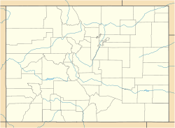
 Dotsero
Coordinates: 39°39′0″N 107°3′30″W / 39.65°N 107.05833°WCoordinates: 39°39′0″N 107°3′30″W / 39.65°N 107.05833°W Country United States State Colorado County Eagle Time zone Mountain (MST) (UTC-7) – Summer (DST) MDT (UTC-6) ZIP codes FIPS code GNIS feature ID Dotsero is a census-designated place in western Eagle County, Colorado in the United States. The population as of the 2010 Census was 705.[1] It is located at the confluence of the Eagle River with the Colorado River, along U.S. Highway 6 and Interstate 70, near the head of Glenwood Canyon, approximately 5 miles (8 km) west of Gypsum. The town consists mostly of a cluster of houses and trailers on both sides of the Eagle River.
Railroad
Dotsero was an important railroad junction point and is located at the southern end of the Dotsero Cutoff of the Denver and Rio Grande Western Railroad. The northern end of cutoff was named Orestod (Dotsero spelled backwards) near Bond, Colorado.
Ferdinand Hayden published an extensive survey of Central and Southwest Colorado in 1877,[2] and used the location of the town of Dotsero as his "Dot Zero" (reference point) for his survey maps.[citation needed] The station name exists from the construction of the Standard Gauge railroad line to Glenwood Springs in the 1890s.[citation needed]
Currently[when?] the railroad line to the east from this junction point over Tennessee Pass lies dormant.

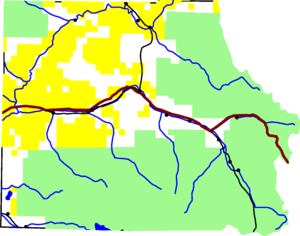 Dotsero is at the confluence of the Eagle and Colorado Rivers in Eagle County.
Volcano
Dotsero is built at the base of Colorado's most recently active volcano, the Dotsero Crater, which, according to the United States Geological Survey, erupted 4,140 years ago.[3]
The main industry at Dotsero for years consisted of making cinderblocks from the volcano.[citation needed]
References
- ^ Colorado Trend Report 2: State and Complete Places (Sub-state 2010 Census Data). Missouri Census Data Center. Accessed 2011-02-25.
- ^ Atlas of Colorado, http://swcenter.fortlewis.edu/inventory/HaydenMaps.htm
- ^ America's Volcanic Past, USGS, http://vulcan.wr.usgs.gov/LivingWith/VolcanicPast/Places/volcanic_past_colorado.html
Municipalities and communities of Eagle County, Colorado Towns 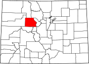
CDPs Unincorporated
communitiesBeaver Creek | Bond | Burns | Cordillera | Eagle-Vail | Gilman
Footnotes ‡This populated place also has portions in an adjacent county or counties
Categories:- Populated places in Eagle County, Colorado
- Census-designated places in Colorado
- Colorado geography stubs


Wikimedia Foundation. 2010.