- Maryland Route 8
-
"MD 8" redirects here. For the congressional district, see Maryland's 8th congressional district.
Maryland Route 8

Route information Maintained by MDSHA Length: 8.37 mi[1] (13.47 km) Major junctions South end: Romancoke Pier in Romancoke 
 US 50 / US 301 in Stevensville
North end:  MD 18 in Stevensville
Location Counties: Queen Anne's Highway system Maryland highway system
Interstate • US • State • Minor • Former • Turnpikes←  MD 7
MD 7MD 10  →
→Maryland Route 8 (MD 8) is a state highway in the U.S. state of Maryland. Known for most of its length as Romancoke Road, the state highway runs 8.37 miles (13.47 km) from Romancoke Pier in Romancoke north to MD 18 in Stevensville. MD 8 is the main north–south highway of Kent Island in western Queen Anne's County. The state highway is also the first highway encountered on U.S. Route 50 and US 301 east of the Chesapeake Bay Bridge. South of Matapeake, Route 8 is paralleled by the Kent Island South Trail.
The section of MD 8 from Stevensville to Matapeake was constructed in 1930 to serve the Annapolis–Matapeake ferry service of the Claiborne-Annapolis Ferry Company. The highway between Matapeake and Romancoke was constructed in 1938 to serve that company's Romancoke–Claiborne ferry. The Stevensville–Matapeake road was originally designated MD 404 and was briefly part of US 50 in the early 1950s. The Matapeake–Romancoke highway was briefly MD 17 before becoming MD 33. After the Chesapeake Bay Bridge opened in 1952, the MD 33 designation was extended north to Stevensville. MD 8 replaced MD 33 on Kent Island in 1960.
Contents
Route description
MD 8 begins at the Romancoke Pier in the unincorporated community of Romancoke. The state highway heads west as two-lane Romancoke Road. MD 8 curves to the north, intersecting Kent Point Road on a tangent. The state highway passes a mix of farmland, forest, and residential subdivisions on its way north. In the hamlet of Normans, the old alignment of MD 8, MD 802 (Batts Neck Road), splits off and later rejoins the present alignment. MD 8 continues north through Matapeake, where the highway passes Matapeake State Park, the former site of the cross-bay ferry. Just north of Bay Bridge Airport, the state highway expands to a four-lane divided highway and intersects MD 835A (Thompson Creek Service Road). Immediately to the north, MD 8 meets US 50 and US 301 (Blue Star Memorial Highway) at a diamond interchange; this interchange, Exit 37, is the first exit east of the Chesapeake Bay Bridge. The highway's name changes to Business Parkway at the interchange, shortly before MD 8 reaches its northern terminus at MD 18. MD 18 heads north as Business Parkway toward Love Point and east as Main Street toward the Stevensville Historic District and Chester.[1][2]
History
The first section of present MD 8, from Stevensville to the Matapeake ferry landing, was paved in 1930 to serve the newly-inaugurated Annapolis–Matapeake ferry across the Chesapeake Bay in 1930.[3] The highway was designated as a westward extension of MD 404 in 1933.[4] The highway from Matapeake to Romancoke was built in 1938 to serve the newly-inaugurated Romancoke–Claiborne ferry across Eastern Bay.[5][6] In 1939, the Romancoke–Matapeake highway was designated as a western extension of MD 17, which ran from Claiborne to Easton.[7] The highway became part of MD 33 in 1940 when MD 33 and MD 17 swapped numbers.[8]
In 1949, US 50 was extended east of Annapolis and replaced MD 404 west of Wye Mills. As a result, the highway between Matapeake and Stevensville became US 50.[9] When the Chesapeake Bay Bridge was completed in 1952, US 50 followed a new divided highway east toward Queenstown. MD 33 was extended north from Matapeake to MD 18 in Stevensville.[10] The Romancoke–Claiborne ferry was discontinued by 1954, but MD 33 remained on Kent Island until it was replaced with the MD 8 designation in 1960.[11][12] MD 8's interchange with US 50 and US 301 was completed by 1987. A divided highway, Business Parkway, was completed at the same time from south of the interchange to Love Point Road where MD 18 presently intersects MD 835C north of the Stevensville Historic District.[13] MD 8's northern terminus moved south to its present location when MD 18 was extended west to Business Parkway in 1989.[14]
Junction list
The entire route is in Queen Anne's County.
Location Mile[1] Destinations Notes Romancoke 0.00 Romancoke Pier Southern terminus Normans 4.23  MD 802 north (Batts Neck Road)
Old alignment of MD 8 5.24 MD 802 south (Batts Neck Road)Stevensville 7.87  MD 835A (Thompson Creek Service Road)
MD 835A is signed as such 8.05 US 50 / US 301 (Blue Star Memorial Highway) – Easton, AnnapolisUS 50 / US 301 Exit 37; diamond interchange 8.37 MD 18 (Main Street/Business Parkway) – Chester, Love PointNorthern terminus 1.000 mi = 1.609 km; 1.000 km = 0.621 mi References
- ^ a b c "Highway Location Reference: Queen Anne's County" (PDF). Maryland State Highway Administration. 2009. http://www.marylandroads.com/Location/2009_QUEENANNES.pdf. Retrieved 2010-09-29.
- ^ Google, Inc. Google Maps – Maryland Route 8 (Map). Cartography by Google, Inc. http://maps.google.com/maps?f=d&source=s_d&saddr=MD-8+N%2FRomancoke+Rd&daddr=MD-8+N%2FBusiness+Pkwy%2FRomancoke+Rd&geocode=FRBHUQId6Dpz-w%3BFdbUUgIdPHhz-w&hl=en&mra=ls&sll=38.931955,-76.3371&sspn=0.122584,0.308647&ie=UTF8&t=h&z=12. Retrieved 2010-09-29.
- ^ Maryland Geological Survey. Map of Maryland Showing State Road System: State Aid Roads and Improved County Road Connections (Map) (1930 ed.).
- ^ Maryland Geological Survey. Map of Maryland Showing State Road System: State Aid Roads and Improved County Road Connections (Map) (1933 ed.).
- ^ Report of the State Roads Commission of Maryland. 1937-1938. Baltimore: Maryland State Roads Commission. 1939-03-04. p. 105. http://www.archive.org/details/reportofstateroa1937mary. Retrieved 2010-09-29.
- ^ Maryland State Roads Commission. Map of Maryland Showing State Road System (Map) (1938 ed.).
- ^ Maryland State Roads Commission. General Highway Map: State of Maryland (Map) (1939 ed.).
- ^ Maryland State Roads Commission. Map of Maryland Showing Highways and Points of Interest (Map) (1940 ed.).
- ^ Maryland State Roads Commission. Maryland: Official Highway Map (Map) (1949 ed.).
- ^ Maryland State Roads Commission. Maryland: Official Highway Map (Map) (1952 ed.).
- ^ Maryland State Roads Commission. Maryland: Official Highway Map (Map) (1954 ed.).
- ^ Maryland State Roads Commission. Maryland: Official Highway Map (Map) (1960 ed.).
- ^ Maryland State Highway Administration. Maryland: Official Highway Map (Map) (1987 ed.).
- ^ Maryland State Highway Administration. Maryland: Official Highway Map (Map) (1989 ed.).
External links
Roads in Queen Anne's County, Maryland State highways 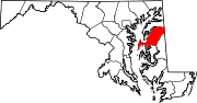
U.S. Highways Categories:- State highways in Maryland
- Roads in Queen Anne's County, Maryland


Wikimedia Foundation. 2010.