- Marple Township, Pennsylvania
Geobox Township
name = Marple Township
native_name =
other_name =
other_name1 =
category = Township
image_size =
image_caption =
flag_size =
symbol_type = Seal
symbol = Marple Township Logo.jpg
symbol_size =
nickname =
motto =
country = United States
state = Pennsylvania
region = Delaware
region_type = County
district =
area_imperial = 10.5
area_land_imperial = 10.2
area_water_imperial = 0.3
area_water_percentage = auto
area_percentage_round = 2
area_round = 1
location =
lat_d = 39
lat_m = 58
lat_s = 30
lat_NS = N
long_d = 75
long_m = 21
long_s = 29
long_EW = W
elevation_imperial = 361
elevation_round = 1
population_as_of = 2000
population = 23737
population_density_imperial = 2326.1
population_density_round = 1
established_type =
established =
mayor =
timezone = EST
utc_offset = -5
timezone_DST = EDT
utc_offset_DST = -4
postal_code =
postal_code_type =
area_code = 610
area_code_type =
code2_type =
code2 =
free_type =
free =
free1_type =
free1 =
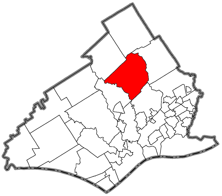
map_caption = Location of Marple Township in Delaware County
map1 = Pennsylvania Locator Map.png
map1_locator = Pennsylvania
map2 = Map of USA PA.svg
map2_caption = Location of Pennsylvania in the United States
website = http://www.marpletwp.comMarple Township is a township in Delaware County,
Pennsylvania ,United States . The population was 23,737 at the 2000 census. ZIP codes include mainly 19008, but also partially 19064 and 19063.Geography
According to the
United States Census Bureau , the township has a total area of 10.5square mile s (27.2km² ), of which, 10.2 square miles (26.4 km²) of it is land and 0.3 square miles (0.8 km²) of it (2.95%) is water.The community of Broomall is located in, but is not coterminous with, Marple Township--parts of Marple Township are also included within the ZIP codes of Springfield Township and Media.
Adjacent Municipalities
*Radnor Township, Delaware County - north
*Haverford Township, Delaware County - east
*Springfield Township, Delaware County - southeast
*Upper Providence Township, Delaware County - southwest
*Newtown Township, Delaware County - westDemographics
As of the
census GR|2 of 2000, there were 23,737 people, 8,623 households, and 6,415 families residing in the township. Thepopulation density was 2,326.1 people per square mile (898.5/km²). There were 8,797 housing units at an average density of 862.1/sq mi (333.0/km²). The racial makeup of the township was 92.60% White, 1.10% African American, 0.09% Native American, 5.51% Asian, 0.12% from other races, and 0.59% from two or more races. Hispanic or Latino of any race were 0.66% of the population.There were 8,623 households out of which 30.0% had children under the age of 18 living with them, 64.1% were married couples living together, 7.6% had a female householder with no husband present, and 25.6% were non-families. 22.6% of all households were made up of individuals and 13.0% had someone living alone who was 65 years of age or older. The average household size was 2.64 and the average family size was 3.12.
In the township the population was spread out with 21.8% under the age of 18, 6.3% from 18 to 24, 24.8% from 25 to 44, 25.0% from 45 to 64, and 22.0% who were 65 years of age or older. The median age was 43 years. For every 100 females there were 89.4 males. For every 100 females age 18 and over, there were 85.1 males.
The median income for a household in the township was $59,577, and the median income for a family was $71,829. Males had a median income of $47,062 versus $32,304 for females. The
per capita income for the township was $28,494. About 2.1% of families and 4.6% of the population were below thepoverty line , including 3.7% of those under age 18 and 5.0% of those age 65 or over.Education
At the secondary level, Marple Township is served by the
Marple-Newtown School District . In terms of higher education,Delaware County Community College , a public, two-year community college, is also located in Marple Township.References
External links
* [http://marpletwp.com/ Marple Township]
* [http://www.delawarecountypa.com/marple.html Marple Township at DelawareCountyPA.com]
* [http://www.marplehistoricalsociety.org/about.html Marple Township Historical Society]
Wikimedia Foundation. 2010.