- Moncel-sur-Seille
-
Moncel-sur-Seille

 Moncel-sur-SeilleLocation within Lorraine region
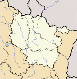 Moncel-sur-Seille
Administration Country France Region Lorraine Department Meurthe-et-Moselle Arrondissement Arrondissement of Nancy Canton Canton of Seichamps Intercommunality Communauté de communes du Grand Couronné Mayor Ennio Bazzara (PR)
(2008–2014)Statistics Elevation 195–283 m (640–928 ft)
(avg. 206 m/676 ft)Land area1 12.41 km2 (4.79 sq mi) Population2 474 (1999) - Density 38 /km2 (98 /sq mi) INSEE/Postal code 54374/ 54280 1 French Land Register data, which excludes lakes, ponds, glaciers > 1 km² (0.386 sq mi or 247 acres) and river estuaries. 2 Population without double counting: residents of multiple communes (e.g., students and military personnel) only counted once. Coordinates: 48°45′57″N 6°25′21″E / 48.7658333333°N 6.4225°E
Moncel-sur-Seille is a commune in the Meurthe-et-Moselle département in north-eastern France.
In the past, inhabitants of Moncel were known by their neighbours as culs crottés ("shit arses"), on account of the unusually clingy mud of their village.[1]
See also
References
- ^ Graham Robb, The Discovery of France, p36, Picador (2007), ISBN9780330427616, citing Vital Collet "Sobriquets caractérisant les habitants de villages lorrains" in Le Pays lorrain, Nancy (1908), pp442-449 and Henri-Adolphe Labourasse, "Anciens us, coutumes, légendes, supersititions, préjugés, etc. du département de la Meuse" in Mémoires de la Société des lettres, sciences et art de Bar-le-Duc, 1902, pp3-225
Categories:- Communes of Meurthe-et-Moselle
- Meurthe-et-Moselle geography stubs


Wikimedia Foundation. 2010.