- Moosic, Pennsylvania
-
Borough of Moosic Settlement Country United States State Pennsylvania County Lackawanna Elevation 876 ft (267 m) Coordinates 41°21′30″N 75°42′44″W / 41.35833°N 75.71222°W Area 6.6 sq mi (17.1 km2) - land 6.5 sq mi (17 km2) - water 0.1 sq mi (0 km2), 1.52% Population 5,719 (2010) Density 879.8 / sq mi (339.7 / km2) Timezone EST (UTC-5) - summer (DST) EDT (UTC-4) Zip Code 18507 Area code 570 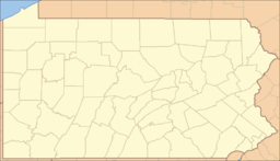
 Location of Moosic in Pennsylvania
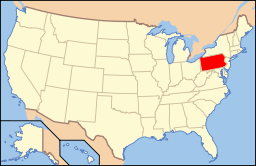 Location of Pennsylvania in the United States
Moosic is a borough in Lackawanna County, Pennsylvania six miles (nine km) south of Scranton and 13 miles (21 km) northeast of Wilkes-Barre on the Lackawanna River.
Moosic is in a former coal-mining region. A few older industries existed at one time, including the manufacturing of canvas gloves and silk products. In 1900, 1,227 people lived in Moosic, and in 1910, 3,964 people lived in Moosic. The population was 5,719 at the 2010 census.
Contents
Economy and culture
Moosic has experienced a recent surge in retail and commercial development, anchored by the area's 20-screen Cinemark movie theater. Other businesses operating offices in the borough include Bank of America, Cigna, Prudential, and Metlife. Additionally, the main studios of local ABC-affiliated station WNEP-TV are also located in the borough.
Other recently-constructed sites in the borough include the Lackawanna County Visitors Center, a Boy Scouts center, as well as the Glenmaura complex of upscale houses. Also featured is the exclusive national golf course Glenmaura National Golf Club, which is recognized as a PGA tournament course and identified by a major U.S. golf magazine as one of the top 100 courses in the nation. In 2005, a plan to build a large upscale shopping center near the theater was announced. The Shoppes at Montage were completed in 2007 consisting of an open, outdoor plaza housing over forty stores and restaurants.
Directly to the north of the borough is the Toyota Pavilion and Sno Mountain Ski Resort in Scranton and directly south is the site of the Wilkes-Barre/Scranton International Airport, located in the adjacent borough of Avoca.
PNC Field, home to the New York Yankees' farm team, the Scranton/Wilkes-Barre Yankees, is situated within the city limits of Moosic [1].
For 2006, a new, 2,000-foot (610 m) extension connects the county's Electric City Trolley Museum line at the Steamtown National Historic Site, Scranton, to a new station and trolley restoration facility, immediately adjacent to the Scranton/Wilkes-Barre Yankees stadium off Montage Mountain Road, Moosic. And for summer 2008, a water park was built on Sno Mountain, called the Sno Cove. It was completed in June, 2009, and will be laid over with "Sno" for the upcoming ski season. It will be used the whole summer in 2009.
Geography
Moosic is located at 41°21′30″N 75°42′44″W / 41.35833°N 75.71222°W (41.358380, -75.712281).[1]
According to the United States Census Bureau, the borough has a total area of 6.6 square miles (17 km2), of which 6.5 square miles (17 km2) is land and 0.1 square miles (0.26 km2) (1.52%) is water.
The borough can further be divided into sections, including Belin Village, Spike Island, The Millwoods, Starks, Lower Moosic, Doug Hill, Glenmaura, Moosic Heights, and Greenwood. Before joining with Taylor to become the Riverside School District, many of these geographic sections housed their own elementary schools.
Demographics
As of the census[2] of 2010, there were 5,719 people, 2,363 households, and 1,596 families residing in the borough. The population density was 879.8 people per square mile (339.7/km²). There were 2,500 housing units at an average density of 384.6 per square mile (150.2/km²). The racial makeup of the borough was 95.3% White, 1% African American, 0.1% American Indian, 1.8% Asian, 1.1% from other races, and 0.6% from two or more races. Hispanic or Latino of any race were 3.7% of the population.
There were 2,363 households out of which 24.1% had children under the age of 18 living with them, 50.7% were married couples living together, 11.8% had a female householder with no husband present, and 32.5% were non-families. 28.7% of all households were made up of individuals and 12.5% had someone living alone who was 65 years of age or older. The average household size was 2.41 and the average family size was 2.98.
In the borough the population was spread out with 19.6% under the age of 18, 61.6% from 18 to 64, and 18.8% who were 65 years of age or older. The median age was 44.4 years.
The median income for a household in the borough was $38,987, and the median income for a family was $47,703. Males had a median income of $35,878 versus $22,261 for females. The per capita income for the borough was $21,178. About 4.3% of families and 8.1% of the population were below the poverty line, including 15.0% of those under age 18 and 6.1% of those age 65 or over.
Schools
The Riverside School District serves Moosic residents.[2] The borough has one elementary school, Riverside Elementary East, which serves both Moosic residents and also Taylor residents for the 5th and 6th grades. High school students attend Riverside Jr.-Sr. High school for grades 7-12, which is located across the Lackawanna River in Taylor, PA.
References
- ^ "US Gazetteer files: 2010, 2000, and 1990". United States Census Bureau. 2011-02-12. http://www.census.gov/geo/www/gazetteer/gazette.html. Retrieved 2011-04-23.
- ^ "American FactFinder". United States Census Bureau. http://factfinder.census.gov. Retrieved 2008-01-31.
Municipalities and communities of Lackawanna County, Pennsylvania Cities 
Boroughs Townships Benton | Carbondale | Clifton | Covington | Elmhurst | Fell | Glenburn | Greenfield | Jefferson | La Plume | Madison | Newton | North Abington | Ransom | Roaring Brook | Scott | South Abington | Spring Brook | Thornhurst | Waverly | West Abington
CDPs Unincorporated
communityCategories:- Populated places established in 1890
- Boroughs in Lackawanna County, Pennsylvania


Wikimedia Foundation. 2010.