- Cleona, Pennsylvania
-
Cleona, Pennsylvania — Borough — 
 Cleona, Pennsylvania
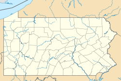
Coordinates: 40°20′14″N 76°28′29″W / 40.33722°N 76.47472°WCoordinates: 40°20′14″N 76°28′29″W / 40.33722°N 76.47472°W Country United States State Pennsylvania County Lebanon Settled 1883 Incorporated 1929 Government - Type Borough Council - Mayor John H. Hartman (R) - Council President Keith Fernsler (R) - Council Vice President Harold Bowman (R) - Public Safety Ellen Burke (R) - Finance Larry Minnich (R) Area - Total 0.9 sq mi (2.3 km2) Elevation 443 ft (135 m) Population (2000) - Total 2,148 - Density 2,464.9/sq mi (951.7/km2) Time zone Eastern (EST) (UTC-5) - Summer (DST) EDT (UTC-4) Zip code 17042 Area code(s) 717 Website Cleona Borough Cleona is a borough in Lebanon County, Pennsylvania, United States. It is part of the Lebanon, Pennsylvania Metropolitan Statistical Area. The population was 2,148 at the 2000 census.
Geography
Cleona is located at 40°20′14″N 76°28′29″W / 40.33722°N 76.47472°W (40.337241, -76.474683)[1].
According to the United States Census Bureau, the borough has a total area of 0.9 square miles (2.3 km2), all of it land.
Cleona is bordered to the north and east by North Lebanon Township (1.7 mi), to the south by North Cornwall Township (1.86 mi), and to the west by North Annville Township (0.37 mi) and Annville Township (0.47 mi).
 Border detail of Cleona and surrounding municipalities
Demographics
As of the census[2] of 2000, there were 2,148 people, 879 households, and 639 families residing in the borough. The population density was 2,464.9 people per square mile (953.3/km²). There were 913 housing units at an average density of 1,047.7 per square mile (405.2/km²). The racial makeup of the borough was 96.55% White, 1.02% African American, 0.05% Native American, 1.21% Asian, 0.05% Pacific Islander, 0.28% from other races, and 0.84% from two or more races. Hispanic or Latino of any race were 1.35% of the population.
There were 879 households out of which 33.6% had children under the age of 18 living with them, 61.1% were married couples living together, 8.2% had a female householder with no husband present, and 27.3% were non-families. 24.1% of all households were made up of individuals and 10.5% had someone living alone who was 65 years of age or older. The average household size was 2.44 and the average family size was 2.86.
In the borough the population was spread out with 23.9% under the age of 18, 7.0% from 18 to 24, 32.4% from 25 to 44, 21.9% from 45 to 64, and 14.8% who were 65 years of age or older. The median age was 38 years. For every 100 females there were 96.9 males. For every 100 females age 18 and over, there were 94.0 males.
The median income for a household in the borough was $44,761, and the median income for a family was $52,328. Males had a median income of $34,574 versus $23,944 for females. The per capita income for the borough was $21,090. About 2.8% of families and 3.4% of the population were below the poverty line, including 1.6% of those under age 18 and 1.6% of those age 65 or over.
References
- ^ "US Gazetteer files: 2010, 2000, and 1990". United States Census Bureau. 2011-02-12. http://www.census.gov/geo/www/gazetteer/gazette.html. Retrieved 2011-04-23.
- ^ "American FactFinder". United States Census Bureau. http://factfinder.census.gov. Retrieved 2008-01-31.
Municipalities and communities of Lebanon County, Pennsylvania City 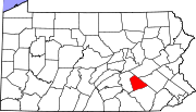
Boroughs Townships Annville | Bethel | Cold Spring | East Hanover | Heidelberg | Jackson | Millcreek | North Annville | North Cornwall | North Lebanon | North Londonderry | South Annville | South Lebanon | South Londonderry | Swatara | Union | West Cornwall | West Lebanon
CDPs Unincorporated
communitiesKleinfeltersville | Ono | Union Water Works | Waldeck
Categories:- Populated places established in 1883
- Boroughs in Lebanon County, Pennsylvania


Wikimedia Foundation. 2010.