- Mandray
-
Mandray

 MandrayLocation within Lorraine region
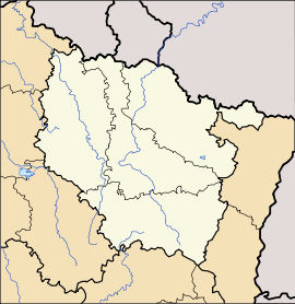 Mandray
Administration Country France Region Lorraine Department Vosges Arrondissement Saint-Dié-des-Vosges Canton Fraize Intercommunality Association of communes of the Upper Meurthe Mayor Emmanuel Laurent
(2008–2014)Statistics Elevation 398–770 m (1,306–2,530 ft)
(avg. 470 m/1,540 ft)Land area1 12.36 km2 (4.77 sq mi) Population2 627 (206) - Density 51 /km2 (130 /sq mi) INSEE/Postal code 88284/ 88650 1 French Land Register data, which excludes lakes, ponds, glaciers > 1 km² (0.386 sq mi or 247 acres) and river estuaries. 2 Population without double counting: residents of multiple communes (e.g., students and military personnel) only counted once. Coordinates: 48°13′08″N 6°59′47″E / 48.2188888889°N 6.99638888889°E
Mandray is a commune in the Vosges department in Lorraine in northeastern France.
Inhabitants are called Mandresayens or Mandresayennes according to gender.
Contents
Geography
Mandray is located some ten kilometres (six miles) southeast of Saint-Dié on the eastern side of the département, and at the western edge of the Vosges Mountains. It nestles in the valley of the Mandresay, a small tributary of the Meurthe River which itself rises nearby. The commune is within the Ballons des Vosges Regional Natural Park.
The commune comprises not one single village but rather a grouping of dispersed hamlets at varying altitudes, these being Haute-Mandray, Mi-Mandray, Basse-Mandray, Bénifosse, la Béhouille, la Nold, le Pré du Moulin, Mardichamp, le Raichant (meaning garden in the local patois), les Angles and les Carrières
Using the Mandray Pass, it is possible to drive to Fraize and to La Croix-aux-Mines. Despite a sign indicating an altitude of 707 meters, the actual altitude of the pass is now calculated as 694 meters.
History
Mandray was the scene of fighting early in the First World War. In retaliation, the Germans torched the church on 28 August 1914 and shot some civilians.
See also
References
Categories:- Communes of Vosges
- Vosges geography stubs


Wikimedia Foundation. 2010.