- Conshohocken, Pennsylvania
-
Borough of Conshohocken Borough  "High-tech" office buildings in Conshohocken have helped earn the area the "Silicon Valley Forge" nickname
Nickname: Conshy Country United States State Pennsylvania County Montgomery Elevation 197 ft (60 m) Coordinates 40°04′38″N 75°18′7″W / 40.07722°N 75.30194°W Area 2.6 sq mi (6.7 km2) - land 2.5 sq mi (6 km2) - water 0.04 sq mi (0 km2), 1.54% Population 7,883 (2010) Density 7,720.4 / sq mi (2,980.9 / km2) Founded 1830 - Incorporated 1850 Government Council-manager Mayor Robert Frost Timezone EST (UTC-5) - summer (DST) EDT (UTC-4) ZIP code 19428 Area code 610  Location of Conshohocken in Montgomery County
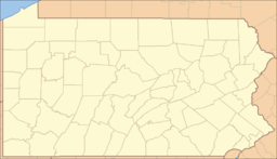
 Location of Conshohocken in Pennsylvania
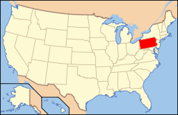 Location of Pennsylvania in the United States
Website: http://www.conshohockenpa.org/ Conshohocken is a borough on the Schuylkill River in Montgomery County, Pennsylvania, in suburban Philadelphia. Historically a large mill town and industrial and manufacturing center, after the decline of industry in recent years Conshohocken has developed into a center of riverfront commercial and residential development.[1] It is commonly referred to by its colloquial nickname, Conshy.[2] The name 'Conshohocken' comes from 'Gueno-sheiki-hacking', meaning 'Pleasant Valley' in the native language of the Lenape tribe of the area's native Americans who first occupied the land over 300 years ago.[citation needed]
In 1940, a New York Times columnist noted lightheartedly that "Some of the residents of Conshohocken, Pa. are concerned because Kitty Foyle's father, in Christopher Morley's novel "Kitty Foyle" (Lippincott), uses the name of their town as a swear word. Others think that it may help advertise the town. One thing is sure—it makes a rattling good cuss-word."[3]
The sister community of West Conshohocken is located across the Schuylkill.
Contents
Geography
Conshohocken is located at 40°4′38″N 75°18′7″W / 40.07722°N 75.30194°W (40.077135, -75.302009)[4].
According to the United States Census Bureau, the borough has a total area of 1.0 square mile (2.6 km2), of which, 1.0 square mile (2.6 km2) of it is land and 0.04 square miles (0.10 km2) of it (2.97%) is water. ..
Demographics
Historical populations Census Pop. %± 1930 10,815 — 1940 10,776 −0.4% 1950 10,922 1.4% 1960 10,259 −6.1% 1970 10,195 −0.6% 1980 8,599 −15.7% 1990 8,064 −6.2% 2000 7,589 −5.9% 2010 7,883 3.9% [5] As of the 2010 census, the borough was 88.7% White, 6.5% Black or African American, 0.1% Native American, 1.8% Asian, and 1.7% were two or more races. 3.5% of the population were of Hispanic or Latino ancestry [1].
As of the census[6] of 2000, there were 7,589 people, 3,329 households, and 1,834 families residing in the borough. The population density was 7,720.4 people per square mile (2,989.9/km²). There were 3,518 housing units at an average density of 3,578.9 per square mile (1,386.0/km²). The racial makeup of the borough was 89.88% White, 7.77% African American, 0.08% Native American, 0.84% Asian, 0.01% Pacific Islander, 0.49% from other races, and 0.92% from two or more races. Hispanic or Latino of any race were 1.34% of the population.
There were 3,329 households out of which 22.9% had children under the age of 18 living with them, 36.5% were married couples living together, 14.1% had a female householder with no husband present, and 44.9% were non-families. 36.0% of all households were made up of individuals and 12.6% had someone living alone who was 65 years of age or older. The average household size was 2.27 and the average family size was 3.02.
In the borough the population was spread out with 20.8% under the age of 18, 8.8% from 18 to 24, 35.9% from 25 to 44, 19.4% from 45 to 64, and 15.1% who were 65 years of age or older. The median age was 35 years. For every 100 females there were 94.2 males. For every 100 females age 18 and over, there were 91.1 males.
The median income for a household in the borough was $43,599, and the median income for a family was $50,601. Males had a median income of $36,299 versus $30,541 for females. The per capita income for the borough was $22,128. About 4.2% of families and 5.8% of the population were below the poverty line, including 6.9% of those under age 18 and 12.7% of those age 65 or over.
Population in 1890, 5470; in 1900, 5762; in 1910, 7480.[7]
Politics and History
Conshohocken has a city manager form of government with a mayor and a seven-member borough council. The mayor is Robert Frost.
Conshohocken was founded in 1830 and incorporated in 1850. In 1890, the population stood at 5,470; in 1900, 5,762; in 1910, 7,480; and in 1940, 10,776. The population was 7,589 at the 2000 census.
The borough is part of the Seventh Congressional District (represented by Rep. Pat Meehan), the 148th State House District (represented by Rep. Mike Gerber) and the 17th State Senate District (represented by Sen. Daylin Leach).
One ward in Conshohocken sits in the 6th congressional district (Congressman Jim Gerlach)
Business History Businesses that influenced the past and helped to create the present day Borough
Alan Wood Steel Company Lower Merion Histoical Society picture of Alan Wood Jr.
Transportation
Conshohocken is served by two SEPTA regional railroad stations, both of which are along the Manayunk/Norristown Line. The main one officially located at Washington and Harry Streets, and the other at Spring Mill at the end of East North Lane, south of Hector Street.
Education
Residents of Conshohocken are served by the Colonial School District.
Economy
AlliedBarton's headquarters and Ikea's US headquarters are in Conshohocken.
Riverwalk Fire
On Wednesday, August 13, 2008, at approximately 4:53 PM [8] a fire started at a building site under construction adjacent to the Riverwalk Millennium apartments in Conshohocken, which consisted of 5 different buildings. The building under construction did not have a sprinkler system yet in place, allowing the fire to spread rapidly. Because of the intense radiant heat only a few feet away, the attics of buildings one and four of the Riverwalk Millenium Complex caught fire. The incident became an 8-alarm blaze which destroyed three of the five apartment buildings. No one was killed as a result of the fire, although several firefighters were treated for minor injuries, and some residents' pets were lost in the blazes.
Conshohocken Fire Chief Robert Phipps referred to the fire as "one of the worst we've had" in the history of the borough. Furthermore, Phipps explained that there were 86 fire companies on site battling the inferno.[9] The amount of the damage is unknown, but it is estimated by property owner J. Brian O'Neill to be between $50 million and $80 million.[10] The cause of the fire is believed to be related to an acetylene torch which ignited at the nearby construction site.[11] An investigation is ongoing.[8]
See also
References
- ^ Fact Sheets-CONSHOHOCKEN BOROUGH
- ^ ALL ABOUT Conshy, Conshohocken Pa
- ^ Brooks, Philip, "Notes on Rare Books," The New York Times, January 14, 1940, p. BR13
- ^ "US Gazetteer files: 2010, 2000, and 1990". United States Census Bureau. 2011-02-12. http://www.census.gov/geo/www/gazetteer/gazette.html. Retrieved 2011-04-23.
- ^ http://www.dvrpc.org/data/databull/rdb/db82/appedixa.xls
- ^ "American FactFinder". United States Census Bureau. http://factfinder.census.gov. Retrieved 2008-01-31.
- ^ New International Encyclopedia
- ^ a b Conshohocken fire under control | 6abc.com
- ^ http://www.timesherald.com/site/news.cfm?newsid=20018316&BRD=1672&PAG=461&dept_id=33380&rfi=6
- ^ http://www.philly.com/philly/news/homepage/20080814_for_the_C_Fire_destroys_Conshohocken_apartment_complex.html
- ^ http://www.philly.com/philly/hp/news_update/20080815_Acetylene_torches_believed_cause_of_Conshohocken_blaze.html
External links
Categories:- Populated places on the Schuylkill River
- Populated places established in 1830
- Boroughs in Montgomery County, Pennsylvania


Wikimedia Foundation. 2010.