Minami-Ōmachi Station

Minami-Ōmachi Station
南大町駅
Minami-Omachi-eki-1.jpg
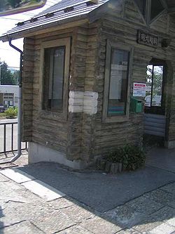
Minami-Ōmachi Station, August 2006
Location
Prefecture Nagano
(See other stations in Nagano)
City Ōmachi
Coordinates 36°29′29″N 137°51′23″E / 36.4913°N 137.8564°E / 36.4913; 137.8564Coordinates: 36°29′29″N 137°51′23″E / 36.4913°N 137.8564°E / 36.4913; 137.8564
Rail services
Operator(s) East Japan Railway Company
Line(s) Ōito Line

Minami-Ōmachi Station (南大町駅 Minami-Ōmachi-eki?) is a station of Ōito Line, East Japan Railway Company in Ōmachi, the city of Ōmachi, Nagano Prefecture, Japan.

Layout

Adjacent stations

« Service »
JR East
Shinano-Tokiwa   Ōito Line   Shinano-Ōmachi

See also


Wikimedia Foundation. 2010.

Игры ⚽ Нужно решить контрольную?

Look at other dictionaries:

  • Minami-Otari Station — 南小谷駅 Minami Otari station, August 2009 Location Prefecture …   Wikipedia

  • Minami-Kamishiro Station — 南神城駅 Minami Kamishiro platform, January 2007 Location Prefecture …   Wikipedia

  • Minami-Toyoshina Station — (南豊科駅, Minami Toyoshina eki?) is a station of Ōito Line, East Japan Railway Company in Toyoshina, the city of Azumino, Nagano Prefecture, Japan. Layout Adjacent stations « …   Wikipedia

  • Matsumoto Station — 松本駅 Matsumoto Station, September 2007 Location Prefecture …   Wikipedia

  • Nakagaya Station — 中萱駅 Nakagaya Station, August 2008 Location Prefecture …   Wikipedia

  • Chikuni Station — (千国駅, Chikuni eki?) is a station of Ōito Line, East Japan Railway Company in Chikuni, the village of Otari, Kitaazumi District, Nagano Prefecture, Japan. Layout Adjacent stations …   Wikipedia

  • Nakashima Station (Hiroshima) — Nakashima Station building (April 17, 2005). Nakashima Station (中島駅, Nakashima Eki …   Wikipedia

  • Ōito Line — JR East E127 series EMU between Uminokuchi and Inao stations Overview Type Heavy rail Locale …   Wikipedia

  • Chūō Kōsoku Bus — (中央高速バス, Chūō Kōsoku Basu?) is a group of Japanese highway bus lines managed by Keio Bus. It connects Tokyo with the areas along the Chūō Expressway, especially Yamanashi Prefecture and Nagano Prefecture. Contents …   Wikipedia

  • Takeo, Saga — Infobox City Japan Name=Takeo JapaneseName=武雄市 Map Region=Kyūshū Prefecture=Saga Prefecture District= Area km2=195.44 PopDate=September 1, 2007 Population=50,820 Density km2=260 Coords=coord|33|12|N|130|1|E|region:JP type:city Tree= Flower= Bird …   Wikipedia

Share the article and excerpts

Direct link
Do a right-click on the link above
and select “Copy Link”