- Devil's Dyke, Sussex
-
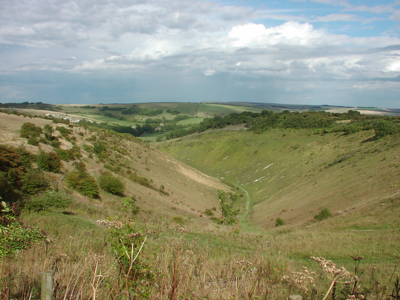
 View from Devil's Dyke
Devil's Dyke is a V-shaped valley on the South Downs Way in southern England, near Brighton and Hove. It is part of the Southern England Chalk Formation. Devil's Dyke is on the way to Brighton and is a big hill at the side of the road.
Contents
Geological history
It is a misconception common amongst local residents of Brighton that the valley was formed by some kind of glacial action, the myth of a 'glacier' being a misunderstanding of accounts such as this one from the Encyclopaedia of Brighton by Timothy Carder (1990):
"In reality the 300-foot-deep valley was carved by tremendous amounts of water running off the Downs during the last Ice Age when large amounts of snow thawed and the frozen chalk prevented any further absorption; erosion was aided by the freeze-thaw cycle and the valley was deepened by the 'sludging' of the saturated chalk.".[1]
The Devil's Dyke V-shaped dry valley is the result of solifluction and river erosion. More than fourteen thousand years ago, the area experienced an intensely cold climate (but not glacial conditions). Snowfields capped the South Downs. Permafrost conditions meant that the chalk was permanently frozen. In summer, the snowfields melted and saturated the top layer of soil, because the water could not permeate the frozen chalk underneath. Waterlogged material situated above the permafrost slid down the gradient, removing material by friction, exposing deeper layers of frozen chalk. When the Ice Age ended, the snowfields covering the South Downs melted, and rivers formed across Sussex. The Devil's Dyke valley was completed by one such river.[2]
Geography
 The Devil's Dyke Hotel and Restaurant.
The hills surrounding the valley offer views of the South Downs, The Weald, and – on a clear day – the Isle of Wight. It is the site of ramparts, all that remain of an Iron Age hillfort, and a pub. It is a popular local beauty spot for the Brighton and Hove area (though it is actually in West Sussex).
Myths regarding the formation of Devil's Dyke
Local folklore explains the valley as the work of the devil. The legend holds that the devil was digging a trench to allow the sea to flood the many churches in the Weald of Sussex. The digging disturbed an old woman who lit a candle, or angered a rooster causing it to crow, making the devil believe the morning was fast approaching. The devil then fled, leaving his trench unfinished. The last shovel of earth he threw over his shoulder fell into the sea, forming the Isle of Wight.
Another story holds that rather than digging to flood Sussex, he was simply in a huge goatlike form, intending to crush the surrounding area. He smelt the tang of salt water in the wind, and fearing his coat would get damp (for he is vain to the point of sin), he fled leaving nothing but a hoof-print, now known as Devil's Dyke.
English pagan Black Metal band Old Forest released a song and video titled 'The Devil's Dyke' on their April 23, 2008 'Death To Music Productions' EP release 'Tales of the Sussex Weald ; Part 1 (The Legend of the Devil's Dyke)'.[3][4]
History
 The Devils Dyke
Ancient history
Before and after the Iron Age, Devil's Dyke was used as a defensive site. This was probably because of its commanding view of the surrounding terrain, and also its steep edges surrounded by large expanses of flat land.
In the Iron Age, Devil's Dyke was an important site. All the vegetation was scraped off the white chalk, leaving Devil's Dyke as an impressive monument to both attract and intimidate the populace.
Victorian times
 Steep Grade Railway about 1908
In late Victorian times Devil's Dyke became a tourist attraction, complete with a fairground, two bandstands, an observatory, a camera obscura, all served by a branchline from Hove. During its heyday, Devil's Dyke was a huge hit with Edwardians, with 30,000 people visiting on Whit Monday in 1893.
- From 1887-1938 a single track railway branch line operated from near Aldrington in Hove to The Dyke railway station, the current Dyke Farm location, to transport sightseers to the foot of the hill.
- From 1894-1909 a cable car operated across the valley, covering a distance of 350 m, suspended 70 m above the valley floor.
- From 1897-1907 there was a "Steep Grade Railway", a funicular rising 100 m from near Poynings to the northern edge of the hillfort.
Traces remain of all three ventures, including the remains of concrete pylon supports for the cable car system.
See also
- Devil's Dyke railway station
References
External links
- National Trust Information on Devil's Dyke
- The Devil's Dyke EXPLORED
- Country File video
- Abandoned Lines and Railways
- [1] [2] [3] Videos of paragliding etc.
Categories:- Geography of East Sussex
- History of East Sussex
- Visitor attractions in East Sussex
- Brighton and Hove
- Ancient dykes


Wikimedia Foundation. 2010.