- Athanasios Diakos, Greece
-
Athanasios Diakos
Αθανάσιος ΔιάκοςLocation 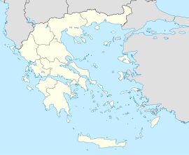
 Athanasios Diakos
Coordinates 38°42′N 22°11′E / 38.7°N 22.183°ECoordinates: 38°42′N 22°11′E / 38.7°N 22.183°E Government Country: Greece Region: Central Greece Regional unit: Phocis Municipality: Delphi Municipal unit: Kallieis Population statistics (as of 2001) Village - Population: 307 Other Time zone: EET/EEST (UTC+2/3) Auto: ΑΜ Athanasios Diakos (Greek: Αθανάσιος Διάκος, older name: Ano Mousounitsa Άνω Μουσουνίτσα) is a small village in the municipal unit of Kallieis, Phocis, Greece in the high Vardousia mountains. Its 2001 population was 307. It is the largest village in the municipality.
Contents
Nearest places
- Mavrolithari, northeast
- Moussounitsa
Population
Year Population 1981 135 1991 308 2001 307 Geography
The mountains dominate the entire area and are made up of forests and barren land, Athanasios Diakos are surrounded by two mountain range, the Vardousia of the Pindos mountains and Oiti to the north (not part of the area) and Gkiona to the south. The Mornos river flows about 2 km to the east. Farmlands are within the village area. The Fthiotis prefecture is bordered to the north
Location and transportation
Athanasios Diakos is located south of Lamia, northwest of Amfissa, north of Lidoriki, north-northeast of Nafpaktos and southeast of Karpenissi. They are also connected with roads connecting Lidoriki and Amfissa. There is an unpaved mountain pass with the Fthiotida prefecture.
Athansios Diakos has about 4 km of paved road and about 6 km of gravel road..
History
Athanasios Diakos then as Ano Mousounitsa dates back to the Slavic peoples times, they inhabited the village, the village was later acquired by the Venetians and the Ottoman Turks, it became a part of Greece after the Greek War of Independence, a famous hero during the cause was Athanasios Diakos, he was later honoured a village after him and battled there, before, it was only known as 'Ano Moustenitsa. It has adopted its current name in the early 20th century. After World War II and the Greek Civil War, its buildings were rebuilt, some of the Allied soldiers were stranded in the pass range at the time. Athanasios Diakos became connected with asphalt in the 1960s. More pavement was accessed in the late 20th century. Electricity, radio and automobiles were introduced in the mid-20th century, television in the late-20th century and computer and internet at the turn of the millennium.
See also
- List of places in the Fokida prefecture
External links
References
Municipal unit of Amfissa Agia Efthymia · Agios Georgios · Agios Konstantinos · Amfissa · Drosochori · Elaionas · Prosilio · SernikakiMunicipal unit of Delphi Municipal unit of Desfina Municipal unit of Galaxidi Municipal unit of Gravia Municipal unit of Itea Municipal unit of Kallieis Athanasios Diakos · Kastriotissa · Mavrolithari · Mousounitsa · Panourgia · Pyra · StromiMunicipal unit of Parnassos Eptalofos · Lilaia · PolydrososCategories:- Populated places in Phocis

Wikimedia Foundation. 2010.