- Montérolier
-
Montérolier

 MontérolierLocation within Upper Normandy region
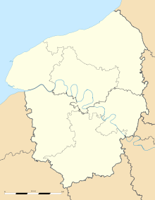 Montérolier
Administration Country France Region Upper Normandy Department Seine-Maritime Arrondissement Dieppe Canton Saint-Saëns Intercommunality Saint-Saëns-Portes de Bray Mayor Yvette Pasquier
(2001–2008)Statistics Elevation 132–212 m (433–696 ft)
(avg. 146 m/479 ft)Land area1 11.7 km2 (4.5 sq mi) Population2 526 (2006) - Density 45 /km2 (120 /sq mi) INSEE/Postal code 76445/ 76680 1 French Land Register data, which excludes lakes, ponds, glaciers > 1 km² (0.386 sq mi or 247 acres) and river estuaries. 2 Population without double counting: residents of multiple communes (e.g., students and military personnel) only counted once. Coordinates: 49°37′48″N 1°20′49″E / 49.63°N 1.34694444444°E
Montérolier is a commune in the Seine-Maritime department in the Haute-Normandie region in northern France.
Contents
Geography
A farming village situated in the Pays de Bray, some 30 miles (48 km) southeast of Dieppe at the junction of the D24 and the D38 roads. The Varenne River has its source here.
Surrounded by the common Neufbosc , Mathonville and Saint-Martin-Osmonville , Montérolier is located 26 km northeast of Mont-Saint-Aignan, the largest city nearby.[1]
History
During 1943, in the Clairefeuille woods at Montérolier, the Germans built underground galleries in which to store V-1 flying bombs. After the Second World War, the galleries were opened to the public. On the 21 and 22 June 1995, 13 people died accidentally in the tunnels.
Population
Population history 1962 1968 1975 1982 1990 1999 2006 459 419 367 398 417 500 506 Starting in 1962: Population without duplicates Places of interest
- The church of Notre-Dame, dating from the eighteenth century.
- Traces of an 11th century castle.
- A nineteenth century château.
- A sandstone cross, from the sixteenth century.
- The tunnels of Montérolier. (Closed since the accident in 1995).
People
- Jean de Grouchy, sieur of Montérolier (1354–1435).
See also
References
External links
- Montérolier - The tunnels of Clairefeuille (French)
- Montérolier on the Quid website (French)
Categories:- Communes of Seine-Maritime
- Dieppe geography stubs


Wikimedia Foundation. 2010.