- Arevshat
-
- For the place in Shirak province, see Arevshat, Shirak; for the village in Azerbaijan, see Dolanlar.
Coordinates: 40°02′21″N 44°32′30″E / 40.03917°N 44.54167°E
Arevshat
ԱրևշատArevshat Church
 Arevshat
Coordinates: 40°02′21″N 44°32′30″E / 40.03917°N 44.54167°E Country Armenia Province Ararat Population (2008) – Total 2,269 Arevshat (Armenian: Արևշատ; formerly, Nizhniy Agbash, Nerkin Agbash, Lusakert, and Arpavar) is a town in the Ararat province of Armenia.
References
- Arevshat at GEOnet Names Server
- World Gazeteer: Armenia – World-Gazetteer.com
- Report of the results of the 2001 Armenian Census
Capital: ArtashatArtashat Abovyan · Araksavan · Arevshat · Artashat · Aygepat · Aygestan · Aygezard · Azatavan · Baghramyan · Bardzrashen · Berdik · Berkanush · Burastan · Byuravan · Dalar · Deghdzut · Dimitrov · Ditak · Dvin · Getazat · Hnaberd · Hovtashen · Jrashen · Kaghtsrashen · Kanachut · Lanjazat · Masis (village) · Mkhchyan · Mrganush · Mrgavan · Mrgavet · Narek · Norashen · Nshavan · Shahumyan · Vardashen · Verin Artashat · Verin Dvin · Vostan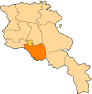
Masis Ararat Aralez · Ararat · Ararat (village) · Armash · Avshar · Aygavan · Dashtakar · Goravan · Lanjanist · Lanjar · Lusarat · Lusashogh · Nor Kyank · Nor Ughi · Noyakert · Paruyr Sevak · Pokr Vedi · Shaghap · Sisavan · Surenavan · Taperakan · Urtsadzor · Urtsalanj · Vanashen · Vardashat · Vedi · Vedu ginu gortsaranin kits · Vosketap · Yeghegnavan · Yeraskh · ZangakatunJamil lanjar. Panoaqil.sukkur.sindh.pakistan.
Categories:- Populated places in Ararat
- Ararat (province) geography stubs


Wikimedia Foundation. 2010.