- Newbern Township, Dickinson County, Kansas
-
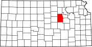
Newbern Township — Township — Location in Dickinson County
Coordinates: 38°49′40″N 097°12′16″W / 38.82778°N 97.20444°WCoordinates: 38°49′40″N 097°12′16″W / 38.82778°N 97.20444°W Country United States State Kansas County Dickinson Area – Total 36.49 sq mi (94.52 km2) – Land 36.44 sq mi (94.39 km2) – Water 0.05 sq mi (0.13 km2) 0.14% Elevation 1,211 ft (369 m) Population (2000) – Total 349 – Density 9.6/sq mi (3.7/km2) Time zone Central Standard Time (UTC-6) – Summer (DST) Central Daylight Time (UTC-5) Area code(s) +1-785 GNIS feature ID 0485530 Newbern Township is a township in Dickinson County, Kansas, USA. As of the 2000 census, its population was 349.
Geography
Newbern Township covers an area of 36.49 square miles (94.5 km2) and contains no incorporated settlements. According to the USGS, it contains two cemeteries: Farmington and Newburn.
The stream of West Branch Turkey Creek runs through this township.
References
External links
Municipalities and communities of Dickinson County, Kansas Cities Abilene | Carlton | Chapman | Enterprise | Herington‡ | Hope | Manchester | Solomon‡ | Woodbine
Townships Unincorporated
communitiesFootnotes ‡This populated place also has portions in an adjacent county or counties
Categories:- Townships in Dickinson County, Kansas
- North Central Kansas geography stubs


Wikimedia Foundation. 2010.