- Tinahely
Infobox Irish Place
name = Tinahely
gaeilge = Tigh na hÉille
crest
motto =
map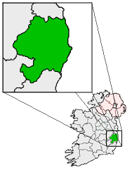
pin coords = left: 49px; top: 90px
north coord = 52.800000
west coord = 6.466667
irish grid = T033731
area =
elevation = 116 m (380 ft)
province =Leinster
county =County Wicklow
town pop = 692
rural pop =
census yr = 2002
web =
|Tinahely (irish place name|Tigh na hÉille|House of Éille) is a
village inCounty Wicklow , Ireland. It lies south of theWicklow Mountains in a valley of theRiver Derry , which runs through the heart of the village. The population of Tinahely itself in the 2002 census was 692, although the electoral division had 1,227 persons registered.Places of interest
*The Courthouse Arts Centre is based in the former courthouse building in the centre of the village. The Courthouse hosts musical performances, artist exhibitions, play and film screenings. The building itself was restored by a committee of local people with help from FÁS.
*A walk along the route of a former railway leads from Tinahely to TomnafinnogeOak Wood in the nearby town of Shillelagh.port
The village has a
Gaelic Athletic Association team and the club colours are red and white.Events
*The Tinahely Agricultural Show takes place annually on the first Monday of August (a
bank holiday in the Republic). The one day Show is held at Fairwood Park and has been running for over 70 years.Transport
*Tinahely railway station opened on
22 May 1865 , closed for passenger and goods traffic on24 April 1944 and finally closed altogether on20 April 1945 . [cite web | title=Tinahely station | work=Railscot - Irish Railways | url=http://www.railscot.co.uk/Ireland/Irish_railways.pdf | accessdate=2007-11-24]ee also
*
List of towns in the Republic of Ireland
*Market Houses in the Republic of Ireland References
External links
* [http://www.tinahely-courthouse.ie Courthouse Arts Centre website]
* [http://www.visitwicklow.ie/TinahelyMain.htm Tinahely at the Wicklow Tourism website]
* [http://wicklow.gaa.ie/Clubs/Tinahely04.htm Tinahely GAA information at the Wicklow GAA website]
Wikimedia Foundation. 2010.