- Monessen, Pennsylvania
-
Monessen City 
Official name: City of Monessen Named for: Monongahela + Essen (city in Germany) Country United States State Pennsylvania County Westmoreland Elevation 1,128 ft (344 m) Coordinates 40°9′15″N 79°52′58″W / 40.15417°N 79.88278°W Area 3.1 sq mi (8 km2) - land 2.9 sq mi (7.5 km2) - water 0.2 sq mi (0.5 km2), 6.45% Population 8,669 (2000) Density 2,986.8 / sq mi (1,153.2 / km2) Settled 1897 - Borough incorporated September 3, 1898 - City incorporated September 16, 1921 Mayor Mary Jo Smith Timezone EST (UTC-5) - summer (DST) EDT (UTC-4) ZIP code 15062 Area code 724 School District Monessen City School District 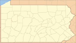
 Location of Monessen in Pennsylvania
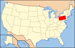 Location of Pennsylvania in the United States
Monessen is a city in Westmoreland County, Pennsylvania, United States. The population was 8,669 at the 2000 census. In 1940, 20,257 people lived there. In 1990 the population was 13,026. Steel-making was a prominent industry in Monessen, which was a Rust Belt borough in the "Mon Valley" of southwestern Pennsylvania that became a third-class city in 1921. It is near Charleroi and Donora, two similar places with similar histories.
Contents
History
Monessen, named for the Monongahela River and the German city of Essen, was created by land speculators fairly late in the history of the Mon Valley, after neighboring towns had already been settled. The East Side Land Company bought land from various farmers, laid out the streets, and then sold the lots to prospective residents and employers. James M. Schoonmaker, who had made his fortune in coke, owned a controlling interest in the land company. Other investors in the land company who were also immortalized in street names include Philander C. Knox, James H. Reed, H. Sellers McKee, George O. Morgan, and George B. Motheral.[1] In May 1897, National Tin Plate Company, founded by William Donner, began building its mill, thus becoming Monessen’s first employer. Sales of lots began on July 27, 1897, for the general public and other employers.[1] Monessen became a borough on September 3, 1898.[2]
Monessen experienced rapid growth in the first two decades of the twentieth century, the population increasing from 2,197 in 1900 to 11,775 in 1910 and then to 18,179 in 1920.
While there were many companies operating in Monessen, the largest employer was Pittsburgh Steel Company, later renamed Wheeling-Pittsburgh Steel. In a practice that is shocking by today’s standards (and not limited to Monessen), pay was determined by ethnic background. For example, a Welsh immigrant would be paid more than an Italian immigrant. A normal workweek was 84 hours (7 days times 12 hours).[3] Employers did not adopt the eight hour workday until the 1920s.
Monessen’s status changed from “borough” to “city” on September 16, 1921.[2]
In the years following World War II, the region’s manufacturers, especially the steel industry, found it harder to compete, leading to a period of employment cutbacks. In 1972, the closure of Page Steel and Wire Company was a major setback to the city. A far greater blow to Monessen occurred when its largest employer, Wheeling-Pittsburgh Steel, closed nearly all its Monessen operations in 1986.[4] (The company’s rail mill did not close until March 1987,[4] due to a bad batch of rails that were shipped.) The mill’s closure marked the end of an era in Monessen's history.
Monessen is currently trying to revitalize itself. The city has made efforts for several years to clean up abandoned properties in hopes of revitalizing the city. In January 2010 the first female mayor, Mary Jo Smith was sworn in at the Monessen Municipal Building.
Geography
Monessen is located at 40°9′15″N 79°52′58″W / 40.15417°N 79.88278°W (40.154271, -79.882779)[5].
According to the United States Census Bureau, the city has a total area of 3.1 square miles (8.0 km2), of which, 2.9 square miles (7.5 km2) of it is land and 0.2 square miles (0.52 km2) of it (4.90%) is water.
Demographics
As of the census[6] of 2000, there were 8,669 people, 3,916 households, and 2,451 families residing in the city. The population density was 2,986.8 people per square mile (1,154.2/km²). There were 4,468 housing units at an average density of 1,539.4 per square mile (594.9/km²). The racial makeup of the city was 83.71% White, 13.99% African American, 0.09% Native American, 0.23% Asian, 0.01% Pacific Islander, 0.33% from other races, and 1.63% from two or more races. Hispanic or Latino of any race were 0.82% of the population. 27.9% were of Italian, 8.4% Slovak, 7.5% German and 7.0% Polish ancestry according to Census 2000.
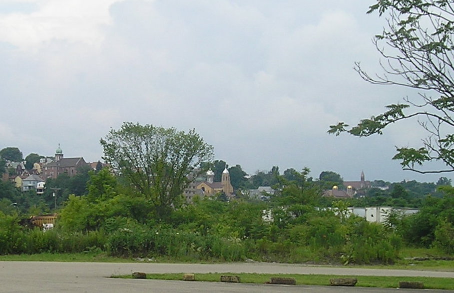
 View of downtown towards the coke works in Monessen, 2008.
There were 3,916 households out of which 21.2% had children under the age of 18 living with them, 42.9% were married couples living together, 15.2% had a female householder with no husband present, and 37.4% were non-families. 34.3% of all households were made up of individuals and 22.2% had someone living alone who was 65 years of age or older. The average household size was 2.19 and the average family size was 2.80.
In the city the population was spread out with 19.6% under the age of 18, 5.3% from 18 to 24, 23.3% from 25 to 44, 22.7% from 45 to 64, and 29.1% who were 65 years of age or older. The median age was 46 years. For every 100 females there were 84.8 males. For every 100 females age 18 and over, there were 79.0 males.
The median income for a household in the city was $26,686, and the median income for a family was $37,269. Males had a median income of $34,773 versus $21,508 for females. The per capita income for the city was $16,627. About 11.5% of families and 15.7% of the population were below the poverty line, including 27.7% of those under age 18 and 8.2% of those age 65 or over.
Notable people
- Michael Moorer, former heavyweight boxer; boxing champion
- Coolio, rapper, artist
- Frances McDormand, Oscar-winning American actress
- Christian B. Anfinsen, Nobel Prize Laureate
- Tom Savini, makeup artist
- Blanche Thebom, mezzo-soprano singer
- Armand Niccolai (1911-1988), former NFL player for the Pittsburgh Pirates/Steelers
References
- ^ a b Vivian, Cassandra (2002). Monessen: A Typical Steel Country Town. Charleston, South Carolina: Arcadia Publishing. pp. 13. ISBN 0-7385-2383-6.
- ^ a b "Westmoreland County (Dates of incorporation of municipalities)" (PDF). Pennsylvania Historical and Museum Commission. http://www.phmc.state.pa.us/Bah/dam/counties/pdfs/Westmoreland.pdf. Retrieved 2008-05-24.
- ^ Vivian, Cassandra (2002). Monessen: A Typical Steel Country Town. Charleston, South Carolina: Arcadia Publishing. pp. 53. ISBN 0-7385-2383-6.
- ^ a b Vivian, Cassandra (2002). Monessen: A Typical Steel Country Town. Charleston, South Carolina: Arcadia Publishing. pp. 143–145. ISBN 0-7385-2383-6.
- ^ "US Gazetteer files: 2010, 2000, and 1990". United States Census Bureau. 2011-02-12. http://www.census.gov/geo/www/gazetteer/gazette.html. Retrieved 2011-04-23.
- ^ "American FactFinder". United States Census Bureau. http://factfinder.census.gov. Retrieved 2008-01-31.
External links
- Monessen City School District
- Monessen Public Library and District Center
- Monessen Chamber of Commerce
- photographs of Wheeling-Pittsburgh Steel blast furnace, 1992
Municipalities and communities of Westmoreland County, Pennsylvania County seat: Greensburg Cities Arnold | Greensburg | Jeannette | Latrobe | Lower Burrell | Monessen | New Kensington
Boroughs Adamsburg | Arona | Avonmore | Bolivar | Delmont | Derry | Donegal | East Vandergrift | Export | Hunker | Hyde Park | Irwin | Laurel Mountain | Ligonier | Madison | Manor | Mount Pleasant | Murrysville | New Alexandria | New Florence | New Stanton | North Belle Vernon | North Irwin | Oklahoma | Penn | Scottdale | Seward | Smithton | South Greensburg | Southwest Greensburg | Sutersville | Trafford‡ | Vandergrift | West Leechburg | West Newton | Youngstown | Youngwood
Townships Allegheny | Bell | Cook | Derry | Donegal | East Huntingdon | Fairfield | Hempfield | Ligonier | Loyalhanna | Mount Pleasant | North Huntingdon | Penn | Rostraver | St. Clair | Salem | Sewickley | South Huntingdon | Unity | Upper Burrell | Washington
CDPs Unincorporated
communitiesAcme | Boquet | Calumet | Hannastown | Hopewell | Hutchinson | Kecksburg | Lloydsville | Luxor | Moween | Norvelt | Ruffs Dale | Southwest | Stahlstown | Standard Shaft | Salina | Turkeytown | United
Ghost town Footnotes ‡This populated place also has portions in an adjacent county or counties
Categories:- Cities in Pennsylvania
- Populated places in Westmoreland County, Pennsylvania
- Populated places established in 1897
- Pittsburgh metropolitan area


Wikimedia Foundation. 2010.