- Dallastown, Pennsylvania
-
Dallastown, Pennsylvania — Borough — Dallastown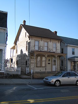
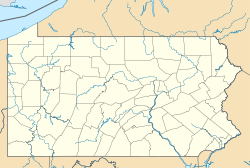

Coordinates: 39°54′0″N 76°38′27″W / 39.9°N 76.64083°WCoordinates: 39°54′0″N 76°38′27″W / 39.9°N 76.64083°W Country United States State Pennsylvania County York Settled 1844 Incorporated 1866 Government – Type Borough Council – Mayor Beverly A. Scott Area – Total 0.7 sq mi (1.8 km2) Elevation 876 ft (267 m) Population (2010) – Total 4,049 – Density 5,784.3/sq mi (2,233.3/km2) Time zone Eastern (EST) (UTC-5) – Summer (DST) EDT (UTC-4) Zip code 17313 Area code(s) 717 Website Dallastown Dallastown is a borough in York County, Pennsylvania, United States. The population was 4,049 at the 2010 census.[1]
Contents
History
Dallastown was named after George M. Dallas of Philadelphia (Vice President of the United States during the Polk administration) during the presidential campaign of 1844. Dallastown was incorporated April 1866.
President Lyndon Johnson visited Dallastown in 1966 as part of the town's centennial celebration.
Geography
According to the United States Census Bureau, the borough has a total area of 0.7 square miles (1.8 km2), all of it land.
Demographics
As of the census[2] of 2000, there were 4,087 people, 1,622 households, and 1,026 families residing in the borough. The population density was 5,567.2 people per square mile (2,161.6/km²). There were 1,707 housing units at an average density of 2,325.2 per square mile (902.8/km²). The racial makeup of the borough was 97.19% White, 0.78% African American, 0.20% Native American, 0.34% Asian, 0.12% Pacific Islander, 0.39% from other races, and 0.98% from two or more races. Hispanic or Latino of any race were 1.79% of the population.
There were 1,622 households out of which 31.6% had children under the age of 18 living with them, 46.4% were married couples living together, 12.5% had a female householder with no husband present, and 36.7% were non-families. 29.8% of all households were made up of individuals and 12.4% had someone living alone who was 65 years of age or older. The average household size was 2.36 and the average family size was 2.91.
In the borough the population was spread out with 23.3% under the age of 18, 9.7% from 18 to 24, 31.1% from 25 to 44, 17.6% from 45 to 64, and 18.3% who were 65 years of age or older. The median age was 36 years. For every 100 females there were 90.2 males. For every 100 females age 18 and over, there were 82.6 males.
The median income for a household in the borough was $37,500, and the median income for a family was $44,500. Males had a median income of $35,679 versus $25,169 for females. The per capita income for the borough was $18,249. About 3.4% of families and 8.7% of the population were below the poverty line, including 6.7% of those under age 18 and 19.2% of those age 65 or over.
Education
Dallastown Borough is home to the Dallastown Area School District. Though Dallastown Area Middle School and Dallastown Area High School are in the borough itself, only 1 of the 5 elementary schools can say they are actually in Dallastown.
St. Joseph's Catholic School is also in Dallastown. It provides Catholic education to students in grades Pre-K to 6.
References
- ^ "Race, Hispanic or Latino, Age, and Housing Occupancy: 2010 Census Redistricting Data (Public Law 94-171) Summary File (QT-PL), Dallastown borough, Pennsylvania". U.S. Census Bureau, American FactFinder 2. http://factfinder2.census.gov. Retrieved October 4, 2011.
- ^ "American FactFinder". United States Census Bureau. http://factfinder.census.gov. Retrieved 2008-01-31.
Municipalities and communities of York County, Pennsylvania City 
Boroughs Cross Roads | Dallastown | Delta | Dillsburg | Dover | East Prospect | Fawn Grove | Felton | Franklintown | Glen Rock | Goldsboro | Hallam | Hanover | Jacobus | Jefferson | Lewisberry | Loganville | Manchester | Mount Wolf | New Freedom | New Salem | North York | Railroad | Red Lion | Seven Valleys | Shrewsbury | Spring Grove | Stewartstown | Wellsville | West York | Windsor | Winterstown | Wrightsville | Yoe | York Haven | Yorkana
Townships Carroll | Chanceford | Codorus | Conewago | Dover | East Hopewell | East Manchester | Fairview | Fawn | Franklin | Heidelberg | Hellam | Hopewell | Jackson | Lower Chanceford | Lower Windsor | Manchester | Manheim | Monaghan | Newberry | North Codorus | North Hopewell | Paradise | Peach Bottom | Penn | Shrewsbury | Spring Garden | Springettsbury | Springfield | Warrington | Washington | West Manchester | West Manheim | Windsor | York
CDPs East York | Emigsville | Grantley | Parkville | Pennville | Queens Gate | Shiloh | Spry | Stonybrook | Susquehanna Trails | Tyler Run | Valley Green | Valley View | Weigelstown Yorklyn |
Unincorporated
communitiesAccomac | Admire | Airville | Ambau | Bandanna | Bermudian‡ | Big Mountain | Blackrock | Brogue | Bryansville | Cly | Craley | Davidsburg | Detters Mill | Fayfield | Foustown | Fuhrmans Mill | Gatchellville | Glades | Glenville | Gnatstown | Hametown | Hanover Junction | Hopewell Center | Kralltown | Leaders Heights | Mackey Ford | Mount Royal | New Bridgeville | New Market | New Park | Porters Sideling | Siddonsburg | Stoverstown | Strinestown | Sunnyburn | Tolna | Thomasville | Valley Forge | Violet Hill | Woodbine
Categories:- Populated places established in 1844
- Boroughs in York County, Pennsylvania


Wikimedia Foundation. 2010.