- Richmond, Rhode Island
Infobox Settlement
official_name = Richmond, Rhode Island
settlement_type = Town
nickname =
motto =
imagesize =
image_caption =
image_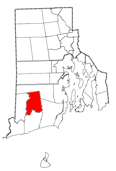
mapsize = 250px
map_caption = Location of Richmond in Rhode Island
mapsize1 =
map_caption1 =subdivision_type = Country
subdivision_name =United States
subdivision_type1 = State
subdivision_name1 =Rhode Island
subdivision_type2 = County
subdivision_name2 = Washingtongovernment_footnotes =
government_type =
leader_title =
leader_name =
leader_title1 =
leader_name1 =
established_title =
established_date =unit_pref = Imperial
area_footnotes =
area_magnitude =
area_total_km2 = 105.6
area_land_km2 = 105.0
area_water_km2 = 0.6
area_total_sq_mi = 40.8
area_land_sq_mi = 40.6
area_water_sq_mi = 0.2population_as_of = 2000
population_footnotes =
population_total = 7222
population_density_km2 = 68.7
population_density_sq_mi = 178.1timezone = Eastern (EST)
utc_offset = -5
timezone_DST = EDT
utc_offset_DST = -4
elevation_footnotes =
elevation_m = 116
elevation_ft = 381
latd = 41 |latm = 29 |lats = 39 |latNS = N
longd = 71 |longm = 40 |longs = 8 |longEW = Wpostal_code_type =
ZIP code s
postal_code = 02800-02899
area_code = 401
blank_name = FIPS code
blank_info = 44-61160GR|2
blank1_name = GNIS feature ID
blank1_info = 1220089GR|3
website =
footnotes =Richmond is a town in Washington County,
Rhode Island ,United States . The population was 7,222 at the 2000 census.History
The town of Richmond, Rhode Island was originally a part of the territory of
Westerly, Rhode Island (1669 to 1747), which remained in dispute for several years between the British Colonies of Rhode Island, Connecticut, and Massachusetts.In 1665,
Charles II , the King of England, dissolved the different charters of the three colonies in dispute, assumed governance, and renamed the area King’s County. In May of 1669, the General Assembly of Rhode Island and Providence Plantations organized King’s County into the town of Westerly. Subsequent to this the town of Westerly organized itself into four separate areas: Westerly, Charlestown, Richmond, and Hopkinton.Richmond, Rhode Island was incorporated as a separate and distinct township in 1747. It is bounded on the north by the town of Exeter, on the west by the Wood River, on the east by the towns of Exeter and South Kingstown, and on the south by the Pawcatuck River.
Previous to both Colony and British rule the southern area of Rhode Island, encompassing Westerly, Charlestown, Richmond, and Hopkinton was inhabited and ruled by the Narragansett Indian Tribe.
Geography
Richmond is some 35 miles south of the capital
Providence, Rhode Island . Richmond is mostly forested and is the home of the Washington County Fair.According to the
United States Census Bureau , the town has a total area of 40.8square mile s (105.6km² ), of which, 40.6 square miles (105.0 km²) of it is land and 0.2 square miles (0.6 km²) of it (0.54%) is water.Demographics
As of the
census GR|2 of 2000, there were 7,222 people, 2,537 households, and 2,034 families residing in the town. Thepopulation density was 178.1 people per square mile (68.7/km²). There were 2,620 housing units at an average density of 64.6/sq mi (24.9/km²). The racial makeup of the town was 96.97% White, 0.40% African American, 0.91% Native American, 0.44% Asian, 0.19% from other races, and 1.08% from two or more races. Hispanic or Latino of any race were 1.23% of the population.There were 2,537 households out of which 40.2% had children under the age of 18 living with them, 69.3% were married couples living together, 7.5% had a female householder with no husband present, and 19.8% were non-families. 14.3% of all households were made up of individuals and 4.4% had someone living alone who was 65 years of age or older. The average household size was 2.84 and the average family size was 3.14.
In the town the population was spread out with 27.9% under the age of 18, 6.1% from 18 to 24, 34.4% from 25 to 44, 24.5% from 45 to 64, and 7.0% who were 65 years of age or older. The median age was 36 years. For every 100 females there were 100.7 males. For every 100 females age 18 and over, there were 97.9 males.
The median income for a household in the town was $59,840, and the median income for a family was $64,688. Males had a median income of $41,357 versus $29,115 for females. The
per capita income for the town was $22,351. About 1.9% of families and 3.0% of the population were below thepoverty line , including 4.2% of those under age 18 and 4.3% of those age 65 or over.National Historic Places in Richmond
*
Carolina Village Historic District
*John Hoxsie House
*Shannock Historic District
*Wyoming Village Historic District References
Wikimedia Foundation. 2010.