- West Columbia, South Carolina
-
West Columbia, South Carolina — City — Location in Lexington County, South Carolina
Coordinates: 33°59′27.8″N 81°4′23.4″W / 33.991056°N 81.073167°WCoordinates: 33°59′27.8″N 81°4′23.4″W / 33.991056°N 81.073167°W Country United States State South Carolina County Lexington Area – Total 6.3 sq mi (16.3 km2) – Land 6.1 sq mi (15.7 km2) – Water 0.2 sq mi (0.5 km2) Elevation 285 ft (87 m) Population (2000) – Total 13,064 – Density 2,152.3/sq mi (831.0/km2) Time zone EST (UTC-5) – Summer (DST) EDT (UTC-4) Area code(s) 803 FIPS code 45-75850[1] GNIS feature ID 1251380[2] Website www.westcolumbiasc.gov West Columbia is a city in Lexington County, South Carolina, United States. The population was 13,064 at the 2000 census. It is part of the Columbia, South Carolina Metropolitan Statistical Area.
West Columbia was incorporated in 1894 as Brookland, but the United States Postal Service called the town "New Brookland" since there was another town called Brookland. In 1936, the name was changed to West Columbia to emphasize its proximity to Columbia, South Carolina. Numerous businesses, churches and a high school retain the Brookland and New Brookland names.
Columbia Metropolitan Airport, which serves Columbia, is located in this city. The airport is the location of a National Weather Service radar station and Weather Forecast Office, which serves eighteen counties in South Carolina and five counties in Georgia.
Contents
Geography
West Columbia lies to the south and west of the Saluda and Congaree Rivers.
According to the United States Census Bureau, the city has a total area of 6.3 square miles (16.3 km²), of which, 6.1 square miles (15.7 km²) of it is land and 0.2 square miles (0.5 km²) of it (3.18%) is water.
Demographics
As of the census[1] of 2000, there were 13,064 people, 5,968 households, and 3,300 families residing in the city. The population density was 2,150.6 people per square mile (831.0/km²). There were 6,436 housing units at an average density of 1,059.5 per square mile (409.4/km²). The racial makeup of the city was 74.54% White, 19.81% African American, 0.28% Native American, 1.71% Asian, 0.02% Pacific Islander, 2.04% from other races, and 1.61% from two or more races. Hispanic or Latino of any race were 4.66% of the population.
There were 5,968 households out of which 22.0% had children under the age of 18 living with them, 37.5% were married couples living together, 14.3% had a female householder with no husband present, and 44.7% were non-families. 36.1% of all households were made up of individuals and 13.0% had someone living alone who was 65 years of age or older. The average household size was 2.13 and the average family size was 2.76.
In the city the population was spread out with 18.8% under the age of 18, 10.1% from 18 to 24, 30.0% from 25 to 44, 22.1% from 45 to 64, and 19.0% who were 65 years of age or older. The median age was 39 years. For every 100 females there were 88.5 males. For every 100 females age 18 and over, there were 86.1 males.
The median income for a household in the city was $30,999, and the median income for a family was $40,253. Males had a median income of $30,033 versus $24,637 for females. The per capita income for the city was $18,135. About 12.8% of families and 16.8% of the population were below the poverty line, including 24.5% of those under age 18 and 11.4% of those age 65 or over.
Education
Lexington County School Districts One and Two serve West Columbia. White Knoll High School serves some of the city's residents who live in District One, and there are two high schools in District Two, Brookland-Cayce High School and Airport High School.
Midlands Technical College also operates their Airport campus near the Columbia Metropolitan Airport.
References
- ^ a b "American FactFinder". United States Census Bureau. http://factfinder.census.gov. Retrieved 2008-01-31.
- ^ "US Board on Geographic Names". United States Geological Survey. 2007-10-25. http://geonames.usgs.gov. Retrieved 2008-01-31.
External links
Municipalities and communities of Lexington County, South Carolina Cities 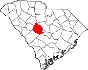
Towns Batesburg-Leesville‡ | Chapin | Gaston | Gilbert | Irmo‡ | Lexington | Pelion | Pine Ridge | South Congaree | Springdale | Summit | Swansea
CDPs Footnotes ‡This populated place also has portions in an adjacent county or counties
 State of South Carolina
Regions Larger cities Smaller cities Towns CDPs Counties - Abbeville
- Aiken
- Allendale
- Anderson
- Bamberg
- Barnwell
- Beaufort
- Berkeley
- Calhoun
- Charleston
- Cherokee
- Chester
- Chesterfield
- Clarendon
- Colleton
- Darlington
- Dillon
- Dorchester
- Edgefield
- Fairfield
- Florence
- Georgetown
- Greenville
- Greenwood
- Hampton
- Horry
- Jasper
- Kershaw
- Lancaster
- Laurens
- Lee
- Lexington
- Marion
- Marlboro
- McCormick
- Newberry
- Oconee
- Orangeburg
- Pickens
- Richland
- Saluda
- Spartanburg
- Sumter
- Union
- Williamsburg
- York
Topics - History
- Famous people
- Governors
- Legislature
- State House
- Congressional districts
- Census areas
- State parks
- Rivers
- Wildlife refuges
- Historic places
- Amusement parks
- Colleges and universities
- Sports venues
- Shopping malls
- Television stations
- Radio stations
- Highways
- Airports
- Visitor attractions
Categories:- Cities in South Carolina
- Lexington County, South Carolina
- Columbia, South Carolina metropolitan area


Wikimedia Foundation. 2010.