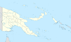
Normanby Island (Papua New Guinea)

Normanby Island (Papua New Guinea)
Normanby

Topographic map of Normanby Island
Normanby Island (Papua New Guinea) is located in Papua New Guinea
{{{alt}}}
Normanby Island (Papua New Guinea)
Geography
Coordinates 10°S 151°E / 10°S 151°E / -10; 151
Archipelago D'Entrecasteaux Islands
Area 1,000 km2 (400 sq mi)
Highest elevation 1,158 m (3,799 ft)
Highest point Prevost Range
Country
Papua New Guinea
Province Milne Bay Province
Largest city Esa’ala

Normanby Island is a volcanic, 400 square mile (1,000 square km), L-shaped island, the southern most island in the D'Entrecasteaux Islands group. It is part of Milne Bay Province, Papua New Guinea.

Normanby Island is 10 miles (16 km) north-east of East Cape, on the island of New Guinea, separated by Goschen Strait, and is separated by the Dawson Strait (Dobu Passage) from Fergusson Island. The island rises to 3,800 feet (1,158 metres) in the Prevost Range in the southeast. The terrain includes low coastal plains and swamplands, high mountains and steep coastal slopes. Sewa Bay provides shelter on the west coast and Awaiara (Sewataitai) Bay on the east coast. The largest settlement, and district headquarters, is Esa’ala at the island’s northern end.

In 1873, the island was visited by British Captain John Moresby, commanding HMS Basilisk, who named it after the Marquess of Normanby, George Augustus Constantine Phipps, a governor of Queensland, Australia.

Once known to produce gold, Normanby now exports copra and some timber. Recent discoveries of gold deposits are beginning to be exploited. Coordinates: 10°00′S 151°00′E / 10°S 151°E / -10; 151


Wikimedia Foundation. 2010.

Игры ⚽ Нужна курсовая?

Look at other dictionaries:

  • Duke of York Island, Papua New Guinea — Duke of York Islands seen from space Duke of York Island is the largest island of Duke of York Islands, Papua New Guinea, at …   Wikipedia

  • Papua New Guinea — This article is about the country. For the Future Sound of London single, see Papua New Guinea (song). Independent State of Papua New Guinea Independen Stet bilong Papua Niugini …   Wikipedia

  • Normanby Island — may refer to: Normanby Island (Queensland), in Australia Normanby Island, Papua New Guinea This disambiguation page lists articles about distinct geographical locations with the same name. If an internal link led you he …   Wikipedia

  • Green Islands (Papua New Guinea) — Green Islands redirects here. For other islands, see Green Island (disambiguation). Green Islands seen from space The Green Islands are a small group of islands in Papua New Guinea. They are located at …   Wikipedia

  • Normanby Island — ▪ island, Papua New Guinea       one of the D Entrecasteaux Islands, Papua New Guinea, southwestern Pacific Ocean. The island lies 10 miles (16 km) from the eastern tip of the island of New Guinea, across Goschen Strait, and is separated from… …   Universalium

  • Normanby — could be: Contents 1 Places 1.1 Places in England 1.2 Places in Australia 1.3 Places in Canada 1.4 …   Wikipedia

  • New Hanover Island — New Hanover New Hanover closeup map …   Wikipedia

  • New Ireland (island) — For the political strategy of the Provisional IRA and Sinn Féin meaning New Ireland in English, see Éire Nua. New Ireland Native name: Niu Ailan New Ireland s main towns and nearby islands …   Wikipedia

  • New Britain — This article is about the island of New Britain in Papua New Guinea. For other uses of the name, see New Britain (disambiguation). New Britain New Britain from space, June 2005. Clearly visible are ash plumes from Langila and Ulawun volcanoes …   Wikipedia

  • Normanby — Isla Normanby Normanby Island Localización País  Papúa Nueva Guinea Archipiélago Islas D Entrecaste …   Wikipedia Español

Share the article and excerpts

Direct link
Do a right-click on the link above
and select “Copy Link”