- Clover, South Carolina
-
Clover, South Carolina — Town — Motto: "The town with love in the middle." Location of Clover, South Carolina
Coordinates: 35°6′44″N 81°13′37″W / 35.11222°N 81.22694°WCoordinates: 35°6′44″N 81°13′37″W / 35.11222°N 81.22694°W Country United States State South Carolina County York Area - Total 2.8 sq mi (7.3 km2) - Land 2.8 sq mi (7.3 km2) - Water 0.0 sq mi (0.0 km2) Elevation 846 ft (258 m) Population (2000) - Total 4,014 - Density 1,433.5/sq mi (553.5/km2) Time zone Eastern (EST) (UTC-5) - Summer (DST) EDT (UTC-4) ZIP code 29710 Area code(s) 803 FIPS code 45-15355[1] GNIS feature ID 1221646[2] Clover is a town in York County, South Carolina, United States located in the greater Charlotte, North Carolina metropolitan area. As of July 2009, the population was at 5,158 within the town limits. Clover is twinned with the Northern Irish town of Larne, located on the East Coast of County Antrim.
Contents
History
Clover was founded in the late 19th century, in the vicinity of an earlier settlement called New Centre, which waned during the Civil War. Prior to Clover's founding, Bethany and Bethel, communities located a few miles west and east, respectively, were primary population centers in northern York District, with well-established Presbyterian churches, post offices and stores.
The pivotal American Revolutionary War battle of Kings Mountain occurred about approximately eight miles to the west on October 7, 1780.
The village of Clover began as a railway stop midway between York, South Carolina, and Gastonia, North Carolina, when the first railroad tracks were laid through the northern section of the county, leading to Gastonia.
Before the Civil War, the Kings Mountain Railway had operated as far north as Yorkville from Chester, but the tracks were destroyed during the war. In 1873, the Chester and Lenoir Narrow Gauge Railway was officially chartered, and the new railroad company acquired the former Kings Mountain rights of way. By 1875, new, narrower gauge tracks constituted the old route, and the following year tracks were laid between Yorkville and the new mill town of Gastonia. The eventual location of the village was mid-point between the two towns and a railway stopping point for taking on water, for the early steam engines.
According to lore, the overflow of water from the railway's water tank fertilized a patch of clover, and the stop was called "the clover patch." The town was incorporated in 1887.
It later became the home of several cotton mills, many of which operated until after World War II.
Geography and climate
Clover is located at 35°6′44″N 81°13′37″W / 35.11222°N 81.22694°W (35.112194, -81.226848)[3].
According to the United States Census Bureau, the town has a total area of 2.8 square miles (7.3 km2), of which, 2.8 square miles (7.3 km2) of it is land and 0.36% is water.
U.S. Highway 321 comprises Clover's Main Street, which runs roughly north and south, and the town square lies at its intersection with state highway 55.
Henry's Knob, a mountain near the town of Clover is the site of a former open-pit mining operation for the world's largest deposit of kyanite. The mountain stands at 1120 ft above sea level. According to United States Environmental Protection Agency (EPA) records, the mine is listed as a Superfund Alternative Site for acid mine drainage and groundwater contamination.[4]
Demographics
As of the census[1] of 2000, there were 4,014 people, 1,517 households, and 1,099 families residing in the town. The population density was 1,433.5 people per square mile (553.5/km²). There were 1,635 housing units at an average density of 583.9 per square mile (225.5/km²). The racial makeup of the town was 75.96% White, 21.03% African American, 0.27% Native American, 0.45% Asian, 0.07% Pacific Islander, 1.30% from other races, and 0.92% from two or more races. Hispanic or Latino of any race were 1.94% of the population.
There were 1,517 households out of which 35.7% had children under the age of 18 living with them, 48.2% were married couples living together, 19.6% had a female householder with no husband present, and 27.5% were non-families. 24.1% of all households were made up of individuals and 10.9% had someone living alone who was 65 years of age or older. The average household size was 2.64 and the average family size was 3.12.
In the town the population was spread out with 28.9% under the age of 18, 7.6% from 18 to 24, 29.7% from 25 to 44, 20.9% from 45 to 64, and 12.8% who were 65 years of age or older. The median age was 34 years. For every 100 females there were 90.6 males. For every 100 females age 18 and over, there were 85.1 males.
The median income for a household in the town was $37,335, and the median income for a family was $43,276. Males had a median income of $33,945 versus $19,840 for females. The per capita income for the town was $16,774. About 13.4% of families and 15.8% of the population were below the poverty line, including 19.5% of those under age 18 and 13.4% of those age 65 or over.
Schools
The schools located in the Clover School District include Bethel Elementary School, Bethany Elementary School, Griggs Road Elementary School, Kinard Elementary School, Crowders Creek Elementary School, Larne Elementary School (named after Clover's Sister City, Larne, Northern Ireland), Clover Middle School, Oakridge Middle School, Knox Street School, and Clover High School.
References
- ^ a b "American FactFinder". United States Census Bureau. http://factfinder.census.gov. Retrieved 2008-01-31.
- ^ "US Board on Geographic Names". United States Geological Survey. 2007-10-25. http://geonames.usgs.gov. Retrieved 2008-01-31.
- ^ "US Gazetteer files: 2010, 2000, and 1990". United States Census Bureau. 2011-02-12. http://www.census.gov/geo/www/gazetteer/gazette.html. Retrieved 2011-04-23.
- ^ http://www.hiltonpond.org/ArticleMineralsSCMain.html.
External links
Municipalities and communities of York County, South Carolina Cities 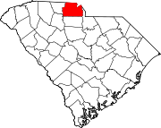
Towns Clover | Fort Mill‡ | Hickory Grove | McConnells | Sharon | Smyrna‡
CDPs India Hook | Lake Wylie | Lesslie | Newport | Riverview
Unincorporated
communitiesCatawba | Filbert | Holy Islamville | Hopewell | Ogden | Red River | Smith | Tirzah
Footnotes ‡This populated place also has portions in an adjacent county or counties
Categories:- Towns in South Carolina
- York County, South Carolina
- Populated places established in 1887


Wikimedia Foundation. 2010.