- Custer, South Dakota
-
Custer, South Dakota — City — The main street in 2003 Location in Custer County and the state of South Dakota
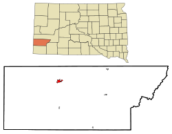
Coordinates: 43°46′6″N 103°35′51″W / 43.76833°N 103.5975°WCoordinates: 43°46′6″N 103°35′51″W / 43.76833°N 103.5975°W Country United States State South Dakota County Custer Founded 1875[1] Area - Total 1.8 sq mi (4.7 km2) - Land 1.8 sq mi (4.7 km2) - Water 0.0 sq mi (0.0 km2) Elevation 5,315 ft (1,620 m) Population (2010) - Total 2,067 - Density 1,148.3/sq mi (439.8/km2) Time zone MST (UTC-7) - Summer (DST) MDT (UTC-6) Zip Code 57730 Area code(s) 605 FIPS code 46-15140[2] GNIS feature ID 1265633[3] Custer is a city in Custer County, South Dakota, United States. The population was 2,067 at the 2010 census. It is the county seat of Custer County.[4]
Contents
History
 Oxen-drawn freight team entering Custer in 1876
Custer is generally considered to be the oldest town established by European Americans in the Black Hills of South Dakota and Wyoming. The site of one of the major encampments of the Black Hills Expedition led by of Lt. Colonel) George Armstrong Custer's 7th Cavalry in 1874, which made the first public discovery of gold in the Black Hills.
For thousands of years, the Black Hills had been part of the territory of varying tribes of indigenous peoples. They were within historical territory of the Oglala Sioux at the time of United States encounter, and within the Great Sioux Reservation established by the US Treaty of Fort Laramie (1868). Having established dominance in the area by the eighteenth century, the Oglala Sioux had long considered the Black Hills as sacred land.
After increasing encroachment by European Americans and violent confrontations, the US government forced the Sioux to cede much of the Black Hills in 1877, and opened the land for individual purchase and settlement. In 1875 trespassing gold-boomers named their settlement Stonewall (after the Confederate general, Stonewall Jackson), but it was renamed for Custer. Almost abandoned in 1876 after word of the much larger gold strikes in Deadwood Gulch spread, Custer later became an established city.
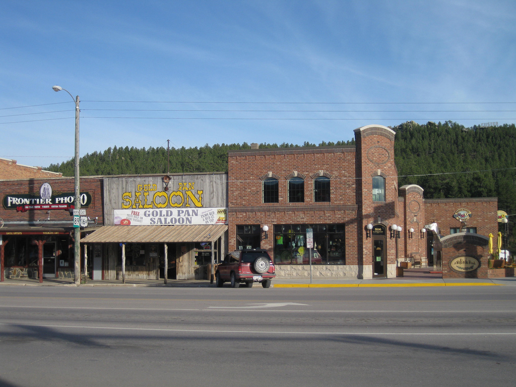
Custer has had a smaller population and been less wealthy than the Northern Hills cities of Deadwood and Lead. In addition to gold, Custer and other cities based their economies on the extraction of industrial minerals, which are still important to the regional economy. Custer claims to have the widest Main Street in the United States. The city made the street wide enough in the nineteenth century for a team of oxen pulling a wagon to turn completely around.
Custer annually observes a "Gold Discovery Days" celebration and festivities over the last full weekend of July. This heritage tourism event celebrates the discovery of gold by the Custer expedition in nearby French Creek and the subsequent founding of the town.
Geography
According to the United States Census Bureau, the city has a total area of 1.8 square miles (4.7 km2), all of it land.
Custer has been assigned the ZIP code 57730 and the FIPS place code 15140. Its primary telephone prefix is 673 in area code 605.
Demographics
As of the census[2] of 2000, there were 1,860 people, 825 households, and 491 families residing in the city. The population density was 1,033.6 people per square mile (399.0/km²). There were 934 housing units at an average density of 519.0 per square mile (200.3/km²). The racial makeup of the city was 95.97% White, 0.38% African American, 1.61% Native American, 0.16% Asian, 0.38% from other races, and 1.51% from two or more races. Hispanic or Latino of any race were 1.51% of the population.
 Downtown Custer, South Dakota
There were 825 households out of which 27.8% had children under the age of 18 living with them, 48.6% were married couples living together, 9.0% had a female householder with no husband present, and 40.4% were non-families. 36.5% of all households were made up of individuals and 16.6% had someone living alone who was 65 years of age or older. The average household size was 2.17 and the average family size was 2.85.
In the city the population was spread out with 23.3% under the age of 18, 6.8% from 18 to 24, 24.6% from 25 to 44, 25.7% from 45 to 64, and 19.6% who were 65 years of age or older. The median age was 42 years. For every 100 females there were 92.5 males. For every 100 females age 18 and over, there were 86.6 males.
The median income for a household in the city was $31,739, and the median income for a family was $41,313. Males had a median income of $28,942 versus $19,688 for females. The per capita income for the city was $17,216. About 6.7% of families and 11.3% of the population were below the poverty line, including 13.9% of those under age 18 and 13.2% of those age 65 or over.
Although the incorporated city has a small population, many residents associated with it and the workforce live outside the city limits in unincorporated Custer County. A steady stream of tourists year round and those attracted to the annual Sturgis Motorcycle Rally add much to the economy and seasonal population of the city.
Economy
 Custer Post Office
In addition to continued mining of precious metals, industrial minerals form the basis of today's local mining industry. Timber harvesting and production, tourism, and government services form the basis for the economy. Custer is the headquarters for the Supervisor of the Black Hills National Forest of South Dakota and Wyoming. It is convenient to major tourist attractions, such as Jewel Cave National Monument, Wind Cave National Park, Custer State Park, and Mount Rushmore National Memorial. The Crazy Horse Memorial is located just north of the city.
The South Dakota State Treatment and Rehabilitation Academy is located south of town and partially within Custer State Park. The Department of Corrections operates the facility for juvenile offenders.
Custer is home to the Bedrock City campground, which attracts visitors to its construction of the fictional town of Bedrock from the animated television series The Flintstones.
Custer State Park, just outside of town, is one of the major tourist destinations in the area during the summer. During the fall, the visitors are mostly hunters hoping to kill deer or turkey in the surrounding forest.
Radio
KFCR AM 1490 and KAWK FM 105.1, owned by Mt. Rushmore Broadcasting, Inc.
References
- ^ "SD Towns". South Dakota State Historical Society. http://history.sd.gov/Archives/forms/exhibits/SD%20Towns.pdf. Retrieved 2010-02-11.
- ^ a b "American FactFinder". United States Census Bureau. http://factfinder.census.gov. Retrieved 2008-01-31.
- ^ "US Board on Geographic Names". United States Geological Survey. 2007-10-25. http://geonames.usgs.gov. Retrieved 2008-01-31.
- ^ "Find a County". National Association of Counties. http://www.naco.org/Counties/Pages/FindACounty.aspx. Retrieved 2011-06-07.
Municipalities and communities of Custer County, South Dakota County seat: CusterCity Custer

Towns Buffalo Gap | Fairburn | Hermosa | Pringle
Unincorporated
communityFour Mile
Categories:- Black Hills
- Cities in South Dakota
- Populated places in Custer County, South Dakota
- County seats in South Dakota
- Populated places established in 1875


Wikimedia Foundation. 2010.