- Sturgis, South Dakota
Infobox Settlement
official_name = Sturgis, South Dakota
other_name =
native_name =
nickname =
settlement_type =City
motto =
imagesize =
image_caption =
flag_size =
image_
seal_size =
image_shield =
shield_size =
image_blank_emblem =
blank_emblem_type =
blank_emblem_size =
imagesize =
image_caption =
flag_size =
image_
seal_size =
image_shield =
shield_size =
image_blank_emblem =
blank_emblem_type =
blank_emblem_size =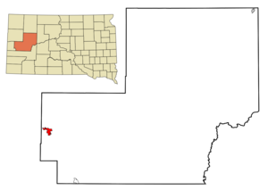
mapsize = 250px
map_caption = Location in Meade County and the state ofSouth Dakota
mapsize1 =
map_caption1 =
image_dot_
dot_mapsize =
dot_map_caption =
dot_x =
dot_y =
pushpin_
pushpin_label_position =
pushpin_map_caption =
pushpin_mapsize =
subdivision_type = Country
subdivision_name =United States
subdivision_type1 = State
subdivision_name1 =South Dakota
subdivision_type2 = County
subdivision_name2 = Meade
subdivision_type3 =
subdivision_name3 =
subdivision_type4 =
subdivision_name4 =
government_footnotes =
government_type =
leader_title =
leader_name =
leader_title1 =
leader_name1 =
leader_title2 =
leader_name2 =
leader_title3 =
leader_name3 =
leader_title4 =
leader_name4 =
established_title =
established_date =
established_title2 =
established_date2 =
established_title3 =
established_date3 =
area_magnitude =
unit_pref = Imperial
area_footnotes =
area_total_km2 = 9.7
area_land_km2 = 9.7
area_water_km2 = 0
area_total_sq_mi = 3.7
area_land_sq_mi = 3.7
area_water_sq_mi = 0
area_water_percent =
area_urban_km2 =
area_urban_sq_mi =
area_metro_km2 =
area_metro_sq_mi =
area_blank1_title =
area_blank1_km2 =
area_blank1_sq_mi =
population_as_of = 2000
population_footnotes =
population_note =
population_total = 6442
population_density_km2 = 664.1
population_density_sq_mi = 1741.1
population_metro =
population_density_metro_km2 =
population_density_metro_sq_mi =
population_urban =
population_density_urban_km2 =
population_density_urban_sq_mi =
population_blank1_title =
population_blank1 =
population_density_blank1_km2 =
population_density_blank1_sq_mi =
timezone = Mountain (MST)
utc_offset = -7
timezone_DST = MDT
utc_offset_DST = -6
latd = 44 |latm = 24 |lats = 37 |latNS = N
longd = 103 |longm = 31 |longs = 7 |longEW = W
elevation_footnotes =
elevation_m = 1043
elevation_ft = 3422
postal_code_type =ZIP code
postal_code = 57785
area_code = 605
blank_name = FIPS code
blank_info = 46-62100GR|2
blank1_name = GNIS feature ID
blank1_info = 1265387GR|3
website =
footnotes =Sturgis is a city in Meade County,
South Dakota ,United States . The population was 6,442 at the 2000 census. It is thecounty seat of Meade CountyGR|6.Sturgis is most famous for being the location of one of the largest annual motorcycle events in the world, which is held annually on the first full week of August. Motorcycle enthusiasts from around the world flock to this usually sleepy town during the
Sturgis Motorcycle Rally .Points of interest
* [http://www.sdgfp.info/Parks/Regions/NorthernHills/BearButte.htm Bear Butte State Park]
* [http://www.fortmeademuseum.org/welcome.htm Fort Meade Cavalry Museum]
* [http://www.sturgismuseum.com/ Sturgis Motorcycle Museum & Hall of Fame]
* [http://www.cem.va.gov/CEM/cems/nchp/blackhills.asp Black Hills National Cemetery]
* [http://www.sdgfp.info/Parks/Regions/Custer/centennial_trail_brochure.pdf South Dakota Centennial Trail]
* [http://www.southdakotacaves.com/wonderland_cave.htm Wonderland Cave]
* [http://www.mt.blm.gov/sdfo/ftmeade/ftmeade.html Fort Meade Recreation Area and National Back Country Byway]
* St. Martin's Chapel
* Poker Alice House
* Annie Tallent Home
* Charles Nolin Monument
* Public Sculptures: "Kinship" at the Sturgis Community Center, "General Samuel D. Sturgis" at the Hills and Plains Park at the east entrance to town, "Jesus in the Garden" at the First United Methodist Church Memorial Garden, "St. Francis of Assisi" at the St. Francis of Assisi Catholic Church, and a new abstract sculpture in front of the Sturgis Public Library.Geography
Sturgis is located at coor dms|44|24|37|N|103|31|7|W|city (44.410322, -103.518486)GR|1.
According to the
United States Census Bureau , the city has a total area of 9.7km² (3.7sq mi), all land.Sturgis has been assigned the
ZIP code 57785, and theFIPS place code 62100.Demographics
As of the
census GR|2 of 2000, there were 6,442 people, 2,738 households, and 1,708 families residing in the city. Thepopulation density was 1,723.6 people per square mile (665.0/km²). There were 2,989 housing units at an average density of 799.7/sq mi (308.6/km²). The racial makeup of the city was 94.80% White, 0.20% African American, 2.48% Native American, 0.31% Asian, 0.33% from other races, and 1.88% from two or more races. Hispanic or Latino of any race were 1.75% of the population.There were 2,738 households out of which 30.2% had children under the age of 18 living with them, 48.0% were married couples living together, 11.5% had a female householder with no husband present, and 37.6% were non-families. 33.3% of all households were made up of individuals and 15.6% had someone living alone who was 65 years of age or older. The average household size was 2.29 and the average family size was 2.91.
In the city the population was spread out with 25.0% under the age of 18, 7.9% from 18 to 24, 25.4% from 25 to 44, 22.5% from 45 to 64, and 19.3% who were 65 years of age or older. The median age was 40 years. For every 100 females there were 91.0 males. For every 100 females age 18 and over, there were 86.1 males.
The median income for a household in the city was $30,253, and the median income for a family was $38,698. Males had a median income of $25,856 versus $18,582 for females. The
per capita income for the city was $16,763. About 11.0% of families and 12.0% of the population were below thepoverty line , including 12.7% of those under age 18 and 6.8% of those age 65 or over.Cold War
As part of the vast
Ellsworth Air Force Base complex, the land north of Sturgis was dotted with 50 Minutemanmissile silo s, with the closest (L5) only 3.5 miles from the center of the town.References
External links
* [http://www.sturgis-sd.gov/ City of Sturgis website]
* [http://www.sturgis-sd.org/ Sturgis Chamber of Commerce]
* [http://www.sturgis.sd.us/ Sturgis, SD information website]
* [http://www.Sturgis.info/ Sturgis, SD Information Directory]
Wikimedia Foundation. 2010.