- Colton, South Dakota
-
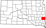
Colton, South Dakota — City — Location in Minnehaha County and the state of South Dakota
Coordinates: 43°47′15″N 96°55′38″W / 43.7875°N 96.92722°WCoordinates: 43°47′15″N 96°55′38″W / 43.7875°N 96.92722°W Country United States State South Dakota County Minnehaha Incorporated 1904[1] Area – Total 0.7 sq mi (1.8 km2) – Land 0.7 sq mi (1.8 km2) – Water 0 sq mi (0 km2) Elevation 1,604 ft (489 m) Population (2010) – Total 687 – Density 981.4/sq mi (381.7/km2) Time zone Central (CST) (UTC-6) – Summer (DST) CDT (UTC-5) ZIP code 57018 Area code(s) 605 FIPS code 46-13380[2] GNIS feature ID 1254438[3] Colton is a city in Minnehaha County, South Dakota, United States. The population was 687 at the 2010 census.
Geography
Colton is located at 43°47′15″N 96°55′38″W / 43.7875°N 96.92722°W (43.787411, -96.927349).[4]
According to the United States Census Bureau, the city has a total area of 0.7 square miles (1.8 km2), all of it land.
Colton has been assigned the ZIP code 57018 and the FIPS place code 13380.
Demographics
As of the census[2] of 2000, there were 662 people, 266 households, and 184 families residing in the city. The population density was 948.1 people per square mile (365.1/km²). There were 285 housing units at an average density of 408.2 per square mile (157.2/km²). The racial makeup of the city was 99.09% White, 0.30% Native American, 0.15% Pacific Islander, 0.30% from other races, and 0.15% from two or more races. Hispanic or Latino of any race were 1.21% of the population.
There were 266 households out of which 32.7% had children under the age of 18 living with them, 57.9% were married couples living together, 9.0% had a female householder with no husband present, and 30.5% were non-families. 27.4% of all households were made up of individuals and 13.2% had someone living alone who was 65 years of age or older. The average household size was 2.43 and the average family size was 2.95.
In the city the population was spread out with 24.5% under the age of 18, 8.8% from 18 to 24, 27.3% from 25 to 44, 19.5% from 45 to 64, and 19.9% who were 65 years of age or older. The median age was 37 years. For every 100 females there were 94.7 males. For every 100 females age 18 and over, there were 96.1 males.
The median income for a household in the city was $42,054, and the median income for a family was $45,139. Males had a median income of $28,958 versus $22,083 for females. The per capita income for the city was $18,189. About 3.6% of families and 4.1% of the population were below the poverty line, including 4.4% of those under age 18 and 4.6% of those age 65 or over.
References
- ^ "SD Towns". South Dakota State Historical Society. http://history.sd.gov/Archives/forms/exhibits/SD%20Towns.pdf. Retrieved 2010-02-11.
- ^ a b "American FactFinder". United States Census Bureau. http://factfinder.census.gov. Retrieved 2008-01-31.
- ^ "US Board on Geographic Names". United States Geological Survey. 2007-10-25. http://geonames.usgs.gov. Retrieved 2008-01-31.
- ^ "US Gazetteer files: 2010, 2000, and 1990". United States Census Bureau. 2011-02-12. http://www.census.gov/geo/www/gazetteer/gazette.html. Retrieved 2011-04-23.
Municipalities and communities of Minnehaha County, South Dakota Cities Baltic | Brandon | Colton | Crooks | Dell Rapids | Garretson | Hartford | Sioux Falls‡ | Valley Springs
Towns Unincorporated
communitiesFootnotes ‡This populated place also has portions in an adjacent county or counties
Categories:- Cities in South Dakota
- Populated places in Minnehaha County, South Dakota
- Sioux Falls metropolitan area


Wikimedia Foundation. 2010.