- Fort Pierre, South Dakota
Infobox Settlement
official_name = Fort Pierre, South Dakota
other_name =
native_name =
nickname =
settlement_type =City
motto =
imagesize =
image_caption =
flag_size =
image_
seal_size =
image_shield =
shield_size =
image_blank_emblem =
blank_emblem_type =
blank_emblem_size =
imagesize =
image_caption =
flag_size =
image_
seal_size =
image_shield =
shield_size =
image_blank_emblem =
blank_emblem_type =
blank_emblem_size =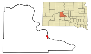
mapsize = 250px
map_caption = Location in Stanley County and the state ofSouth Dakota
mapsize1 =
map_caption1 =
image_dot_
dot_mapsize =
dot_map_caption =
dot_x =
dot_y =
pushpin_
pushpin_label_position =
pushpin_map_caption =
pushpin_mapsize =
subdivision_type = Country
subdivision_name =United States
subdivision_type1 = State
subdivision_name1 =South Dakota
subdivision_type2 = County
subdivision_name2 = Stanley
subdivision_type3 =
subdivision_name3 =
subdivision_type4 =
subdivision_name4 =
government_footnotes =
government_type =
leader_title =
leader_name =
leader_title1 =
leader_name1 =
leader_title2 =
leader_name2 =
leader_title3 =
leader_name3 =
leader_title4 =
leader_name4 =
established_title =
established_date =
established_title2 =
established_date2 =
established_title3 =
established_date3 =
area_magnitude =
unit_pref = Imperial
area_footnotes =
area_total_km2 = 7.6
area_land_km2 = 7.5
area_water_km2 = 0.1
area_total_sq_mi = 2.9
area_land_sq_mi = 2.9
area_water_sq_mi = 0
area_water_percent =
area_urban_km2 =
area_urban_sq_mi =
area_metro_km2 =
area_metro_sq_mi =
area_blank1_title =
area_blank1_km2 =
area_blank1_sq_mi =
population_as_of = 2000
population_footnotes =
population_note =
population_total = 1991
population_density_km2 = 262
population_density_sq_mi = 686.6
population_metro =
population_density_metro_km2 =
population_density_metro_sq_mi =
population_urban =
population_density_urban_km2 =
population_density_urban_sq_mi =
population_blank1_title =
population_blank1 =
population_density_blank1_km2 =
population_density_blank1_sq_mi =
timezone = Mountain (MST)
utc_offset = -7
timezone_DST = MDT
utc_offset_DST = -6
latd = 44 |latm = 21 |lats = 32 |latNS = N
longd = 100 |longm = 22 |longs = 33 |longEW = W
elevation_footnotes =
elevation_m = 437
elevation_ft = 1434
postal_code_type =ZIP code
postal_code = 57532
area_code = 605
blank_name = FIPS code
blank_info = 46-22260GR|2
blank1_name = GNIS feature ID
blank1_info = 1255113GR|3
website =
footnotes =Fort Pierre is a city in Stanley County,
South Dakota ,United States . It is part of thePierre, South Dakota Micropolitan Statistical Area. The population was 1,991 at the 2000 census. It is thecounty seat of Stanley County.GR|6 Lily Park, in Fort Pierre, is situated at the mouth of the Bad River. The site where theLewis and Clark Expedition met with the Teton Sioux is located nearby. It derives its name fromPierre Chouteau, Jr. , a fur trader who established the fort.Geography
Fort Pierre is located at coor dms|44|21|32|N|100|22|33|W|city (44.358941, -100.375742)GR|1.
According to the
United States Census Bureau , the city has a total area of 3.0square mile s (7.6km² ), of which, 2.9 square miles (7.5 km²) of it is land and 0.1 square miles (0.1 km²) of it (1.69%) is water.Fort Pierre has been assigned the
ZIP code 57532 and theFIPS place code 22260.Demographics
As of the
census GR|2 of 2000, there were 1,991 people, 810 households, and 538 families residing in the city. Thepopulation density was 686.6 people per square mile (265.1/km²). There were 875 housing units at an average density of 301.8/sq mi (116.5/km²). The racial makeup of the city was 92.16% White, 0.20% African American, 5.22% Native American, 0.30% Asian, 0.15% from other races, and 1.96% from two or more races. Hispanic or Latino of any race were 0.40% of the population.There were 810 households out of which 34.3% had children under the age of 18 living with them, 51.4% were married couples living together, 10.9% had a female householder with no husband present, and 33.5% were non-families. 28.4% of all households were made up of individuals and 8.9% had someone living alone who was 65 years of age or older. The average household size was 2.45 and the average family size was 3.01.
In the city the population was spread out with 28.0% under the age of 18, 6.9% from 18 to 24, 28.3% from 25 to 44, 25.4% from 45 to 64, and 11.3% who were 65 years of age or older. The median age was 37 years. For every 100 females there were 99.9 males. For every 100 females age 18 and over, there were 95.8 males.
The median income for a household in the city was $41,181, and the median income for a family was $47,885. Males had a median income of $29,948 versus $21,208 for females. The
per capita income for the city was $20,478. About 7.4% of families and 8.9% of the population were below thepoverty line , including 12.2% of those under age 18 and 14.8% of those age 65 or over.Notable Natives
*
John C. Waldron -World War II aviator from Fort Pierre.
*Walter Dale Miller -Former governor who resides there part of the time.
*Casey Tibbs -American cowboy and actor.References
External links
Wikimedia Foundation. 2010.