- Chapel-en-le-Frith
-
Coordinates: 53°19′19″N 1°55′01″W / 53.322°N 1.917°W
Chapel-en-le-Frith 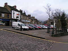
Market square, Chapel-en-le-Frith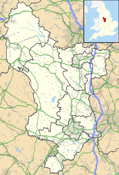
 Chapel-en-le-Frith
Chapel-en-le-Frith shown within DerbyshirePopulation 8,821 (Parish) OS grid reference SK055806 Parish Chapel-en-le-Frith District High Peak Shire county Derbyshire Region East Midlands Country England Sovereign state United Kingdom Post town HIGH PEAK Postcode district SK23 Dialling code 01298 Police Derbyshire Fire Derbyshire Ambulance East Midlands EU Parliament East Midlands UK Parliament High Peak List of places: UK • England • Derbyshire Chapel-en-le-Frith (pronounced /ˌtʃæpəl ˌɒn lə ˈfrɪθ/) is a small town in Derbyshire, England, on the edge of the Peak District near the border with Cheshire, 33 km (21 miles) from Manchester. Dubbed "The Capital of the Peak District", the settlement was established by the Normans in the 12th century, originally as a hunting lodge within the Forest of High Peak. This led to the French-derived name of Chapel-en-le-Frith ("Chapel in the forest").[1] The population of 'Chapel', as the locals commonly refer to it, is approximately 10,000. For some years Chapel was the location of the High Peak Borough Council offices. There is a golf club, a cricket club and a football club.
Contents
Church of St Thomas Becket
The first chapel in the town (now the Church of St. Thomas Becket) was originally built by the Normans but was replaced with a larger building a hundred years later. It stands at the highest point in the town. The current building is now almost entirely of 18th-century construction. Buried in the churchyard are soldiers of the Scottish army of the Duke of Hamilton who marched south in support of Charles I in 1648. After their defeat at Preston, they were marched to Chapel and imprisoned in the church for sixteen days in such squalid conditions that forty died; a further ten died when they were marched towards Cheshire. The Eccles Pike Cross lies in the churchyard. It was moved here from Ollerenshaw Farm in 1925. It is believed to be Anglo-Saxon and is covered in very worn carvings.[2]
Customs
A curfew bell has been rung in the town since 1070, and on Shrove Tuesday a Pudding Bell is rung at eleven in the morning to remind housewives to prepare their batter.
There is a regular market place, cobbled and raised above the High Street, which is still used every Thursday to host the local market (though due to the current economic climate the number of stalls present has declined considerably). A market cross has a faint date which may read 1636, but the cross itself is considerably older.[2]
Industry
There is a certain amount of industry — especially behind the church in the lowest part of the town, where the brake-lining manufacturer Ferodo (an anagram of Frood, the 19th-century founder's name, with the addition of a letter "e") was a family concern for over a hundred years; it is now part of the international conglomerate Federal-Mogul.
Institutions
Chapel Poor Law Union was established in December 1837. The union workhouse was built c.1840 on the Whaley Bridge road (grid reference SK051805). It consisted of an entrance range and an accommodation block of three wings centred on an octagonal hub, an infirmary and an isolation hospital. The workhouse was later converted to an old people's home, and was demolished in the early 1980s.[3]
High Peak Radio, Independent Local Radio for High Peak and the Hope Valley, broadcasts from studios just off the High Street.
Transport
Chapel-en-le-Frith railway station is located 1.5 km (ca. 1 mile) from the town centre, on the commuter line from Buxton to Manchester Piccadilly. The other railway line passing through the town, which has a more centrally located station (Chapel-en-le-Frith Central, built by the Midland Railway), was once one of the main lines from London to Manchester. While it no longer carries passenger traffic, it now carries a constant stream of roadstone from the quarries around Buxton. It terminates at its junction with the Manchester–Sheffield trans-Pennine line by way of two viaducts, diverging east and west, above the Black Brook valley at Chapel Milton near Chinley signalbox.
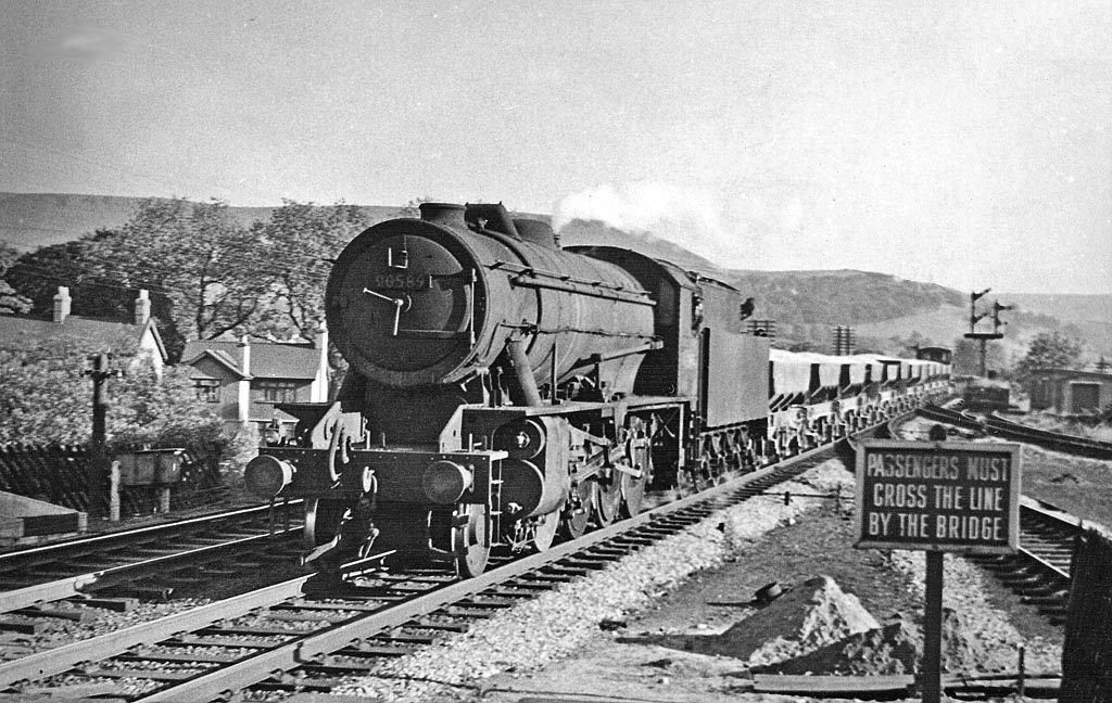
 Near the former Chapel-en-le-Frith Central in 1957
Moorlands
To the north lie the Dark Peak highlands, which are made up of millstone grit and are heather-covered, rugged and bleak. Here are Chinley Churn and South Head with, a little further off, Kinder Scout, which looms above the whole area. To the south is the gentler and more pastoral White Peak, consisting largely of limestone grasslands, nevertheless with spectacular bluffs and the occasional gorge. Combs Moss, a gritstone 'edge', dominates the valley in which Chapel lies from the south and Eccles Pike rises sharply above the town to its west.
Education
There are two schools in the town; Chapel-en-le-Frith High School and Chapel-en-le-Frith Primary School.
References
- ^ Parish Council history page
- ^ a b Neville T. Sharpe, Crosses of the Peak District (Landmark Collectors Library, 2002)
- ^ Higginbotham, P. (2007), Workhouses of the Midlands, Tempus, Stroud. Page 27. ISBN 978-0-7524-4488-8
External links
- Chapel-en-le-Frith Parish Council
- Chapel-en-le-Frith.com website
- Chapel-en-le-Frith Primary School
- Chapel-en-le-Frith High School
- The Church of St Thomas Becket
- Chapel Golf Club
- Chapel-en-le-Frith Cricket Club
Ceremonial county of Derbyshire Unitary authorities Boroughs or districts Major settlements - Alfreton
- Ashbourne
- Bakewell
- Belper
- Bolsover
- Buxton
- Chapel-en-le-Frith
- Chesterfield
- Clay Cross
- Darley Dale
- Derby
- Dronfield
- Eckington
- Glossop
- Hadfield
- Heanor
- Ilkeston
- Killamarsh
- Langley Mill
- Long Eaton
- Matlock
- Melbourne
- New Mills
- Ripley
- Sandiacre
- Shirebrook
- Staveley
- Swadlincote
- Whaley Bridge
- Wirksworth
See also: List of civil parishes in Derbyshire
Rivers Topics Categories:- Towns in Derbyshire
- Towns and villages of the Peak District


Wikimedia Foundation. 2010.