- Murfreesboro, Tennessee
-
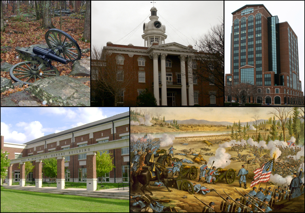
Murfreesboro, Tennessee — City — From top left, cannon at Stones River National Battlefield, Rutherford County Courthouse, Swanson Building, MTSU's Paul W. Martin Sr. Honors Building, Battle of Stones River.

LogoNickname(s): "The 'Boro" Motto: Creating a better quality of life. Location in Rutherford County and the state of Tennessee.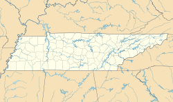
 Murfreesboro, Tennessee
Coordinates: 35°50′46″N 86°23′31″W / 35.84611°N 86.39194°W Country United States State Tennessee County Rutherford Settled 1811 Incorporated 1817 Government – Type Mayor-Council – Mayor Tommy Bragg – Vice mayor Chris Bratcher Area – City 39.2 sq mi (101.5 km2) – Land 39.0 sq mi (101.0 km2) – Water 0.20 sq mi (0.5 km2) 0.54% Elevation 619.0 ft (186 m) Population (2010)[1][2] – City 108,755 – Density 2,774.4/sq mi (1,071.2/km2) – Urban 135,855 Time zone CST (UTC-6) – Summer (DST) CDT (UTC-5) ZIP codes 37127-37130 Area code(s) 615 FIPS code 47-51560[3] GNIS feature ID 1295105[4] Website MurfreesboroTN.gov Murfreesboro is a city in and the county seat of Rutherford County, Tennessee, United States.[5] The population was 108,755 according to the United States Census Bureau's 2010 U.S. Census, up from 68,816 residents certified during the 2000 census.[1] The center of population of Tennessee is located in Murfreesboro.[6] The city is part of the Nashville metropolitan area, which includes thirteen counties and a population of 1,666,566 (2009).[7]
Although Murfreesboro is sometimes considered a suburb of Nashville, Tennessee, which is 35 miles (56 km) to the northwest, it is far enough away and has a large enough population to maintain a separate identity from its larger neighbor, and thus can be considered a smaller city within the Nashville-Murfreesboro metropolitan area. It is Tennessee's fastest growing major city and one of the fastest growing cities in the country, with a population growth from 46,000 to 69,000 between 1990 and 2000, a change of 50%. The city is also home to Middle Tennessee State University, the largest undergraduate university in the state of Tennessee, with an undergraduate population of 22,299 and 25,188 total students as of 2009[update].[8]
In 2006, Murfreesboro was ranked by Money as the 84th best place to live in the United States, out of 745 cities with a population over 50,000.[9][10]
Contents
History
In 1811, the Tennessee State Legislature established a county seat for Rutherford County. The town was first named "Cannonsburgh" in honor of Tennessee politician Newton Cannon, but was soon renamed "Murfreesboro" for Revolutionary War hero Colonel Hardy Murfree, later the great-grandfather of author Mary Noailles Murfree.
As Tennessee grew westward, it became clear that having the state capital in Knoxville would be a burden to those who had to travel from the western end of the state. In 1818, Murfreesboro became the capital of Tennessee until 1826, when Nashville became the state capital.[11]
Civil War
On December 31, 1862, the Battle of Stones River, also called the Battle of Murfreesboro, was fought near Murfreesboro between the Union Army of the Cumberland and the Confederate Army of Tennessee. This was a major engagement of the American Civil War. Between December 31 and January 2, 1863, there were 23,515 casualties,.[12] It was the bloodiest battle of the war based on percentage of casualties.
Following the Confederate retreat from the Battle of Perryville in central Kentucky, Confederate forces moved through East Tennessee and then turned northwest to defend at Murfreesboro. General Bragg's veteran cavalry was successful in harassing General Rosecrans' troop movements and in capturing and destroying supply trains, but could not completely stop the supplies and reinforcements from reaching Rosecrans. Despite the large number of casualties, the battle was tactically inconclusive, but is considered a Union victory. At the end of the battle, Confederate General Braxton Bragg retreated 36 miles (58 km) south to Tullahoma. General Rosecrans did not pursue until he had a secure logistical posture six months later in June 1863. The battle was strategically significant since it provided the basis for the further movement to Chattanooga and Atlanta which would eventually result in the Union splitting the Eastern and Western theaters by Sherman's March to the Sea. Stones River National Battlefield is now a historical site.
General Rosecrans further movement to the south was dependent on a secure source of provisions. Murfreesboro was destined to become a supply depot for the Union Army. Soon after the battle ended in January 1863, Brigadier General James St. Clair Morton, Chief Engineer of the Army of the Cumberland was charged with constructing Fortress Rosecrans approximately 2 miles (3.2 km) northwest of the town. The fortifications comprised more than 225 acres (0.91 km2) and were the largest built during the war. Immense quantities of supplies were to be maintained in the fortress. The fortress consisted of eight lunettes, four redoubts and connecting fortifications. Both the Nashville and Chattanooga Railroad and the West Fork of the Stones River ran through the fortress. Two roads provided additional transportation capabilities. The interior of the fortress was a huge logistical resource center including sawmills, warehouses, quartermaster maintenance depots, ammunition magazines, and living quarters for the two thousand troops responsible for the operation and defense of the fortress. After the fortress was rushed to completion in June, Rosecrans moved south leaving Brigadier General Horatio P. Van Cleve in command.[13] The fortress was never assaulted by Confederate forces, in part, because the Union held the town hostage by keeping cannon aimed at the courthouse in the center of the town. Significant portions of the earthworks still exist and have been incorporated into the battlefield site.
Post Civil War
Murfreesboro had begun as a mainly agricultural community, but by 1853 the area was home to several colleges and academies, earning it the nickname "Athens of Tennessee". Despite the trauma of the Civil War, by the early 1900s its growth began to regain momentum, in contrast to large areas of the South. In 1911, the state created Middle Tennessee State Normal School, a two-year school for training teachers. There was a subsequent merger with the Tennessee College for Women. In 1925 the school was expanded to a four-year institution. During and following World War II, it grew and evolved to become Middle Tennessee State University in 1965.[14] MTSU now has the highest undergraduate enrollment in the state.
World War II resulted in Murfreesboro beginning to move away from an agriculture-based economy and diversify economically with industry, manufacturing, and education contributing significantly. Since the end of World War II, growth has been steady giving rise to a stable economy. Murfreesboro has enjoyed substantial residential and commercial growth, with its population increasing 123.9% between 1990 and 2010, from 44,922 to 100,575.[15]
Geography
 Swanson Building. Joseph Swanson is a major developer in the area.
Murfreesboro is located at 35°50′46″N 86°23′31″W / 35.846143°N 86.392078°W.[16]
According to the United States Census Bureau, the city has a total area of 39.2 square miles (102 km2). 39.0 square miles (101 km2) of it is land and 0.2 square miles (0.52 km2) of it (0.54%) is water.
Murfreesboro is the geographic center of the state of Tennessee. A stone monument marks the official site on Old Lascassas Pike, about 0.5 miles (0.80 km) north of MTSU.
The West Fork of the Stones River flows through Murfreesboro. A walking trail, the Greenway, parallels the river for several miles. A smaller waterway, Lytle Creek, flows through downtown including historic "Cannonsburgh Village". It's total length is 19 miles (31 km) and parts of the creek suffers from pollution due to the urban environment and its use as a storm-water runoff.[17] Within the city limits are also a number of natural and man-made lakes.
Transportation
Murfreesboro is served by Nashville International Airport (IATA code BNA), Smyrna Airport (MQY) and Murfreesboro Municipal Airport (MBT). The city also benefits from several highways running through the city, including Interstate 24; U.S. Routes 41, 70S and 231; and State Routes 1, 2, 10, 96, 99, 268 and 840. Industry also has access to North-South rail service with the rail line from Nashville to Chattanooga.
Public transportation
The City of Murfreesboro ordered nine buses to serve as the city's new transportation. Each bus is capable of holding sixteen people and includes two spaces for wheelchairs. With the system being called "Rover", the buses are bright green in color with "Rover" and a cartoon dog painted on the side.
The system has been in service since April 2007, with buses operating in six major corridors: Memorial Boulevard, NW Broad Street, Old Fort Parkway, South Church Street (Stopping at Warrior Drive), Mercury Boulevard and Highland Avenue.
A one-way fare is US$1.00 for adults, US$0.50 for children 6-16 and seniors 65 and over, and free for children under 6. The system operates Monday to Friday, 6:00 a.m. to 6:00 p.m.[18][19]
Demographics
Historical populations Census Pop. %± 1850 1,917 — 1860 2,861 49.2% 1870 3,502 22.4% 1880 3,800 8.5% 1890 3,739 −1.6% 1900 3,999 7.0% 1910 4,679 17.0% 1920 5,367 14.7% 1930 7,993 48.9% 1940 9,495 18.8% 1950 13,052 37.5% 1960 18,991 45.5% 1970 26,360 38.8% 1980 32,845 24.6% 1990 44,922 36.8% 2000 68,816 53.2% 2010 108,755 58.0% Sources:[1][20] As of the census[3] of 2000, there were 68,816 people, 26,511 households, and 15,747 families residing in the city. The population density was 1,764.9 inhabitants per square mile (681.4 /km2). There were 28,815 housing units at an average density of 739.0 per square mile (285.3 /km2). The racial makeup of the city was 79.85% White, 13.89% African American, 0.28% Native American, 2.69% Asian, 0.03% Pacific Islander, 1.88% from other races, and 1.38% from two or more races. Hispanic or Latino of any race were 3.53% of the population.
There were 26,511 households out of which 30.7% had children under the age of 18 living with them, 43.8% were married couples living together, 11.9% had a female householder with no husband present, and 40.6% were non-families. 28.3% of all households were made up of individuals and 7.0% had someone living alone who was 65 years of age or older. The average household size was 2.42 and the average family size was 3.02.
In the city the population was spread out with 22.7% under the age of 18, 20.5% from 18 to 24, 30.8% from 25 to 44, 17.3% from 45 to 64, and 8.8% who were 65 years of age or older. The median age was 29 years. For every 100 females there were 98.7 males. For every 100 females age 18 and over, there were 97.2 males.
The median income for a household in the city was $39,705, and the median income for a family was $52,654. Males had a median income of $36,078 versus $26,531 for females. The per capita income for the city was $20,219. About 8.2% of families and 14.1% of the population were below the poverty line, including 12.0% of those under the age of 18 and 11.1% of those 65 and older.
Special census estimates in 2005 indicated 81,393 residents, and in 2006 the U.S. Census Bureau's American Community Survey estimated a population of 92,559, with 35,842 households and 20,979 families in the city.[21][22] Murfreesboro's 2008 special census reported that the population had reached 100,575,[21] while preliminary information from the 2010 U.S. Census indicates a population of 108,755.[1]
Parks
- Cannonsburgh Village,[23] World's Largest Cedar Bucket.
- Old Fort Park,.[24] 50-acre (200,000 m2) park including baseball fields, tennis courts, Kids Castle playground, 18-hole championship golf course, picnic shelters, bike trails.
- Barfield-Crescent Park,.[25] 430-acre (1.7 km2) park including 8 baseball fields, 7 miles (11 km) of bike/running trails, 18-hole championship disc golf course, and 10 picnic shelters.
Culture
Music
Murfreesboro hosts several music-oriented events annually, including the Main Street Jazzfest, which is presented by MTSU's School of Music. For over 30 years, Uncle Dave Macon Days has celebrated the musical tradition of Uncle Dave Macon. This annual July event includes national competitions for old-time music and dancing.
Because of MTSU's large music program, the city has fostered a number of bands and songwriters, including: The Tony Danza Tapdance Extravaganza, A Plea for Purging, Self, Fluid Ounces, The Katies, Count Bass D, Destroy Destroy Destroy, The Features and PRo.
Arts
Murfreesboro contains a Center for the Arts close to the Square, which entertains with a variety of exhibits, theatre arts, concerts, dances, and magic shows. Murfreesboro Little Theatre has provided the community with popular and alternative forms of theatre arts since 1962. New organizations including Youth Empowerment through Arts and Humanities (YEAH!) and the Murfreesboro Youth Orchestra offer music- and art-based programming for young people.
Museums
The Discovery Center at Murfree Spring houses an interactive gallery of exhibits and is a local favorite for school trips.
Bradley Academy Museum contains collectibles and exhibits of the first school in Rutherford County. This school was later renovated to become to only African American school in Murfreesboro, which closed in 1955.
The Cannonsburgh Pioneer Village is a reproduction of what a working pioneer village would have looked like from the period of 1830s to the 1930s. Visitors can view the grist mill, school house, Leeman House, Caboose, Wedding Chapel, and even a doctor's office.
Stones River National Battlefield, the museum and battlefield described about the Battle of Stones River on December 31, 1862 – January 3, 1863, one of American Civil War Battles.
Oaklands Historic House Museum, a 19th century house that was involved in the Battle of Stones River and has a baseball park.
Shopping
There are two main malls located within the city limits. Stones River Mall is a traditional enclosed mall, featuring stores and restaurants such as Forever 21, Aeropostale, Journey's, Hot Topic, Agaci, Dillard's, Buckle, Books-a-Million, The Olive Garden, TGI Fridays.
The Avenue Murfreesboro is an outdoor lifestyle center with such shops as American Eagle, Hollister, Best Buy, Belk, Petco, Dicks Sporting Goods, Express, Mimi's Cafe, Macaroni Grille and Longhorn Steakhouse.
The Historic Downtown Murfreesboro district also offers a wide variety of shopping and dining experiences that encircle the pre-Civil War Courthouse.
Media
Murfreesboro is serviced by the following media outlets:
Newspapers:
- The Daily News Journal
- [1] - The Murfreesboro Post
- The Murfreesboro Pulse
Radio:
TV:
- Channel 3 - Murfreesboro Government-access television (GATV) cable TV channel
- WETV-LP
- MTTV - MTSU student-run station Educational-access television
2009 Tornado
Murfreesboro has been in the path of destructive tornados several times. On April 10, 2009, at approximately 12:30 p.m. CDT, an EF4 tornado struck the western and northern fringes of the city of Murfreesboro. As a result, two people were killed and 41 others injured. 845 homes were affected: 117 were totally destroyed; 292 had major damage; 175 had minor damage and 255 others were affected to some degree. The tornado, which the National Weather Service indicates was on the ground for about a half hour, is estimated to have caused in excess of US$40 million in damages.[26]
Mosque controversy
Beginning in 2010, the Islamic Center of Murfreesboro faced protests, some Islamophobic, opposing the building of a new 6,800-square-foot (630 m2) mosque. Signs on the building site were vandalized, with the first saying "not welcome" sprayed across it and the second being cut in two.[27] Construction equipment was also torched by arsonists.[28]
In August 2011, a Rutherford County judge upheld his previous decision allowing the mosque to be built.[29] The Center has a membership of around 250 Islamic families.[30]
Points of interest
- Discovery Center at Murfree Spring
- Geographic center of Tennessee
- Middle Tennessee State University
- Oaklands Historic House Museum
- Stones River Greenway Arboretum
- Stones River National Battlefield
Murfreesboro is the home of a Consolidated Mail Outpatient Pharmacy (CMOP). It is part of an initiative by the Department of Veterans Affairs to provide mail order prescriptions to veterans using computerization at strategic locations throughout the United States. It's located on the campus of the Alvin C. York Veterans Hospital.
Top employers in Murfreesboro
# Employer Number of
employees1. Rutherford County government 3,350 2. Middle Tennessee State University 1,700 3. State Farm Operations Center 1,450 4. Alvin C. York Veterans Administration Medical Center 1,411 5. Middle Tennessee Medical Center 1,300 6. Verizon Wireless Call Center 1,083 7. Murfreesboro city government 827 (full time)
234 (part time)8. General Mills/Pillsbury Company 750 9. Johnson Controls, Inc. 750 10. MAHLE Tennex 650 11. Lewis Brothers Bakeries 525 - Information is current as of November 2006.[31]
See also
- Blackman, Tennessee
- Boxwood (Murfreesboro, Tennessee)
- Barrett Firearms Manufacturing
- First Presbyterian Church (Murfreesboro, Tennessee)
- Murfreesboro Musicians
- Murphy Center
References
- ^ a b c d Brown, Emily; DeBarros, Anthony; DeRamus, Kristin; et al. (2011). "Census 2010: Tennessee". USA Today. http://www.usatoday.com/news/nation/census/profile/TN. Retrieved March 17, 2011.
- ^ "Population of Urban Clusters and Urbanized Areas, by State". EPA.gov. http://www.epa.gov/ttn/atw/oilgas/names_ucua.pdf.
- ^ a b "American FactFinder". United States Census Bureau. http://factfinder.census.gov. Retrieved 2008-01-31.
- ^ "US Board on Geographic Names". United States Geological Survey. 2007-10-25. http://geonames.usgs.gov. Retrieved 2008-01-31.
- ^ "Find a County". National Association of Counties. http://www.naco.org/Counties/Pages/FindACounty.aspx. Retrieved 2011-06-07.
- ^ "Population and Population Centers by State: 2000". Census.gov. http://www.census.gov/geo/www/cenpop/statecenters.txt. Retrieved January 12, 2007.
- ^ U.S. Census Population Estimates for 2007 - Counties
- ^ "Middle Tennessee State University: Fall 2009 Enrollment" (PDF). Tennessee Board of Regents. March 18, 2010. http://www.tbr.state.tn.us/WorkArea/linkit.aspx?LinkIdentifier=id&ItemID=6423. Retrieved September 13, 2010.
- ^ "Best places to live 2006: Murfreesboro, TN snapshot". CNN.com. 2006. http://money.cnn.com/magazines/moneymag/bplive/2006/snapshots/PL4751560.html. Retrieved March 21, 2008.
- ^ "Murfreesboro a 'Best Place' to live". Nashville Business Journal. July 17, 2006. http://www.bizjournals.com/nashville/stories/2006/07/17/daily1.html. Retrieved July 23, 2007.
- ^ "History of Murfreesboro, TN". MurfreesboroTN.gov. Archived from the original on April 29, 2007. http://web.archive.org/web/20070429175608/http://www.murfreesborotn.gov/visiting/history.htm. Retrieved May 22, 2007.
- ^ http://www.nps.gov/hps/abpp/battles/tn010.htm
- ^ "TN Encyclopedia: FORTRESS ROSECRANS". http://tennesseeencyclopedia.net/imagegallery.php?EntryID=F054. Retrieved November 19, 2010.
- ^ "Facts - Middle Tennessee State University". http://www.mtsu.edu/about_facts.shtml. Retrieved November 19, 2010.
- ^ http://www.murfreesborotn.gov/default.aspx?ekmenu=160&id=3140
- ^ "US Gazetteer files: 2010, 2000, and 1990". United States Census Bureau. 2011-02-12. http://www.census.gov/geo/www/gazetteer/gazette.html. Retrieved 2011-04-23.
- ^ "Lytle Creek". MurfreesboroTN.gov. November 3, 2009. http://www.murfreesborotn.gov/default.aspx?ekmenu=42&id=4770. Retrieved September 8, 2011.
- ^ "'Rover' bus service set to begin in early April". MurfreesboroTN.gov. Archived from the original on May 2, 2007. http://web.archive.org/web/20070502191425/http://www.murfreesborotn.gov/news/roverbegins.htm. Retrieved March 22, 2007.
- ^ Hutchens, Turner (January 5, 2007). "Work begins on Rover bus fleet". Daily News Journal.
- ^ "Decennials: Census of Population and Housing". Census.gov. http://www.census.gov/prod/www/abs/decennial/. Retrieved March 1, 2011.
- ^ a b Hudgins, Melinda (July 1, 2009). "'Boro ranks 12th in U.S. for growth". Daily News Journal. http://dnj.com/article/20090701/NEWS01/907010331/. Retrieved July 1, 2009.
- ^ "2006 population estimate for Murfreesboro city". United States Census Bureau. 2006. http://factfinder.census.gov/servlet/SAFFPopulation?_event=&geo_id=16000US4751560&_geoContext=01000US%7C04000US47%7C16000US4751560&_cityTown=Murfreesboro&_state=04000US47. Retrieved July 25, 2007.
- ^ http://www.rutherfordchamber.org/cvb/visitors/what-to-see/what-to-see-detail.php?PRKey=4
- ^ http://www.murfreesborotn.gov/government/parks_rec/Parks/old_fort.htm
- ^ http://www.murfreesborotn.gov/government/parks_rec/Parks/barfield_crescent.htm
- ^ Davis, Doug (April 17, 2009). "Damage estimates hit $41.8M". The Daily News Journal. http://www.dnj.com/article/20090417/NEWS01/904170331. Retrieved April 17, 2009.
- ^ Kauffman, Elizabeth (August 19, 2010). "In Murfreesboro, Tenn.: Church 'Yes,' Mosque 'No'". Time. http://www.time.com/time/nation/article/0,8599,2011847,00.html. Retrieved July 18, 2011.
- ^ "Fire at Tenn. Mosque Building Site Ruled Arson". Associated Press via CBS News. August 30, 2010. http://www.cbsnews.com/stories/2010/08/28/national/main6814690.shtml. Retrieved July 18, 2011.
- ^ Broden, Scott (Aug 31, 2011). "Judge upholds ruling for Murfreesboro mosque". The Tennessean. Gannett Tennessee. http://www.tennessean.com/article/20110831/NEWS01/308310117/Judge-upholds-ruling-Murfreesboro-mosque. Retrieved 2011-9-4.
- ^ Blackburn, Bradley (June 18, 2010). "Plan for Mosque in Tennessee Town Draws Criticism from Residents". ABC News. ABC News. http://abcnews.go.com/WN/murfreesboro-tennessee-mosque-plan-draws-criticism-residents/story?id=10956381. Retrieved 2011-9-7.
- ^ "Post Top 10 employers". The Murfreesboro Post. November 2006. http://www.murfreesboropost.com/news.php?viewStory=717. Retrieved March 26, 2007.
External links
- Murfreesboro city website
- Linebaugh Public Library System
- Daily News Journal (newspaper)
- Murfreesboro Post (newspaper)
- Murfreesboro, Tennessee is at coordinates 35°50′46″N 86°23′31″W / 35.846143°N 86.392078°WCoordinates: 35°50′46″N 86°23′31″W / 35.846143°N 86.392078°W
Municipalities and communities of Rutherford County, Tennessee County seat: MurfreesboroCities Eagleville | La Vergne | Murfreesboro

Town CDP Unincorporated
communitiesFootnotes ‡This populated place also has portions in an adjacent county or counties
Nashville Metropolitan Area Principal City Other Major Cities Counties
lCategories:- Murfreesboro, Tennessee
- County seats in Tennessee
- Former United States state capitals
- Nashville metropolitan area
- Populated places established in 1811
- Populated places in Rutherford County, Tennessee


Wikimedia Foundation. 2010.