- Cross Plains, Texas
-
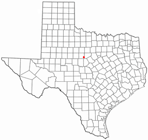
Cross Plains, Texas — Town — Location of Cross Plains, Texas

Coordinates: 32°7′35″N 99°9′53″W / 32.12639°N 99.16472°WCoordinates: 32°7′35″N 99°9′53″W / 32.12639°N 99.16472°W Country United States State Texas County Callahan Area – Total 1.2 sq mi (3.1 km2) – Land 1.2 sq mi (3.1 km2) – Water 0.0 sq mi (0.0 km2) Elevation 1,742 ft (531 m) Population (2000) – Total 1,068 – Density 893.1/sq mi (344.8/km2) Time zone Central (CST) (UTC-6) – Summer (DST) CDT (UTC-5) ZIP code 76443 Area code(s) 254 FIPS code 48-17816[1] GNIS feature ID 1333719[2] Website http://www.crossplainstx.com/ Cross Plains is a town in Callahan County, Texas, United States. The population was 1,068 at the 2000 census. It is part of the Abilene, Texas Metropolitan Statistical Area.
Contents
Geography
Cross Plains is located at 32°7′35″N 99°9′53″W / 32.12639°N 99.16472°W (32.126467, -99.164677)[3].
According to the United States Census Bureau, the town has a total area of 1.2 square miles (3.1 km2), all of it land.
Demographics
As of the census[1] of 2000, there were 1,068 people, 432 households, and 285 families residing in the town. The population density was 893.1 people per square mile (343.6/km²). There were 554 housing units at an average density of 463.3 per square mile (178.3/km²). The racial makeup of the town was 97.28% White, 0.47% Native American, 1.69% from other races, and 0.56% from two or more races. Hispanic or Latino of any race were 5.34% of the population.
There were 432 households out of which 28.9% had children under the age of 18 living with them, 50.2% were married couples living together, 10.6% had a female householder with no husband present, and 33.8% were non-families. 32.2% of all households were made up of individuals and 19.4% had someone living alone who was 65 years of age or older. The average household size was 2.40 and the average family size was 3.03.
In the town the population was spread out with 25.1% under the age of 18, 7.3% from 18 to 24, 21.7% from 25 to 44, 22.4% from 45 to 64, and 23.5% who were 65 years of age or older. The median age was 42 years. For every 100 females there were 84.1 males. For every 100 females age 18 and over, there were 81.0 males.
The median income for a household in the town was $22,235, and the median income for a family was $27,500. Males had a median income of $22,188 versus $17,955 for females. The per capita income for the town was $13,284. About 18.5% of families and 23.3% of the population were below the poverty line, including 33.3% of those under age 18 and 19.0% of those age 65 or over.
History
Cross Plains had been named Turkey Creek - the stream that still crosses the town's Treadaway Park. In its early years, Cross Plains had the basic necessities like a store, a cotton gin and gristmill, but little else. In 1878, the United States Government granted a post office to Cross Plains, which was named for the crossings of stagecoaches and military roads prior to the Civil War. It is said that Robert E. Lee and U.S. Grant camped with their troops at a grove of live oak trees on the banks of Turkey Creek, which is now known as Treadway Park. East and West Caddo Peaks, located 5 miles (8.0 km) west, were used as landmarks by early Indians, soldiers and also by government surveying crews. They had one newspaper in 1902 (The Herald), but it soon went out of business. The second paper, The Cross Plains Review started in 1909 and continues to publish a weekly newspaper every Wednesday. The town moved from the west banks of Turkey Creek to its present site in January 1911, in anticipation of the coming railroad. On January 11, 1912, the first train arrived, the Texas Central, which was soon to become the Missouri-Kansas-Texas Railroad. An oil boom in 1925 increased the population, and by 1940 it was over 1,200. It has remained hovering around the 1,000 mark for the last 50 years. City documents are unavailable to the public.
Education
The Town of Cross Plains is served by the Cross Plains Independent School District.
In 2004, voters passed a $1.1 million bond package for new classrooms and gymnasium for the Cross Plains Independent School District.
The CPISD has an average enrollment of approximately 455 students.
Robert E. Howard
 The Robert E. Howard Museum, former home of the author
The pulp fiction author Robert E. Howard, creator of the character Conan the Barbarian among others, lived in Cross Plains from the age of 13 until his death by suicide in 1936. His former home in Cross Plains is now a museum. Every year, Cross Plains holds the Robert E. Howard Days and a Barbarian Festival [3] on the second weekend of June.[4][5]
Major highways
2005 wildfire
On December 27, 2005, a grass/range wildfire destroyed 116 homes in and around Cross Plains. On December 29, 2005 the Texas Department of Public Safety (DPS) listed 85 single family homes, 25 mobile homes and 6 apartment units as being destroyed. An additional 36 homes were damaged. The First United Methodist Church building of Cross Plains was also destroyed. Two people died after being trapped in their houses.
The fire started 5 miles (8.0 km) west of the city along Highway 36, and westerly winds of up to 30 miles per hour spread the flames into town, burning a total of 7,665 acres (31.0 km2) of land.
The fire spared the nearly century-old house (now a museum) of Robert E. Howard, author of the Conan the Barbarian books.
References
- ^ a b "American FactFinder". United States Census Bureau. http://factfinder.census.gov. Retrieved 2008-01-31.
- ^ "US Board on Geographic Names". United States Geological Survey. 2007-10-25. http://geonames.usgs.gov. Retrieved 2008-01-31.
- ^ "US Gazetteer files: 2010, 2000, and 1990". United States Census Bureau. 2011-02-12. http://www.census.gov/geo/www/gazetteer/gazette.html. Retrieved 2011-04-23.
- ^ [1]
- ^ [2]
External links
Municipalities and communities of Callahan County, Texas Cities 
Towns Cross Plains | Putnam
Unincorporated
communitiesGhost towns Categories:- Populated places in Callahan County, Texas
- Towns in Texas
- Abilene metropolitan area


Wikimedia Foundation. 2010.