- Nipigon, Ontario
Infobox Settlement
official_name = Township of Nipigon, Ontario
other_name =
native_name =
nickname =
settlement_type =
motto =
imagesize =
image_caption =
flag_size =
image_
seal_size =
image_shield =
shield_size =
city_logo =
citylogo_size =
mapsize =
map_caption =
mapsize1 =
map_caption1 =
image_dot_
imagesize =
image_caption =
flag_size =
image_
seal_size =
image_shield =
shield_size =
city_logo =
citylogo_size =
mapsize =
map_caption =
mapsize1 =
map_caption1 =
image_dot_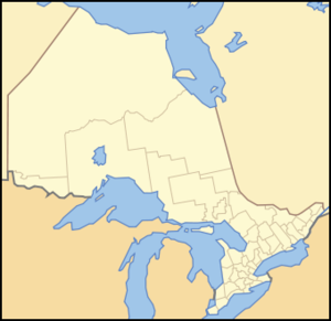
dot_mapsize = 250px
dot_map_caption = Location of Nipigon, Ontario
dot_x = 75 |dot_y = 129
pushpin_
pushpin_label_position =
pushpin_map_caption =
pushpin_mapsize =
subdivision_type = Country
subdivision_name =Canada
subdivision_type1 = Province
subdivision_name1 =Ontario
subdivision_type2 = Region
subdivision_name2 =Northwestern Ontario
subdivision_type3 = District
subdivision_name3 = Thunder Bay District
subdivision_type4 =
subdivision_name4 =
government_footnotes =
government_type =
leader_title = Mayor
leader_name =Richard Harvey
leader_title1 =
leader_name1 =
leader_title2 =
leader_name2 =
leader_title3 =
leader_name3 =
leader_title4 =
leader_name4 =
established_title =
established_date =
established_title2 =
established_date2 =
established_title3 =
established_date3 =
area_magnitude =
unit_pref =
area_footnotes =
area_total_km2 =
area_land_km2 = 109.14
area_water_km2 =
area_total_sq_mi =
area_land_sq_mi =
area_water_sq_mi =
area_water_percent =
area_urban_km2 =
area_urban_sq_mi =
area_metro_km2 =
area_metro_sq_mi =
population_as_of = 2006
population_footnotes =
population_note =
population_total = 1,752
population_density_km2 = 16.1
population_density_sq_mi =
population_metro =
population_density_metro_km2 =
population_density_metro_sq_mi =
population_urban =
population_density_urban_km2 =
population_density_urban_sq_mi =
population_blank1_title =
population_blank1 =
population_density_blank1_km2 = |population_density_blank1_sq_mi =
timezone = EST
utc_offset = −5
timezone_DST = EDT
utc_offset_DST = −4
latd=49 |latm=00 |lats= |latNS=N
longd=88 |longm=25 |longs= |longEW=W
elevation_footnotes =
elevation_m =
elevation_ft =
postal_code_type = Postal Code
postal_code = P0T 2J0
area_code = 807
blank_name =
blank_info =
blank1_name =
blank1_info =
website = [http://www.nipigon.net/]
footnotes =Nipigon is a township in
Thunder Bay District ,Northwestern Ontario ,Canada , located on the most northern point ofLake Superior and situated along the west side of theNipigon River and south of the small Lake Helen running betweenLake Nipigon and Lake Superior. The bay is situated to the north and has several islands. Lake Nipigon is located about 20 to 30 km north of Nipigon.Nipigon is served by several transportation corridors:
* Highway 17, the
Trans-Canada Highway .
* Highway 11
*Canadian Pacific Railway
*Canadian National Railway Economy
The chief industries in Nipigon are forest products, fishing, and tourism.
Nipigon is a setting off point for fishing excursions onto Lake Superior and the Nipigon River system leading up to Lake Nipigon. Fish varieties common to this area include
Atlantic salmon ,lake trout ,speckled trout (the world's largest speckled trout was caught in the Nipigon River in 1916, weighing in at convert|14.5|lb|kgFact|date=October 2008),rainbow trout ,walleye ,northern pike andperch . There is a number of charter companies with skippers who have a knowledge of the waters and can usually land anglers right on top of the fish.Mill fire
On February 6, 2007, a devastating fire ripped through Multiply Forest Products, burning the mill to the ground. The mill was the main employer in the town. Less than a month earlier workers at the mill had purchased it from
Columbia Forest Products ofPortland, Oregon . At the time of the sale, a $4-million modernization plan for the mill was also announced. More than 100 people were employed at the plant, which produced hardwood underlayment for vinyl, ceramic tile and laminate flooring.A cause for the fire has yet to be determined.
Geography
For about 15 km, Highway 11 runs within Nipigon River and a lake. Nipigon is located northeast of Thunder Bay, southwest of Geraldton and
Longlac , west of Marathon and northwest of Sault Ste. Marie. The crater onMars named Nipigon Crater or Crater Nipigon is named after this town.Nipigon is surrounded with pine and other varieties of forests. The power line connecting from Lake Nipigon supplies electricity to Thunder Bay and area. The other power line runs between Thunder Bay and the rest of Ontario. Timbering has been common sporadically to the north, the northwest and further north within Lake Nipigon along with parts of the southwest which formed old forest roads to the northeast and north. The municipality of Greenstone lies to the north. A manufacturing plant lies to the south. Several other unincorporated municipalities were around Nipigon. A communications tower near Nipigon broadcasts a local radio station and television channels from Thunder Bay including CKPR (TBT) and
CBQT .There are two bridges at the east end of town spanning the Nipigon River, one a single-line railway bridge, and the other a two-lane road bridge. Collectively, they comprise the narrowest east-west land link in Canada's transportation system. Both Highways 11 and 17, and both railways, route all their traffic across the bridges. The only other east-west link in this part of Canada is the path across the dam north of the town (not an actual road) or a few logging roads far north of the town.
Nearest places
*Thunder Bay, southwest
*Longlac, northeast
*Marathon, east
*Weather radarExternal links
*http://www.nipigon.net/
*http://www.northwestontario.worldweb.com/Nipigon
Wikimedia Foundation. 2010.