- Old Canadian National rail yard
-
Coordinates: 53°32′51″N 113°30′30″W / 53.5475°N 113.50833°W
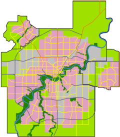
 Location of the old Canadian National rail yard in Edmonton
The old Canadian National rail yard in Edmonton was once the centre of economic activity in that city. Its redevelopment has fundamentally altered the appearance of the city. The former yard occupied a long, narrow strip from 103 Avenue to 105 Avenue north to south and from 101 Street to 116 Street east and west.
Contents
Railway era
Edmonton's transition from a frontier outpost to a railway town was delayed because the Canadian Pacific Railway's decision in the 1880s to shift the route of its planned main Winnipeg–Vancouver line south through Calgary. It was further hampered when in 1891 the planned Calgary and Edmonton Railway choose to build its terminus south of the North Saskatchewan River, in what soon became the rival settlement of Strathcona.
In 1903, the Canadian Northern Railway opened a short spur across the Low Level Bridge, linking Edmonton with Strathcona, but Edmonton's major introduction to the rail age came in 1905 when the CNoR's main transcontinental line reached it from Winnipeg. The CNoR's station was located at what is now 104 Avenue and 101 Street, and its yard to the west. Around this yard, Edmonton's warehouse district developed.
In response, the Canadian Pacific extended its C&E line over the river and expanded its station in Strathcona. In 1910, the CNoR station began accepting trains from the Grand Trunk Pacific Railway (GTPR) which had also reached Edmonton. The CNoR and GTPR had rival plans to link Edmonton to the Pacific Coast, CNoR at Vancouver and GTPR at Prince Rupert, British Columbia. The companies were not able turn a profit during the lean years of the Great War, and by 1919 both had been nationalized by the federal government and made part of Canadian National Railways (CNR).
As a major centre for the CNR, Edmonton became one of the most important rail hubs in Canada. In 1928, a new station was opened at 101 Street and 104 Avenue, and was expanded in 1948. In 1964, it was demolished to make way for Edmonton's first skyscraper, the Canadian National Tower. In 1968, CN announced plans to build a massive 800-foot (240 m) "pylon" on the site, but this was never acted on.[1] The yards functioned until 1988, and the last freight sheds were destroyed in 1996.
Redevelopment
Since the early 1990s the area has seen increasing redevelopment. CN donated some of the land to Grant MacEwan University for its new campus, and some of it was taken by the government-owned Canada Lands Company for private sale. The former yards are now (as of 2008[update]) almost completely covered with new buildings, and redevelopment has spread into the former warehouse and industrial areas that once lined the tracks. From east to west the buildings now on the former rail yards are:
- Station Lands and EPCOR Tower
- CN Tower
- Bacarat Casino
- Grant MacEwan University City Centre Campus
- Square 104 (condos)
- Oliver Village (a mixed strip mall and condo development)
- Longstreet Mall
- Oliver Square (a strip mall)
This area has also been touted as possible location for a new arena to replace Rexall Place[2].
References
External links
- Herzog, Lawrence (January 13, 2005). "A Grand and Fabulous Railway Station". Real Estate Weekly 23 (2). http://www.rewedmonton.ca/content_view2?CONTENT_ID=897.
- Herzog, Lawrence (August 4, 2005). "When the rails led to Edmonton". Real Estate Weekly 23 (31). http://www.rewedmonton.ca/content_view2?CONTENT_ID=1118.
- Herzog, Lawrence (August 11, 2005). "Grand Trunk Pacific and Canadian National Railways". Real Estate Weekly 23 (32). http://www.rewedmonton.ca/content_view2?CONTENT_ID=1128.

Queen Mary Park Central McDougall McCauley Oliver 
McCauley  Old Canadian National rail yard

Oliver Downtown Core Boyle Street Categories:- Canadian National Railway facilities
- Rail infrastructure in Alberta
- History of Edmonton
- Former buildings and structures of Canada
- Buildings and structures in Edmonton
- Rail yards in Canada

Wikimedia Foundation. 2010.