- Forsan, Texas
Infobox Settlement
official_name = Forsan, Texas
settlement_type =City
nickname =
motto =
imagesize =
image_caption =
image_
mapsize = 250px
map_caption = Location of Forsan, Texas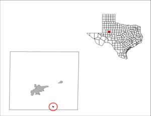
mapsize1 = 250px
map_caption1 =subdivision_type = Country
subdivision_name =United States
subdivision_type1 = State
subdivision_name1 =Texas
subdivision_type2 = County
subdivision_name2 = Howardgovernment_footnotes =
government_type =
leader_title =
leader_name =
leader_title1 =
leader_name1 =
established_title =
established_date =unit_pref = Imperial
area_footnotes =area_magnitude =
area_total_km2 = 0.8
area_land_km2 = 0.8
area_water_km2 = 0.0
area_total_sq_mi = 0.3
area_land_sq_mi = 0.3
area_water_sq_mi = 0.0population_as_of = 2000
population_footnotes =
population_total = 226
population_density_km2 = 300.7
population_density_sq_mi = 778.8timezone = Central (CST)
utc_offset = -6
timezone_DST = CDT
utc_offset_DST = -5
elevation_footnotes =
elevation_m = 850
elevation_ft = 2789
latd = 32 |latm = 6 |lats = 34 |latNS = N
longd = 101 |longm = 21 |longs = 56 |longEW = Wpostal_code_type =
ZIP code
postal_code = 79733
area_code = 915
blank_name = FIPS code
blank_info = 48-26640GR|2
blank1_name = GNIS feature ID
blank1_info = 1336045GR|3
website =
footnotes =Forsan is a city in Howard County,
Texas ,United States . The population was 226 at the 2000 census. The name is derived from the belief that there were four oil sands in the area.fact|date=December 2007History
The town was established in 1929. Due to the discovery of oil, the town expanded after 1931 to more than 400 residents.
Forsan was incorporated in the 1960s.
Geography
Forsan is located at coor dms|32|6|34|N|101|21|56|W|city (32.109359, -101.365531)GR|1.
According to the
United States Census Bureau , the city has a total area of 0.3square mile s (0.8km² ), all of it land.Forsan is on Farm to Market Road 461 off of
U.S. Route 87 .Demographics
As of the
census GR|2 of 2000, there were 226 people, 84 households, and 69 families residing in the city. Thepopulation density was 778.8 people per square mile (300.9/km²). There were 96 housing units at an average density of 330.8/sq mi (127.8/km²). The racial makeup of the city was 97.79% White, 0.44% Native American, 0.44% from other races, and 1.33% from two or more races. Hispanic or Latino of any race were 12.39% of the population.There were 84 households out of which 41.7% had children under the age of 18 living with them, 66.7% were married couples living together, 11.9% had a female householder with no husband present, and 16.7% were non-families. 16.7% of all households were made up of individuals and 8.3% had someone living alone who was 65 years of age or older. The average household size was 2.69 and the average family size was 2.96.
In the city the population was spread out with 31.9% under the age of 18, 4.9% from 18 to 24, 25.2% from 25 to 44, 23.5% from 45 to 64, and 14.6% who were 65 years of age or older. The median age was 37 years. For every 100 females there were 94.8 males. For every 100 females age 18 and over, there were 97.4 males.
The median income for a household in the city was $36,000, and the median income for a family was $38,750. Males had a median income of $36,250 versus $17,250 for females. The
per capita income for the city was $17,103. About 11.5% of families and 16.4% of the population were below thepoverty line , including 30.4% of those under the age of eighteen and none of those sixty five or over.Education
Forsan is served by the
Forsan Independent School District References
External links
*History: [http://forsan.esc18.net/History/Forsan_History.htm The History of Forsan]
* [http://forsan.esc18.net Forsan Independent School District]
* [http://www.tsha.utexas.edu/handbook/online/articles/FF/hlf23.html Texas handbook information]

Wikimedia Foundation. 2010.