- Roaring Springs, Texas
Infobox Settlement
official_name = Roaring Springs, Texas
settlement_type =Town
nickname =
motto =
imagesize =
image_caption =
image_
mapsize = 250px
map_caption = Location of Roaring Springs, Texas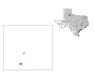
mapsize1 = 250px
map_caption1 =subdivision_type = Country
subdivision_name =United States
subdivision_type1 = State
subdivision_name1 =Texas
subdivision_type2 = County
subdivision_name2 = Motleygovernment_footnotes =
government_type =
leader_title =
leader_name =
leader_title1 =
leader_name1 =
established_title =
established_date =unit_pref = Imperial
area_footnotes =area_magnitude =
area_total_km2 = 2.8
area_land_km2 = 2.8
area_water_km2 = 0.0
area_total_sq_mi = 1.1
area_land_sq_mi = 1.1
area_water_sq_mi = 0.0population_as_of = 2000
population_footnotes =
population_total = 265
population_density_km2 = 95.9
population_density_sq_mi = 248.4timezone = Central (CST)
utc_offset = -6
timezone_DST = CDT
utc_offset_DST = -5
elevation_footnotes =
elevation_m = 764
elevation_ft = 2507
latd = 33 |latm = 54 |lats = 3 |latNS = N
longd = 100 |longm = 51 |longs = 28 |longEW = Wpostal_code_type =
ZIP code
postal_code = 79256
area_code = 806
blank_name = FIPS code
blank_info = 48-62528GR|2
blank1_name = GNIS feature ID
blank1_info = 1366557GR|3
website =
footnotes =Roaring Springs is a town in Motley County,
Texas ,United States . The population was 265 at the 2000 census. The town was laid out in 1912, anticipating service of theQuanah, Acme and Pacific Railroad , and named in 1913, when the railroad began operations.Geography
Roaring Springs is located at coor dms|33|54|3|N|100|51|28|W|city (33.900716, -100.857640)GR|1.
According to the
United States Census Bureau , the town has a total area of 1.1square mile s (2.8km² ), all of it land.Demographics
As of the
census GR|2 of 2000, there were 265 people, 117 households, and 82 families residing in the town. Thepopulation density was 248.4 people per square mile (95.6/km²). There were 145 housing units at an average density of 135.9/sq mi (52.3/km²). The racial makeup of the town was 91.70% White, 1.51% African American, 6.04% from other races, and 0.75% from two or more races. Hispanic or Latino of any race were 8.30% of the population.There were 117 households out of which 24.8% had children under the age of 18 living with them, 54.7% were married couples living together, 11.1% had a female householder with no husband present, and 29.9% were non-families. 25.6% of all households were made up of individuals and 15.4% had someone living alone who was 65 years of age or older. The average household size was 2.26 and the average family size was 2.68.
In the town the population was spread out with 23.0% under the age of 18, 4.5% from 18 to 24, 22.3% from 25 to 44, 23.8% from 45 to 64, and 26.4% who were 65 years of age or older. The median age was 45 years. For every 100 females there were 103.8 males. For every 100 females age 18 and over, there were 98.1 males.
The median income for a household in the town was $26,250, and the median income for a family was $30,625. Males had a median income of $25,625 versus $16,750 for females. The
per capita income for the town was $14,901. About 9.3% of families and 18.1% of the population were below thepoverty line , including 34.7% of those under the age of eighteen and 10.8% of those sixty five or over.Education
The Town of Roaring Springs is served by the
Motley County Independent School District .References
External links
*

Wikimedia Foundation. 2010.